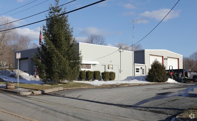
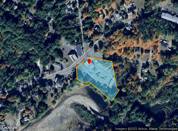
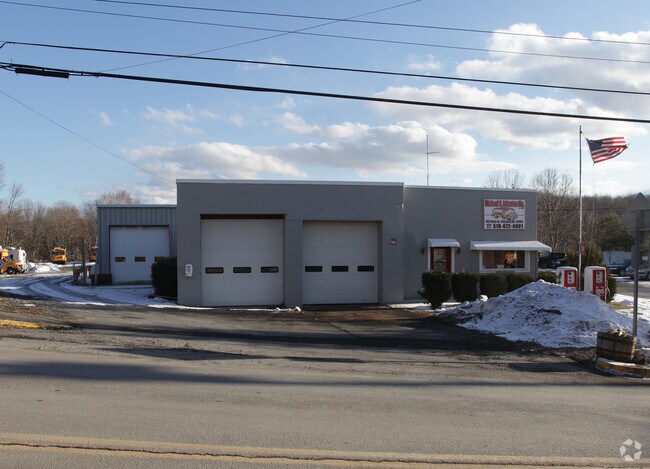
Property Record
165 Main St, Philmont, NY 12565
NEARBY LISTINGS FOR SALE OR LEASE
-
-
View all Philmont listings for sale on LoopNet.com
Property Detail
165 Main St
Hudson, NY
BK760 PG168
102801-113-009-0003-081-000-0000
Columbia
Warehouse
New York
2025
81.000
2024
2.30 AC
001000
Columbia County
1,656 SF
Albany/Schenectady/Troy
DEMOGRAPHICS near 165 Main St
1 Mile
3 Mile
5 Mile
2024 Total Population
1,156
2,730
6,383
2029 Population
1,112
2,640
6,207
Pop Growth 2024-2029
(3.81%)
(3.30%)
(2.76%)
Average Age
42
44
46
2024 Total Households
457
1,112
2,650
HH Growth 2024-2029
(4.16%)
(3.51%)
(2.87%)
Median Household Inc
$48,580
$58,856
$67,399
Avg Household Size
2.40
2.30
2.30
2024 Avg HH Vehicles
1.00
2.00
2.00
Median Home Value
$172,222
$217,605
$259,480
Median Year Built
1948
1961
1969
Nearby Places
- Restaurants
- Banks
- Shops
- Fitness
- Groceries
Nearby Properties
Address
Land Use
TOTAL SIZE
Lot Size
Zoning
Address
Land Use
TOTAL SIZE
Lot Size
Zoning
27,408 SF
161.02 AC
HM
Address
Land Use
TOTAL SIZE
Lot Size
Zoning
Address
Land Use
TOTAL SIZE
Lot Size
Zoning
Address
Land Use
TOTAL SIZE
Lot Size
Zoning
46,870 SF
37 AC
07 - MIXED
Address
Land Use
TOTAL SIZE
Lot Size
Zoning
54,688 SF
18.76 AC
07 - MIXED
Address
Land Use
TOTAL SIZE
Lot Size
Zoning
5,400 SF
34.40 AC
07 - MIXED
Address
Land Use
TOTAL SIZE
Lot Size
Zoning
1,911 SF
188.02 AC
RA1 C
Address
Land Use
TOTAL SIZE
Lot Size
Zoning
Address
Land Use
TOTAL SIZE
Lot Size
Zoning
Address
Land Use
TOTAL SIZE
Lot Size
Zoning
12,347 SF
165.30 AC
07 - MIXED
Address
Land Use
TOTAL SIZE
Lot Size
Zoning
28,248 SF
2 AC
07 - MIXED
Address
Land Use
TOTAL SIZE
Lot Size
Zoning
4,960 SF
50 AC
RA1 C
Address
Land Use
TOTAL SIZE
Lot Size
Zoning
8,818 SF
11.90 AC
HM
Address
Land Use
TOTAL SIZE
Lot Size
Zoning
2,484 SF
3.40 AC
07 - MIXED
Address
Land Use
TOTAL SIZE
Lot Size
Zoning
2,714 SF
139.50 AC
RA1 C
Address
Land Use
TOTAL SIZE
Lot Size
Zoning
250.90 AC
07 - MIXED
Address
Land Use
TOTAL SIZE
Lot Size
Zoning
4,500 SF
24.27 AC
RU C
Address
Land Use
TOTAL SIZE
Lot Size
Zoning
2,152 SF
89.80 AC
07 - MIXED
Address
Land Use
TOTAL SIZE
Lot Size
Zoning
3,041 SF
67.70 AC
01 - NOT Z
Address
Land Use
TOTAL SIZE
Lot Size
Zoning
211.60 AC
07 - MIXED
Address
Land Use
TOTAL SIZE
Lot Size
Zoning
3,236 SF
128.57 AC
RA2
Address
Land Use
TOTAL SIZE
Lot Size
Zoning
2,400 SF
66.40 AC
07 - MIXED
Address
Land Use
TOTAL SIZE
Lot Size
Zoning
57,793 SF
36.70 AC
07 - MIXED
Address
Land Use
TOTAL SIZE
Lot Size
Zoning
6,992 SF
1.90 AC
07 - MIXED
Address
Land Use
TOTAL SIZE
Lot Size
Zoning
112.90 AC
01 - NOT Z
Address
Land Use
TOTAL SIZE
Lot Size
Zoning
106.90 AC
01 - NOT Z
Address
Land Use
TOTAL SIZE
Lot Size
Zoning
101 AC
01 - NOT Z
Address
Land Use
TOTAL SIZE
Lot Size
Zoning
20 AC
Address
Land Use
TOTAL SIZE
Lot Size
Zoning
159 AC
07 - MIXED
Address
Land Use
TOTAL SIZE
Lot Size
Zoning
3,769 SF
0.71 AC
01 - NOT Z
The World's #1 Commercial Real Estate Marketplace
Connect with us
© 2025 CoStar Group
The information above has been obtained from sources believed reliable. While we do not doubt its accuracy we have not verified it and make no guarantee, warranty or representation about it. It is your responsibility to independently confirm its accuracy and completeness. Any projections, opinions, assumptions, or estimates used are for example only and do not represent the current or future performance of the property. The value of this transaction to you depends on tax and other factors which should be evaluated by your tax, financial, and legal advisors. You and your advisors should conduct a careful, independent investigation of the property to determine to your satisfaction the suitability of the property for your needs.