Property Record
165 Us Highway 19 N, Camilla, GA 31730
NEARBY LISTINGS FOR SALE OR LEASE
-
-
View all Camilla listings for sale on LoopNet.com
Property Detail
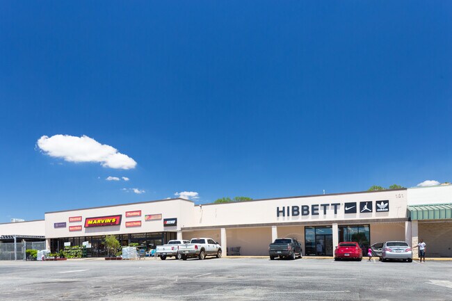
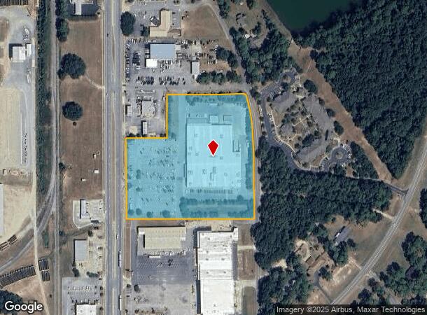
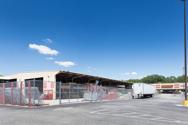
165 Us Highway 19 N
C0200-102-000
Comb W 103 & Part Of
Wholesaleoutletdiscountstore
165 HWY 19
X
Mitchell
13205C0377C
Georgia
2024
7.25 AC
2024
Albany/Southwest
090300
Other Market Areas
71,652 SF
DEMOGRAPHICS near 165 Us Highway 19 N
1 Mile
3 Mile
5 Mile
2024 Total Population
2,769
6,404
7,887
2029 Population
2,685
6,182
7,599
Pop Growth 2024-2029
(3.03%)
(3.47%)
(3.65%)
Average Age
41
42
42
2024 Total Households
1,115
2,359
2,782
HH Growth 2024-2029
(3.23%)
(3.52%)
(3.63%)
Median Household Inc
$37,000
$39,399
$40,560
Avg Household Size
2.40
2.40
2.40
2024 Avg HH Vehicles
1.00
1.00
2.00
Median Home Value
$73,763
$86,585
$91,117
Median Year Built
1973
1975
1976
Nearby Places
Map Layers
Map Styles
 Street
 Aerial
- Restaurants
- Banks
- Shops
- Fitness
- Groceries
PUBLIC TRANSPORTATION
AIRPORT
Southwest Georgia Regional
DRIVE
WALK
Distance
Southwest Georgia Regional
41 min
28.4 mi
SALE & LEASE HISTORY
LISTING DATE
SALE/LEASE

Jun 28, 2022
For Sale
Nearby Properties
Address
Land Use
TOTAL SIZE
Lot Size
Zoning
Address
Land Use
TOTAL SIZE
Lot Size
Zoning
6.32 AC
Address
Land Use
TOTAL SIZE
Lot Size
Zoning
13,312 SF
57.14 AC
Address
Land Use
TOTAL SIZE
Lot Size
Zoning
3,942 SF
10 AC
Address
Land Use
TOTAL SIZE
Lot Size
Zoning
32,684 SF
16 AC
Address
Land Use
TOTAL SIZE
Lot Size
Zoning
72,540 SF
66.46 AC
Address
Land Use
TOTAL SIZE
Lot Size
Zoning
1,800 SF
1.15 AC
Address
Land Use
TOTAL SIZE
Lot Size
Zoning
101,840 SF
15 AC
Address
Land Use
TOTAL SIZE
Lot Size
Zoning
9,672 SF
20 AC
Address
Land Use
TOTAL SIZE
Lot Size
Zoning
13,622 SF
11.62 AC
Address
Land Use
TOTAL SIZE
Lot Size
Zoning
19,290 SF
5.36 AC
Address
Land Use
TOTAL SIZE
Lot Size
Zoning
59,571 SF
3.44 AC
Address
Land Use
TOTAL SIZE
Lot Size
Zoning
27,356 SF
0.90 AC
Address
Land Use
TOTAL SIZE
Lot Size
Zoning
17,000 SF
10 AC
Address
Land Use
TOTAL SIZE
Lot Size
Zoning
15,458 SF
1.88 AC
Address
Land Use
TOTAL SIZE
Lot Size
Zoning
5,919 SF
5.57 AC
Address
Land Use
TOTAL SIZE
Lot Size
Zoning
14,934 SF
2.69 AC
Address
Land Use
TOTAL SIZE
Lot Size
Zoning
3,472 SF
9 AC
Address
Land Use
TOTAL SIZE
Lot Size
Zoning
34,817 SF
4.92 AC
Address
Land Use
TOTAL SIZE
Lot Size
Zoning
10,186 SF
0.99 AC
Address
Land Use
TOTAL SIZE
Lot Size
Zoning
9,198 SF
0.92 AC
Address
Land Use
TOTAL SIZE
Lot Size
Zoning
15,808 SF
1.66 AC
Address
Land Use
TOTAL SIZE
Lot Size
Zoning
9,108 SF
57.04 AC
Address
Land Use
TOTAL SIZE
Lot Size
Zoning
12,082 SF
0.88 AC
Address
Land Use
TOTAL SIZE
Lot Size
Zoning
366.62 AC
AR-1
Address
Land Use
TOTAL SIZE
Lot Size
Zoning
7,950 SF
7.90 AC
Address
Land Use
TOTAL SIZE
Lot Size
Zoning
7,968 SF
2.38 AC
Address
Land Use
TOTAL SIZE
Lot Size
Zoning
2,653 SF
7.94 AC
Address
Land Use
TOTAL SIZE
Lot Size
Zoning
5,405 SF
0.93 AC
Address
Land Use
TOTAL SIZE
Lot Size
Zoning
20,266 SF
1.55 AC
The World's #1 Commercial Real Estate Marketplace
Connect with us
© 2026 CoStar Group
The information above has been obtained from sources believed reliable. While we do not doubt its accuracy we have not verified it and make no guarantee, warranty or representation about it. It is your responsibility to independently confirm its accuracy and completeness. Any projections, opinions, assumptions, or estimates used are for example only and do not represent the current or future performance of the property. The value of this transaction to you depends on tax and other factors which should be evaluated by your tax, financial, and legal advisors. You and your advisors should conduct a careful, independent investigation of the property to determine to your satisfaction the suitability of the property for your needs.