Property Record
165 Vac Cor, Palmdale, CA 93591

Property Detail
165 Vac Cor
Los Angeles-Long Beach-Glendale, CA
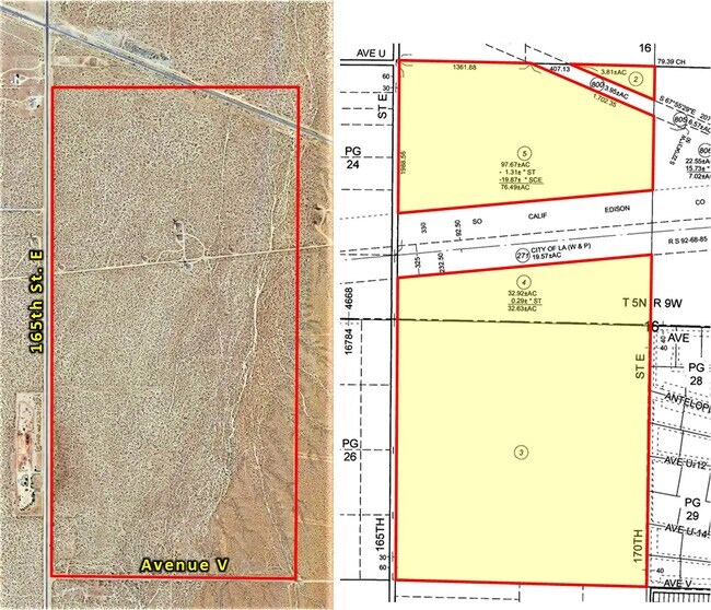
LOT COM E ON N LINE OF SEC 16 T 5N R 9W 1769.01 FT FROM NW COR OF SD SEC TH S 67 5529 E TO N AND S C/L OF SD SEC TH N THEREON TO SD N LINE TH W TO BEG PART OF NW 1/4 OF SEC 16 T 5N R 9W
3080-027-003
LOS ANGELES
Desertorbarrenland
California
LCA11*
16
A Areas with a 1% annual chance of flooding and a 26% chance of flooding over the life of a 30-year mortgage.
158.18 AC
2024
NE LA County Outlying
2025
Los Angeles
900104
NEARBY LISTINGS FOR SALE OR LEASE
DEMOGRAPHICS near 165 Vac Cor
1 mile
3 mile
5 mile
2025 Total Population
29
499
3,441
2030 Population
29
506
3,421
Pop Growth 2025-2030
0.00%
+ 1.40%
(0.58%)
Average Age
47
49
43
2025 Total Households
11
212
1,226
HH Growth 2025-2030
0.00%
+ 0.94%
(0.82%)
Median Household Inc
$24,999
$52,500
$70,389
Avg Household Size
2.30
2.30
2.70
2025 Avg HH Vehicles
2.00
2.00
2.00
Median Home Value
$250,000
$180,768
$303,274
Median Year Built
1977
1976
1979
Nearby Places
Map Layers
Map Styles
 Street
 Aerial
Layers
 Traffic
 Biking
Places
Listings with unknown addresses are not visible on the map
- Restaurants
- Banks
- Shops
- Fitness
- Groceries
SALE & LEASE HISTORY
LISTING DATE
SALE/LEASE

Jul 22, 2022
For Sale
Nearby Properties
Address
Land Use
TOTAL SIZE
Lot Size
Zoning
Address
Land Use
TOTAL SIZE
Lot Size
Zoning
139.80 AC
LCA25*
Address
Land Use
TOTAL SIZE
Lot Size
Zoning
31.31 AC
LCA11*
Address
Land Use
TOTAL SIZE
Lot Size
Zoning
28.54 AC
LCA120000*
Address
Land Use
TOTAL SIZE
Lot Size
Zoning
124.17 AC
LCA2
Address
Land Use
TOTAL SIZE
Lot Size
Zoning
3,404 SF
75.49 AC
LCC4-5
Address
Land Use
TOTAL SIZE
Lot Size
Zoning
39.28 AC
LCA11*
Address
Land Use
TOTAL SIZE
Lot Size
Zoning
4,120 SF
1.88 AC
LCA11*
Address
Land Use
TOTAL SIZE
Lot Size
Zoning
19.42 AC
LCA11*
Address
Land Use
TOTAL SIZE
Lot Size
Zoning
48.44 AC
LCA12*
Address
Land Use
TOTAL SIZE
Lot Size
Zoning
78.51 AC
LCA25*
Address
Land Use
TOTAL SIZE
Lot Size
Zoning
60.18 AC
LCA11*
Address
Land Use
TOTAL SIZE
Lot Size
Zoning
103.79 AC
LCA25*
Address
Land Use
TOTAL SIZE
Lot Size
Zoning
78.40 AC
LCQ*
Address
Land Use
TOTAL SIZE
Lot Size
Zoning
149.84 AC
LCA25*
Address
Land Use
TOTAL SIZE
Lot Size
Zoning
1 SF
79.92 AC
LCA25*
Address
Land Use
TOTAL SIZE
Lot Size
Zoning
71 AC
LCQ*
Address
Land Use
TOTAL SIZE
Lot Size
Zoning
78.87 AC
LCA11*
Address
Land Use
TOTAL SIZE
Lot Size
Zoning
19.96 AC
LCA25*
Address
Land Use
TOTAL SIZE
Lot Size
Zoning
19.89 AC
LCA25*
Address
Land Use
TOTAL SIZE
Lot Size
Zoning
20.02 AC
LCA25*
Address
Land Use
TOTAL SIZE
Lot Size
Zoning
77.17 AC
LCA25*
Address
Land Use
TOTAL SIZE
Lot Size
Zoning
92.70 AC
LCA12*
Address
Land Use
TOTAL SIZE
Lot Size
Zoning
38.49 AC
LCA11-C4*
Address
Land Use
TOTAL SIZE
Lot Size
Zoning
204.81 AC
LCA25*
Address
Land Use
TOTAL SIZE
Lot Size
Zoning
10.01 AC
LCA11*
Address
Land Use
TOTAL SIZE
Lot Size
Zoning
10.01 AC
LCA11*
Address
Land Use
TOTAL SIZE
Lot Size
Zoning
51.92 AC
LCA25*
Address
Land Use
TOTAL SIZE
Lot Size
Zoning
5.09 AC
LCA25*
Address
Land Use
TOTAL SIZE
Lot Size
Zoning
41.08 AC
LCA25*
Address
Land Use
TOTAL SIZE
Lot Size
Zoning
4.70 AC
LCA11*
The World's #1 Commercial Real Estate Marketplace
Connect with us
© 2026 CoStar Group
The information above has been obtained from sources believed reliable. While we do not doubt its accuracy we have not verified it and make no guarantee, warranty or representation about it. It is your responsibility to independently confirm its accuracy and completeness. Any projections, opinions, assumptions, or estimates used are for example only and do not represent the current or future performance of the property. The value of this transaction to you depends on tax and other factors which should be evaluated by your tax, financial, and legal advisors. You and your advisors should conduct a careful, independent investigation of the property to determine to your satisfaction the suitability of the property for your needs.