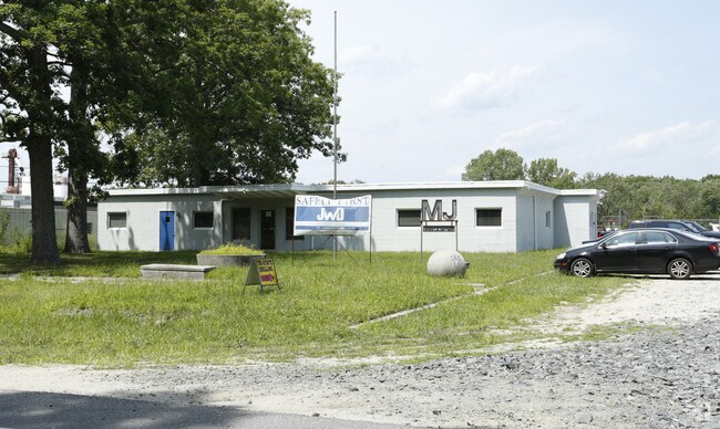
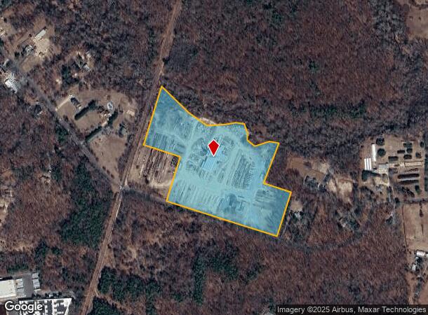
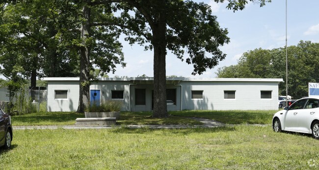
Property Record
165 Victory Rd, Howell, NJ 07731
NEARBY LISTINGS FOR SALE OR LEASE
Property Detail
165 Victory Rd
21-00052-0000-00009
L10
Industrialgeneral
Monmouth
A
New Jersey
34025C0320F
9
2024
22.08 AC
2025
Western Monmouth
811200
Northern New Jersey
4,612 SF
Lakewood-New Brunswick, NJ
DEMOGRAPHICS near 165 Victory Rd
1 mile
3 mile
5 mile
2024 Total Population
790
31,402
141,956
2029 Population
780
31,225
145,084
Pop Growth 2024-2029
(1.27%)
(0.56%)
+ 2.20%
Average Age
40
35
32
2024 Total Households
253
8,969
38,700
HH Growth 2024-2029
(1.58%)
(1.45%)
+ 1.37%
Median Household Inc
$147,321
$119,933
$83,781
Avg Household Size
3.00
3.30
3.30
2024 Avg HH Vehicles
2.00
2.00
2.00
Median Home Value
$444,697
$412,266
$393,076
Median Year Built
1983
1982
1981
Nearby Places
Map Layers
Map Styles
 Street
 Aerial
Transit
 Traffic
 Biking
Places
Listings with unknown addresses are not visible on the map
- Restaurants
- Banks
- Shops
- Fitness
- Groceries
PUBLIC TRANSPORTATION
COMMUTER RAIL
Belmar (North Jersey Coast Line - NJ Transit Commuter Rail (NJ Transit))
Drive
Walk
Distance
Belmar (North Jersey Coast Line - NJ Transit Commuter Rail (NJ Transit))
15 min
9.5 mi
AIRPORT
Trenton Mercer
Drive
Walk
Distance
Trenton Mercer
60 min
43.8 mi
Freight Ports
New York Container Terminal
Drive
Walk
Distance
New York Container Terminal
63 min
46.5 mi
Nearby Properties
Address
Land Use
TOTAL SIZE
Lot Size
Zoning
Address
Land Use
TOTAL SIZE
Lot Size
Zoning
105.04 AC
SED
Address
Land Use
TOTAL SIZE
Lot Size
Zoning
161,340 SF
35.35 AC
HD-1
Address
Land Use
TOTAL SIZE
Lot Size
Zoning
28.99 AC
HD-1
Address
Land Use
TOTAL SIZE
Lot Size
Zoning
14.73 AC
R-5
Address
Land Use
TOTAL SIZE
Lot Size
Zoning
162,000 SF
34.35 AC
ARE2
Address
Land Use
TOTAL SIZE
Lot Size
Zoning
8,784 SF
16.16 AC
R-LM
Address
Land Use
TOTAL SIZE
Lot Size
Zoning
360,400 SF
35.98 AC
SED
Address
Land Use
TOTAL SIZE
Lot Size
Zoning
2,736 SF
18.04 AC
R15
Address
Land Use
TOTAL SIZE
Lot Size
Zoning
2,976 SF
336.41 AC
POS
Address
Land Use
TOTAL SIZE
Lot Size
Zoning
98,731 SF
13.65 AC
HD
Address
Land Use
TOTAL SIZE
Lot Size
Zoning
141,437 SF
13.35 AC
HD-1
Address
Land Use
TOTAL SIZE
Lot Size
Zoning
125,379 SF
22.16 AC
HD
Address
Land Use
TOTAL SIZE
Lot Size
Zoning
51,531 SF
13.30 AC
HD
Address
Land Use
TOTAL SIZE
Lot Size
Zoning
24,630 SF
6.93 AC
HD-1
Address
Land Use
TOTAL SIZE
Lot Size
Zoning
1,124 SF
7.80 AC
B4
Address
Land Use
TOTAL SIZE
Lot Size
Zoning
13,350 SF
71.10 AC
ARE6
Address
Land Use
TOTAL SIZE
Lot Size
Zoning
123,578 SF
9.28 AC
HD-1
Address
Land Use
TOTAL SIZE
Lot Size
Zoning
9.09 AC
R15
Address
Land Use
TOTAL SIZE
Lot Size
Zoning
8.96 AC
HD
Address
Land Use
TOTAL SIZE
Lot Size
Zoning
35.06 AC
HD-1
Address
Land Use
TOTAL SIZE
Lot Size
Zoning
30,529 SF
1.41 AC
HD-1
Address
Land Use
TOTAL SIZE
Lot Size
Zoning
13.24 AC
SED
Address
Land Use
TOTAL SIZE
Lot Size
Zoning
65.74 AC
SED
Address
Land Use
TOTAL SIZE
Lot Size
Zoning
5,787 SF
8.01 AC
R12
Address
Land Use
TOTAL SIZE
Lot Size
Zoning
78,528 SF
6.21 AC
R-3
Address
Land Use
TOTAL SIZE
Lot Size
Zoning
60,315 SF
2.55 AC
R15
Address
Land Use
TOTAL SIZE
Lot Size
Zoning
56,674 SF
12.91 AC
HD-1
Address
Land Use
TOTAL SIZE
Lot Size
Zoning
2,336 SF
29.02 AC
POS
Address
Land Use
TOTAL SIZE
Lot Size
Zoning
13.33 AC
SED
Address
Land Use
TOTAL SIZE
Lot Size
Zoning
6.24 AC
SED
The World's #1 Commercial Real Estate Marketplace
Connect with us
© 2026 CoStar Group
The information above has been obtained from sources believed reliable. While we do not doubt its accuracy we have not verified it and make no guarantee, warranty or representation about it. It is your responsibility to independently confirm its accuracy and completeness. Any projections, opinions, assumptions, or estimates used are for example only and do not represent the current or future performance of the property. The value of this transaction to you depends on tax and other factors which should be evaluated by your tax, financial, and legal advisors. You and your advisors should conduct a careful, independent investigation of the property to determine to your satisfaction the suitability of the property for your needs.