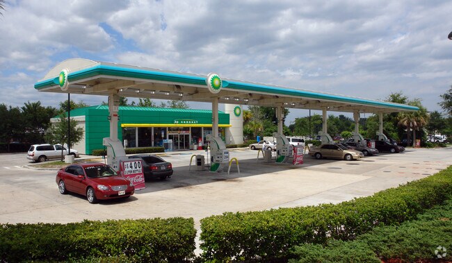
Property Record
1650 E Silver Star Rd, Ocoee, FL 34761


Property Detail
1650 E Silver Star Rd
16-2228-8041-00-020
SILVER ARK 28/120 LOT 2 (LESS R/W ON S PER 6138/4969 & LESS R/W ON W PER 6675/3935)
Storebuilding
Orange
C-2
Florida
B and X Area of moderate flood hazard, usually the area between the limits of the 100-year and 500-year floods.
2
2025
0.86 AC
2025
West Colonial
015005
Orlando
6,657 SF
Orlando-Kissimmee-Sanford, FL
NEARBY LISTINGS FOR SALE OR LEASE
DEMOGRAPHICS near 1650 E Silver Star Rd
1 mile
3 mile
5 mile
2024 Total Population
11,472
91,279
235,582
2029 Population
12,349
98,830
255,780
Pop Growth 2024-2029
+ 7.64%
+ 8.27%
+ 8.57%
Average Age
41
39
39
2024 Total Households
3,818
30,800
80,441
HH Growth 2024-2029
+ 7.96%
+ 8.65%
+ 9.00%
Median Household Inc
$84,738
$73,313
$71,628
Avg Household Size
2.90
2.90
2.90
2024 Avg HH Vehicles
2.00
2.00
2.00
Median Home Value
$354,761
$344,885
$362,990
Median Year Built
1991
1990
1990
Nearby Places
Map Layers
Map Styles
 Street
 Aerial
Transit
 Traffic
 Biking
Places
Listings with unknown addresses are not visible on the map
- Restaurants
- Banks
- Shops
- Fitness
- Groceries
PUBLIC TRANSPORTATION
AIRPORT
Orlando International
Drive
Walk
Distance
Orlando International
34 min
22.8 mi
Orlando Sanford International
Drive
Walk
Distance
Orlando Sanford International
49 min
30.1 mi
Freight Ports
Port Canaveral
Drive
Walk
Distance
Port Canaveral
80 min
64.8 mi
Nearby Properties
Address
Land Use
TOTAL SIZE
Lot Size
Zoning
Address
Land Use
TOTAL SIZE
Lot Size
Zoning
840,260 SF
65.85 AC
C-2
Address
Land Use
TOTAL SIZE
Lot Size
Zoning
481,795 SF
16.56 AC
I-1
Address
Land Use
TOTAL SIZE
Lot Size
Zoning
669,041 SF
43.79 AC
I-1
Address
Land Use
TOTAL SIZE
Lot Size
Zoning
321,759 SF
PUD-HD
Address
Land Use
TOTAL SIZE
Lot Size
Zoning
420,291 SF
23.36 AC
P-D
Address
Land Use
TOTAL SIZE
Lot Size
Zoning
387,922 SF
27.44 AC
P-D
Address
Land Use
TOTAL SIZE
Lot Size
Zoning
368,910 SF
14.02 AC
CAPUD
Address
Land Use
TOTAL SIZE
Lot Size
Zoning
471,646 SF
36.24 AC
P-D
Address
Land Use
TOTAL SIZE
Lot Size
Zoning
342,875 SF
11.35 AC
PUD-COMM
Address
Land Use
TOTAL SIZE
Lot Size
Zoning
446,425 SF
25.15 AC
PUD-IND
Address
Land Use
TOTAL SIZE
Lot Size
Zoning
347,605 SF
9.10 AC
C-2
Address
Land Use
TOTAL SIZE
Lot Size
Zoning
359,382 SF
16.38 AC
PUD
Address
Land Use
TOTAL SIZE
Lot Size
Zoning
167,285 SF
164.77 AC
C-3
Address
Land Use
TOTAL SIZE
Lot Size
Zoning
314,643 SF
38.04 AC
PUD
Address
Land Use
TOTAL SIZE
Lot Size
Zoning
561,460 SF
25.11 AC
P-D
Address
Land Use
TOTAL SIZE
Lot Size
Zoning
263,067 SF
41.46 AC
P-D
Address
Land Use
TOTAL SIZE
Lot Size
Zoning
322,283 SF
19.29 AC
R-3
Address
Land Use
TOTAL SIZE
Lot Size
Zoning
265,223 SF
1.89 AC
R-3
Address
Land Use
TOTAL SIZE
Lot Size
Zoning
196,924 SF
2.53 AC
P-S
Address
Land Use
TOTAL SIZE
Lot Size
Zoning
238,004 SF
13.11 AC
R-3
Address
Land Use
TOTAL SIZE
Lot Size
Zoning
221,959 SF
10.82 AC
P-D
Address
Land Use
TOTAL SIZE
Lot Size
Zoning
493,556 SF
28.89 AC
I-2
Address
Land Use
TOTAL SIZE
Lot Size
Zoning
167,486 SF
14.70 AC
R-1A
Address
Land Use
TOTAL SIZE
Lot Size
Zoning
401,307 SF
14.31 AC
R-3
Address
Land Use
TOTAL SIZE
Lot Size
Zoning
352,671 SF
25.54 AC
P-D
Address
Land Use
TOTAL SIZE
Lot Size
Zoning
179,371 SF
21.52 AC
A-1
Address
Land Use
TOTAL SIZE
Lot Size
Zoning
261,608 SF
21.73 AC
C-2
Address
Land Use
TOTAL SIZE
Lot Size
Zoning
183,582 SF
16.82 AC
C-2
Address
Land Use
TOTAL SIZE
Lot Size
Zoning
337,037 SF
0.62 AC
R-3
Address
Land Use
TOTAL SIZE
Lot Size
Zoning
257,477 SF
16.59 AC
P-D
The World's #1 Commercial Real Estate Marketplace
Connect with us
© 2026 CoStar Group
The information above has been obtained from sources believed reliable. While we do not doubt its accuracy we have not verified it and make no guarantee, warranty or representation about it. It is your responsibility to independently confirm its accuracy and completeness. Any projections, opinions, assumptions, or estimates used are for example only and do not represent the current or future performance of the property. The value of this transaction to you depends on tax and other factors which should be evaluated by your tax, financial, and legal advisors. You and your advisors should conduct a careful, independent investigation of the property to determine to your satisfaction the suitability of the property for your needs.