Property Record
1650 Eagle Way, Ashland, OH 44805
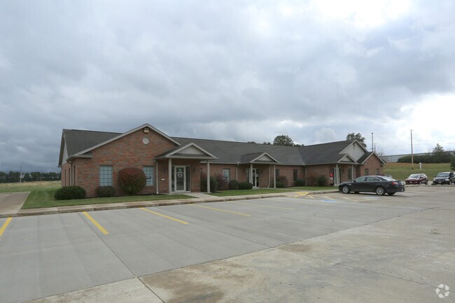

Property Detail
1650 Eagle Way
Ashland, OH
1650 EAGLE WAY R=165 LOT 4388 ABATED THRU 2019
P44-165-0-0011-00
Ashland
Officebuilding
Ohio
B and X Area of moderate flood hazard, usually the area between the limits of the 100-year and 500-year floods.
4388
2025
1.17 AC
2025
Ohio North Area
970800
Other Market Areas
5,870 SF
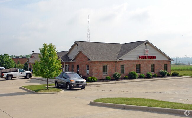
NEARBY LISTINGS FOR SALE OR LEASE
-
-
View all Ashland listings for lease on LoopNet.com
DEMOGRAPHICS near 1650 Eagle Way
1 mile
3 mile
5 mile
2025 Total Population
2,406
19,894
26,093
2030 Population
2,445
20,177
26,436
Pop Growth 2025-2030
+ 1.62%
+ 1.42%
+ 1.31%
Average Age
46
41
42
2025 Total Households
1,009
8,405
10,873
HH Growth 2025-2030
+ 2.18%
+ 1.63%
+ 1.46%
Median Household Inc
$63,562
$57,883
$60,691
Avg Household Size
2.10
2.20
2.30
2025 Avg HH Vehicles
2.00
2.00
2.00
Median Home Value
$197,958
$162,240
$172,048
Median Year Built
1982
1957
1962
Nearby Places
Map Layers
Map Styles
 Street
 Aerial
Layers
 Traffic
 Biking
Places
Listings with unknown addresses are not visible on the map
- Restaurants
- Banks
- Shops
- Fitness
- Groceries
SALE & LEASE HISTORY
LISTING DATE
SALE/LEASE

Oct 25, 2017
For Lease
May 23, 2018
For Sale
Feb 11, 2020
For Lease
Nearby Properties
Address
Land Use
TOTAL SIZE
Lot Size
Zoning
Address
Land Use
TOTAL SIZE
Lot Size
Zoning
7,737 SF
16.67 AC
Address
Land Use
TOTAL SIZE
Lot Size
Zoning
125,000 SF
2.57 AC
Address
Land Use
TOTAL SIZE
Lot Size
Zoning
3,786 SF
11.90 AC
Address
Land Use
TOTAL SIZE
Lot Size
Zoning
39,589 SF
15.28 AC
Address
Land Use
TOTAL SIZE
Lot Size
Zoning
602,490 SF
30.07 AC
Address
Land Use
TOTAL SIZE
Lot Size
Zoning
792 SF
47.90 AC
Address
Land Use
TOTAL SIZE
Lot Size
Zoning
15,279 SF
69.95 AC
Address
Land Use
TOTAL SIZE
Lot Size
Zoning
104,076 SF
5 AC
Address
Land Use
TOTAL SIZE
Lot Size
Zoning
37,974 SF
7.35 AC
Address
Land Use
TOTAL SIZE
Lot Size
Zoning
39,229 SF
13.47 AC
Address
Land Use
TOTAL SIZE
Lot Size
Zoning
62,667 SF
2.80 AC
Address
Land Use
TOTAL SIZE
Lot Size
Zoning
215,905 SF
38.12 AC
Address
Land Use
TOTAL SIZE
Lot Size
Zoning
52,176 SF
0.22 AC
Address
Land Use
TOTAL SIZE
Lot Size
Zoning
74,191 SF
6.81 AC
Address
Land Use
TOTAL SIZE
Lot Size
Zoning
95,413 SF
0.20 AC
Address
Land Use
TOTAL SIZE
Lot Size
Zoning
71,621 SF
6.19 AC
Address
Land Use
TOTAL SIZE
Lot Size
Zoning
57,097 SF
25.50 AC
Address
Land Use
TOTAL SIZE
Lot Size
Zoning
166,768 SF
132.09 AC
Address
Land Use
TOTAL SIZE
Lot Size
Zoning
234,000 SF
13.02 AC
Address
Land Use
TOTAL SIZE
Lot Size
Zoning
1,411 SF
10.44 AC
Address
Land Use
TOTAL SIZE
Lot Size
Zoning
14,296 SF
5.45 AC
Address
Land Use
TOTAL SIZE
Lot Size
Zoning
50,000 SF
14.43 AC
Address
Land Use
TOTAL SIZE
Lot Size
Zoning
46,137 SF
0.20 AC
Address
Land Use
TOTAL SIZE
Lot Size
Zoning
576 SF
19.97 AC
Address
Land Use
TOTAL SIZE
Lot Size
Zoning
40,091 SF
0.17 AC
Address
Land Use
TOTAL SIZE
Lot Size
Zoning
8,283 SF
9 AC
Address
Land Use
TOTAL SIZE
Lot Size
Zoning
30,971 SF
5.86 AC
Address
Land Use
TOTAL SIZE
Lot Size
Zoning
19,069 SF
8.09 AC
Address
Land Use
TOTAL SIZE
Lot Size
Zoning
35,180 SF
20.65 AC
Address
Land Use
TOTAL SIZE
Lot Size
Zoning
10,224 SF
2.81 AC
The World's #1 Commercial Real Estate Marketplace
Connect with us
© 2026 CoStar Group
The information above has been obtained from sources believed reliable. While we do not doubt its accuracy we have not verified it and make no guarantee, warranty or representation about it. It is your responsibility to independently confirm its accuracy and completeness. Any projections, opinions, assumptions, or estimates used are for example only and do not represent the current or future performance of the property. The value of this transaction to you depends on tax and other factors which should be evaluated by your tax, financial, and legal advisors. You and your advisors should conduct a careful, independent investigation of the property to determine to your satisfaction the suitability of the property for your needs.