Property Record
1650 Oracal Pkwy, Ellabell, GA 31308


NEARBY LISTINGS FOR SALE OR LEASE
Property Detail
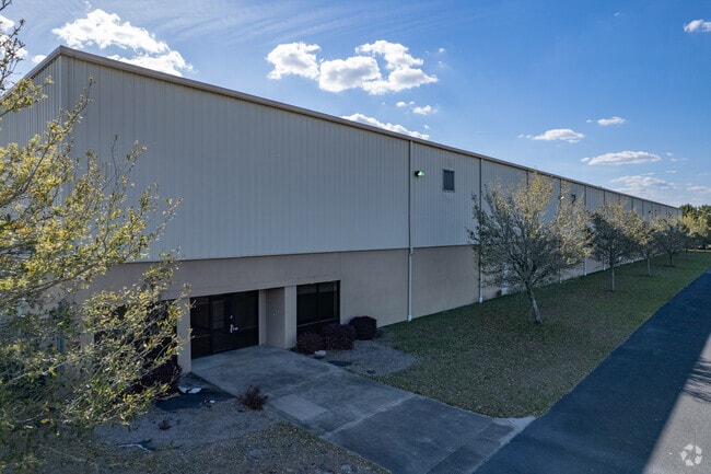
1650 Oracal Pkwy
Savannah
Interstate Centre
Savannah, GA
PB 543 / PG 5 INTERSTATE CENTRE LOT 9B
0292-009-02
Bryan
Industrialgeneral
Georgia
2024
9b
2024
6.66 AC
920101
Bryan County
80,000 SF
DEMOGRAPHICS near 1650 Oracal Pkwy
1 Mile
3 Mile
5 Mile
2024 Total Population
8
2,165
9,508
2029 Population
9
2,552
11,025
Pop Growth 2024-2029
+ 12.50%
+ 17.88%
+ 15.95%
Average Age
42
39
39
2024 Total Households
3
789
3,472
HH Growth 2024-2029
0.00%
+ 18.00%
+ 15.96%
Median Household Inc
$59,999
$57,413
$62,486
Avg Household Size
2.00
2.70
2.70
2024 Avg HH Vehicles
2.00
2.00
2.00
Median Home Value
$150,000
$166,974
$174,612
Median Year Built
2005
1994
1994
Nearby Places
Map Layers
Map Styles
 Street
 Aerial
- Restaurants
- Banks
- Shops
- Fitness
- Groceries
PUBLIC TRANSPORTATION
AIRPORT
Savannah/Hilton Head International
DRIVE
WALK
Distance
Savannah/Hilton Head International
38 min
24.1 mi
Freight Ports
Georgia Ports - Savannah
DRIVE
WALK
Distance
Georgia Ports - Savannah
40 min
26.8 mi
SALE & LEASE HISTORY
LISTING DATE
SALE/LEASE

Oct 16, 2024
For Lease
May 24, 2024
For Lease
Mar 22, 2023
For Sale
Jun 20, 2023
For Lease
Dec 29, 2024
For Lease
Nearby Properties
Address
Land Use
TOTAL SIZE
Lot Size
Zoning
Address
Land Use
TOTAL SIZE
Lot Size
Zoning
30 AC
I-2
Address
Land Use
TOTAL SIZE
Lot Size
Zoning
1,047,504 SF
108.80 AC
I-1
Address
Land Use
TOTAL SIZE
Lot Size
Zoning
992,000 SF
80.30 AC
I-1
Address
Land Use
TOTAL SIZE
Lot Size
Zoning
499,200 SF
29.58 AC
I-2
Address
Land Use
TOTAL SIZE
Lot Size
Zoning
637,875 SF
74.90 AC
I-1
Address
Land Use
TOTAL SIZE
Lot Size
Zoning
2,975.27 AC
A-5/I-2
Address
Land Use
TOTAL SIZE
Lot Size
Zoning
547,200 SF
47.56 AC
I-2
Address
Land Use
TOTAL SIZE
Lot Size
Zoning
418,951 SF
43.81 AC
I-2
Address
Land Use
TOTAL SIZE
Lot Size
Zoning
604,800 SF
52.70 AC
I-2
Address
Land Use
TOTAL SIZE
Lot Size
Zoning
700,000 SF
56.33 AC
I-2
Address
Land Use
TOTAL SIZE
Lot Size
Zoning
463,250 SF
38.13 AC
I-2
Address
Land Use
TOTAL SIZE
Lot Size
Zoning
1,144 AC
I-2
Address
Land Use
TOTAL SIZE
Lot Size
Zoning
633,120 SF
32.43 AC
I-2
Address
Land Use
TOTAL SIZE
Lot Size
Zoning
294,868 SF
32.90 AC
I-2
Address
Land Use
TOTAL SIZE
Lot Size
Zoning
712,200 SF
48.96 AC
I-2
Address
Land Use
TOTAL SIZE
Lot Size
Zoning
251.60 AC
I-1
Address
Land Use
TOTAL SIZE
Lot Size
Zoning
309.71 AC
I-2
Address
Land Use
TOTAL SIZE
Lot Size
Zoning
114.22 AC
I-2
Address
Land Use
TOTAL SIZE
Lot Size
Zoning
63.80 AC
I-2
Address
Land Use
TOTAL SIZE
Lot Size
Zoning
57.19 AC
I-2
Address
Land Use
TOTAL SIZE
Lot Size
Zoning
80.37 AC
I-2
Address
Land Use
TOTAL SIZE
Lot Size
Zoning
98.85 AC
I-2
Address
Land Use
TOTAL SIZE
Lot Size
Zoning
159.92 AC
I-2
Address
Land Use
TOTAL SIZE
Lot Size
Zoning
3.28 AC
I-2
Address
Land Use
TOTAL SIZE
Lot Size
Zoning
54,000 SF
4.12 AC
I-2
Address
Land Use
TOTAL SIZE
Lot Size
Zoning
52.10 AC
I-R
Address
Land Use
TOTAL SIZE
Lot Size
Zoning
38,200 SF
27.72 AC
I-2
Address
Land Use
TOTAL SIZE
Lot Size
Zoning
50,000 SF
32.90 AC
I-2
Address
Land Use
TOTAL SIZE
Lot Size
Zoning
26.55 AC
I-R
The World's #1 Commercial Real Estate Marketplace
Connect with us
© 2026 CoStar Group
The information above has been obtained from sources believed reliable. While we do not doubt its accuracy we have not verified it and make no guarantee, warranty or representation about it. It is your responsibility to independently confirm its accuracy and completeness. Any projections, opinions, assumptions, or estimates used are for example only and do not represent the current or future performance of the property. The value of this transaction to you depends on tax and other factors which should be evaluated by your tax, financial, and legal advisors. You and your advisors should conduct a careful, independent investigation of the property to determine to your satisfaction the suitability of the property for your needs.