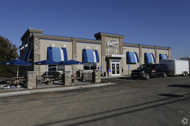
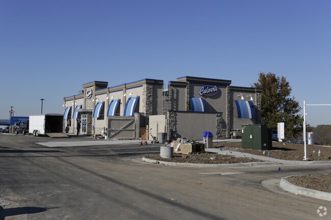
Property Record
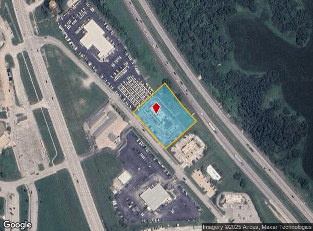
1650 Prairie View Rd, Platte City, MO 64079
NEARBY LISTINGS FOR SALE OR LEASE
Property Detail
1650 Prairie View Rd
Kansas City, MO-KS
Water Tower Plaza
12-90-31-000-000-011-000
WATER TOWER PLAZA REPLAT LOT 2
Restaurantdrivein
Platte
X
Missouri
29095C0010G
2
2024
1.65 AC
2025
I-29 Corridor
030502
Kansas City
4,429 SF
DEMOGRAPHICS near 1650 Prairie View Rd
1 Mile
3 Mile
5 Mile
2024 Total Population
3,957
12,904
14,373
2029 Population
4,329
14,122
15,737
Pop Growth 2024-2029
+ 9.40%
+ 9.44%
+ 9.49%
Average Age
39
39
40
2024 Total Households
1,627
4,854
5,390
HH Growth 2024-2029
+ 9.40%
+ 9.41%
+ 9.46%
Median Household Inc
$64,266
$91,924
$92,313
Avg Household Size
2.40
2.60
2.60
2024 Avg HH Vehicles
2.00
2.00
2.00
Median Home Value
$198,900
$266,477
$271,302
Median Year Built
1987
1996
1995
Nearby Places
Map Layers
Map Styles
 Street
 Aerial
- Restaurants
- Banks
- Shops
- Fitness
- Groceries
PUBLIC TRANSPORTATION
AIRPORT
Kansas City International
DRIVE
WALK
Distance
Kansas City International
12 min
6.3 mi
Nearby Properties
Address
Land Use
TOTAL SIZE
Lot Size
Zoning
Address
Land Use
TOTAL SIZE
Lot Size
Zoning
176,408 SF
14.36 AC
Address
Land Use
TOTAL SIZE
Lot Size
Zoning
6,006 SF
5.07 AC
Address
Land Use
TOTAL SIZE
Lot Size
Zoning
100 SF
33.28 AC
Address
Land Use
TOTAL SIZE
Lot Size
Zoning
26,678 SF
7.09 AC
Address
Land Use
TOTAL SIZE
Lot Size
Zoning
53,291 SF
6.93 AC
Address
Land Use
TOTAL SIZE
Lot Size
Zoning
70,560 SF
7.04 AC
Address
Land Use
TOTAL SIZE
Lot Size
Zoning
91,016 SF
5.62 AC
Address
Land Use
TOTAL SIZE
Lot Size
Zoning
30,181 SF
1.99 AC
Address
Land Use
TOTAL SIZE
Lot Size
Zoning
77,579 SF
6.39 AC
Address
Land Use
TOTAL SIZE
Lot Size
Zoning
1,594 SF
27.66 AC
Address
Land Use
TOTAL SIZE
Lot Size
Zoning
2,888 SF
5.37 AC
Address
Land Use
TOTAL SIZE
Lot Size
Zoning
80,529 SF
2.30 AC
Address
Land Use
TOTAL SIZE
Lot Size
Zoning
78,947 SF
3.99 AC
Address
Land Use
TOTAL SIZE
Lot Size
Zoning
18,065 SF
1.22 AC
Address
Land Use
TOTAL SIZE
Lot Size
Zoning
14,548 SF
2.02 AC
Address
Land Use
TOTAL SIZE
Lot Size
Zoning
39,371 SF
3.22 AC
Address
Land Use
TOTAL SIZE
Lot Size
Zoning
7,464 SF
2.19 AC
Address
Land Use
TOTAL SIZE
Lot Size
Zoning
13,814 SF
1.57 AC
Address
Land Use
TOTAL SIZE
Lot Size
Zoning
7,200 SF
4.79 AC
Address
Land Use
TOTAL SIZE
Lot Size
Zoning
16,570 SF
0.41 AC
Address
Land Use
TOTAL SIZE
Lot Size
Zoning
3,909 SF
2.22 AC
Address
Land Use
TOTAL SIZE
Lot Size
Zoning
12,560 SF
1.84 AC
Address
Land Use
TOTAL SIZE
Lot Size
Zoning
32,617 SF
2.56 AC
Address
Land Use
TOTAL SIZE
Lot Size
Zoning
3,893 SF
1.97 AC
Address
Land Use
TOTAL SIZE
Lot Size
Zoning
19,000 SF
4.68 AC
Address
Land Use
TOTAL SIZE
Lot Size
Zoning
26,756 SF
1.56 AC
Address
Land Use
TOTAL SIZE
Lot Size
Zoning
9,000 SF
4.93 AC
Address
Land Use
TOTAL SIZE
Lot Size
Zoning
28,125 SF
2.53 AC
The World's #1 Commercial Real Estate Marketplace
Connect with us
© 2026 CoStar Group
The information above has been obtained from sources believed reliable. While we do not doubt its accuracy we have not verified it and make no guarantee, warranty or representation about it. It is your responsibility to independently confirm its accuracy and completeness. Any projections, opinions, assumptions, or estimates used are for example only and do not represent the current or future performance of the property. The value of this transaction to you depends on tax and other factors which should be evaluated by your tax, financial, and legal advisors. You and your advisors should conduct a careful, independent investigation of the property to determine to your satisfaction the suitability of the property for your needs.