Property Record
1650 S Yellowstone Hwy, Idaho Falls, ID 83402


Property Detail
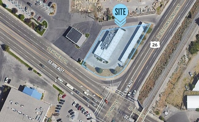
1650 S Yellowstone Hwy
RPA00007249390
.48 A S1/2 SE1/4 SE1/4, SEC 24, T 2N, R 37
Restaurantdrivein
Bonneville
R2
Idaho
2025
0.48 AC
2025
Downtown Idaho Falls
971200
Other Market Areas
1,406 SF
Idaho Falls, ID
NEARBY LISTINGS FOR SALE OR LEASE
DEMOGRAPHICS near 1650 S Yellowstone Hwy
1 mile
3 mile
5 mile
2025 Total Population
8,554
67,285
103,295
2030 Population
9,007
70,916
108,888
Pop Growth 2025-2030
+ 5.30%
+ 5.40%
+ 5.41%
Average Age
37
38
37
2025 Total Households
3,598
25,111
37,075
HH Growth 2025-2030
+ 5.42%
+ 5.45%
+ 5.50%
Median Household Inc
$54,011
$66,336
$69,892
Avg Household Size
2.30
2.60
2.70
2025 Avg HH Vehicles
2.00
2.00
2.00
Median Home Value
$290,062
$346,706
$360,334
Median Year Built
1958
1978
1988
Nearby Places
Map Layers
Map Styles
 Street
 Aerial
Layers
 Traffic
 Biking
Places
Listings with unknown addresses are not visible on the map
- Restaurants
- Banks
- Shops
- Fitness
- Groceries
PUBLIC TRANSPORTATION
AIRPORT
Idaho Falls Regional
Drive
Walk
Distance
Idaho Falls Regional
6 min
3.2 mi
SALE & LEASE HISTORY
LISTING DATE
SALE/LEASE

Nov 07, 2024
For Sale
Jun 28, 2022
For Sale
Apr 02, 2025
For Lease
Apr 02, 2025
For Sale
Nearby Properties
Address
Land Use
TOTAL SIZE
Lot Size
Zoning
Address
Land Use
TOTAL SIZE
Lot Size
Zoning
159,026 SF
13.94 AC
R2
Address
Land Use
TOTAL SIZE
Lot Size
Zoning
375,295 SF
26.11 AC
R2
Address
Land Use
TOTAL SIZE
Lot Size
Zoning
57,420 SF
8.59 AC
Address
Land Use
TOTAL SIZE
Lot Size
Zoning
37,287 SF
9.46 AC
Address
Land Use
TOTAL SIZE
Lot Size
Zoning
267,740 SF
45.91 AC
Address
Land Use
TOTAL SIZE
Lot Size
Zoning
4,813 SF
13.50 AC
Address
Land Use
TOTAL SIZE
Lot Size
Zoning
136,343 SF
10 AC
Address
Land Use
TOTAL SIZE
Lot Size
Zoning
4,118 SF
25.18 AC
R2
Address
Land Use
TOTAL SIZE
Lot Size
Zoning
253,387 SF
18.33 AC
R2
Address
Land Use
TOTAL SIZE
Lot Size
Zoning
1 SF
35.35 AC
R2
Address
Land Use
TOTAL SIZE
Lot Size
Zoning
220,179 SF
22.20 AC
R2
Address
Land Use
TOTAL SIZE
Lot Size
Zoning
111,649 SF
8.60 AC
Address
Land Use
TOTAL SIZE
Lot Size
Zoning
106,733 SF
2.99 AC
Address
Land Use
TOTAL SIZE
Lot Size
Zoning
108,128 SF
14.53 AC
Address
Land Use
TOTAL SIZE
Lot Size
Zoning
1,908 SF
5.77 AC
Address
Land Use
TOTAL SIZE
Lot Size
Zoning
61,948 SF
4.51 AC
Address
Land Use
TOTAL SIZE
Lot Size
Zoning
273,545 SF
15.89 AC
R2
Address
Land Use
TOTAL SIZE
Lot Size
Zoning
27,084 SF
3.69 AC
Address
Land Use
TOTAL SIZE
Lot Size
Zoning
7,617 SF
4.65 AC
Address
Land Use
TOTAL SIZE
Lot Size
Zoning
89,263 SF
3.92 AC
Address
Land Use
TOTAL SIZE
Lot Size
Zoning
25,629 SF
14.42 AC
Address
Land Use
TOTAL SIZE
Lot Size
Zoning
61,715 SF
4.12 AC
Address
Land Use
TOTAL SIZE
Lot Size
Zoning
1,472 SF
4.38 AC
Address
Land Use
TOTAL SIZE
Lot Size
Zoning
25,889 SF
2.91 AC
Address
Land Use
TOTAL SIZE
Lot Size
Zoning
98,476 SF
0.66 AC
R2
Address
Land Use
TOTAL SIZE
Lot Size
Zoning
163,776 SF
9.56 AC
R2
Address
Land Use
TOTAL SIZE
Lot Size
Zoning
152,632 SF
7.49 AC
R2
Address
Land Use
TOTAL SIZE
Lot Size
Zoning
4,074 SF
10.06 AC
R2
Address
Land Use
TOTAL SIZE
Lot Size
Zoning
91,002 SF
2.70 AC
R2
Address
Land Use
TOTAL SIZE
Lot Size
Zoning
93,971 SF
9.38 AC
R2
The World's #1 Commercial Real Estate Marketplace
Connect with us
© 2026 CoStar Group
The information above has been obtained from sources believed reliable. While we do not doubt its accuracy we have not verified it and make no guarantee, warranty or representation about it. It is your responsibility to independently confirm its accuracy and completeness. Any projections, opinions, assumptions, or estimates used are for example only and do not represent the current or future performance of the property. The value of this transaction to you depends on tax and other factors which should be evaluated by your tax, financial, and legal advisors. You and your advisors should conduct a careful, independent investigation of the property to determine to your satisfaction the suitability of the property for your needs.