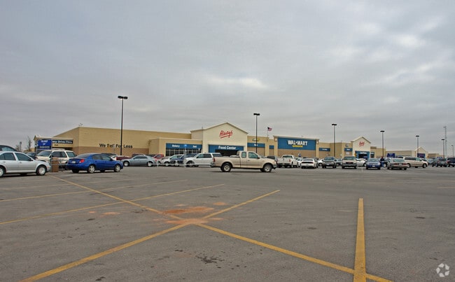
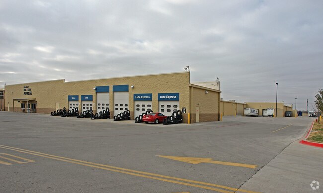
Property Record
1650 State Highway 351, Abilene, TX 79601

Property Detail
1650 State Highway 351
Abilene, TX
WAL-MART SUPERCENTER ADDN, BLOCK 1, LOT 1, ACRES 20.942
973045
Taylor
Multipleuses
Texas
B and X Area of moderate flood hazard, usually the area between the limits of the 100-year and 500-year floods.
1
2024
20.94 AC
2025
North Abilene
013300
Other Market Areas
209,580 SF
NEARBY LISTINGS FOR SALE OR LEASE
DEMOGRAPHICS near 1650 State Highway 351
1 mile
3 mile
5 mile
2025 Total Population
3,876
25,596
60,839
2030 Population
4,040
26,688
63,145
Pop Growth 2025-2030
+ 4.23%
+ 4.27%
+ 3.79%
Average Age
34
35
37
2025 Total Households
1,477
9,541
22,859
HH Growth 2025-2030
+ 4.47%
+ 4.44%
+ 4.01%
Median Household Inc
$58,858
$49,478
$52,660
Avg Household Size
2.30
2.30
2.40
2025 Avg HH Vehicles
2.00
2.00
2.00
Median Home Value
$242,251
$160,090
$146,441
Median Year Built
1997
1979
1961
Nearby Places
Map Layers
Map Styles
 Street
 Aerial
Transit
 Traffic
 Biking
Places
Listings with unknown addresses are not visible on the map
- Restaurants
- Banks
- Shops
- Fitness
- Groceries
PUBLIC TRANSPORTATION
AIRPORT
Abilene Regional
Drive
Walk
Distance
Abilene Regional
12 min
6.0 mi
Freight Ports
Calhoun Port
Drive
Walk
Distance
Calhoun Port
442 min
379.3 mi
SALE & LEASE HISTORY
LISTING DATE
SALE/LEASE

Oct 14, 2016
For Lease
Feb 15, 2017
For Lease
Nearby Properties
Address
Land Use
TOTAL SIZE
Lot Size
Zoning
Address
Land Use
TOTAL SIZE
Lot Size
Zoning
959,214 SF
94.96 AC
Address
Land Use
TOTAL SIZE
Lot Size
Zoning
24.36 AC
Address
Land Use
TOTAL SIZE
Lot Size
Zoning
812,955 SF
99.27 AC
Address
Land Use
TOTAL SIZE
Lot Size
Zoning
169,821 SF
3.59 AC
Address
Land Use
TOTAL SIZE
Lot Size
Zoning
325,355 SF
9.83 AC
Address
Land Use
TOTAL SIZE
Lot Size
Zoning
141,777 SF
36.78 AC
Address
Land Use
TOTAL SIZE
Lot Size
Zoning
115,568 SF
23.57 AC
Address
Land Use
TOTAL SIZE
Lot Size
Zoning
212,450 SF
9.43 AC
Address
Land Use
TOTAL SIZE
Lot Size
Zoning
108,121 SF
15 AC
Address
Land Use
TOTAL SIZE
Lot Size
Zoning
728,862 SF
102.37 AC
Address
Land Use
TOTAL SIZE
Lot Size
Zoning
144,349 SF
11.07 AC
Address
Land Use
TOTAL SIZE
Lot Size
Zoning
166,224 SF
8.79 AC
Address
Land Use
TOTAL SIZE
Lot Size
Zoning
229,988 SF
9.22 AC
Address
Land Use
TOTAL SIZE
Lot Size
Zoning
88,656 SF
4.14 AC
Address
Land Use
TOTAL SIZE
Lot Size
Zoning
2.63 AC
Address
Land Use
TOTAL SIZE
Lot Size
Zoning
52,028 SF
3.62 AC
Address
Land Use
TOTAL SIZE
Lot Size
Zoning
67,593 SF
49.82 AC
Address
Land Use
TOTAL SIZE
Lot Size
Zoning
62,823 SF
9.39 AC
Address
Land Use
TOTAL SIZE
Lot Size
Zoning
130,048 SF
8.22 AC
Address
Land Use
TOTAL SIZE
Lot Size
Zoning
101,812 SF
6.28 AC
Address
Land Use
TOTAL SIZE
Lot Size
Zoning
60,944 SF
2.86 AC
Address
Land Use
TOTAL SIZE
Lot Size
Zoning
2.63 AC
Address
Land Use
TOTAL SIZE
Lot Size
Zoning
77,187 SF
3.58 AC
Address
Land Use
TOTAL SIZE
Lot Size
Zoning
42,509 SF
8.63 AC
Address
Land Use
TOTAL SIZE
Lot Size
Zoning
38,150 SF
3.52 AC
Address
Land Use
TOTAL SIZE
Lot Size
Zoning
54,844 SF
12.70 AC
Address
Land Use
TOTAL SIZE
Lot Size
Zoning
108,695 SF
4 AC
Address
Land Use
TOTAL SIZE
Lot Size
Zoning
67,823 SF
14.89 AC
Address
Land Use
TOTAL SIZE
Lot Size
Zoning
30,455 SF
5.41 AC
The World's #1 Commercial Real Estate Marketplace
Connect with us
© 2026 CoStar Group
The information above has been obtained from sources believed reliable. While we do not doubt its accuracy we have not verified it and make no guarantee, warranty or representation about it. It is your responsibility to independently confirm its accuracy and completeness. Any projections, opinions, assumptions, or estimates used are for example only and do not represent the current or future performance of the property. The value of this transaction to you depends on tax and other factors which should be evaluated by your tax, financial, and legal advisors. You and your advisors should conduct a careful, independent investigation of the property to determine to your satisfaction the suitability of the property for your needs.