Property Record
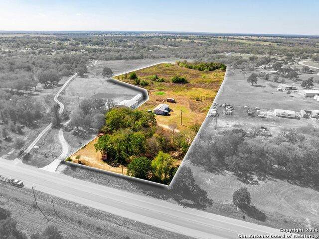
1650 N State Highway 95, Bastrop, TX 78602

NEARBY LISTINGS FOR SALE OR LEASE
-
-
View all Bastrop listings for sale on LoopNet.com
Property Detail
1650 N State Highway 95
Austin
Barker, Leman
Austin-Round Rock, TX
Bastrop
122293
Texas
Mobilemanufacturedhomeregardlessoflandownership
10.01 AC
X
Bastrop County
48021C0225E
DEMOGRAPHICS near 1650 N State Highway 95
1 Mile
3 Mile
5 Mile
2024 Total Population
647
6,897
12,027
2029 Population
771
8,306
14,446
Pop Growth 2024-2029
+ 19.17%
+ 20.43%
+ 20.11%
Average Age
37
36
37
2024 Total Households
209
1,859
3,359
HH Growth 2024-2029
+ 20.10%
+ 21.89%
+ 21.49%
Median Household Inc
$62,727
$74,726
$76,713
Avg Household Size
3.00
3.20
3.10
2024 Avg HH Vehicles
3.00
2.00
2.00
Median Home Value
$94,766
$162,815
$162,246
Median Year Built
1985
1993
1993
Nearby Places
Map Layers
Map Styles
 Street
 Aerial
- Restaurants
- Banks
- Shops
- Fitness
- Groceries
PUBLIC TRANSPORTATION
AIRPORT
Austin-Bergstrom International
DRIVE
WALK
Distance
Austin-Bergstrom International
51 min
34.7 mi
Freight Ports
Calhoun Port
DRIVE
WALK
Distance
Calhoun Port
179 min
151.5 mi
SALE & LEASE HISTORY
LISTING DATE
SALE/LEASE

Dec 03, 2024
For Sale
Nearby Properties
Address
Land Use
TOTAL SIZE
Lot Size
Zoning
Address
Land Use
TOTAL SIZE
Lot Size
Zoning
2,938.59 AC
Address
Land Use
TOTAL SIZE
Lot Size
Zoning
162,027 SF
368.29 AC
Address
Land Use
TOTAL SIZE
Lot Size
Zoning
87,953 SF
8.06 AC
Address
Land Use
TOTAL SIZE
Lot Size
Zoning
769.75 AC
Address
Land Use
TOTAL SIZE
Lot Size
Zoning
1 SF
163.41 AC
Address
Land Use
TOTAL SIZE
Lot Size
Zoning
529.49 AC
Address
Land Use
TOTAL SIZE
Lot Size
Zoning
449.50 AC
Address
Land Use
TOTAL SIZE
Lot Size
Zoning
113,607 SF
21.73 AC
Address
Land Use
TOTAL SIZE
Lot Size
Zoning
155.91 AC
Address
Land Use
TOTAL SIZE
Lot Size
Zoning
133.77 AC
Address
Land Use
TOTAL SIZE
Lot Size
Zoning
73,206 SF
5 AC
Address
Land Use
TOTAL SIZE
Lot Size
Zoning
11,758 SF
9.31 AC
Address
Land Use
TOTAL SIZE
Lot Size
Zoning
50,482 SF
31.97 AC
Address
Land Use
TOTAL SIZE
Lot Size
Zoning
19,625 SF
0.53 AC
Address
Land Use
TOTAL SIZE
Lot Size
Zoning
11,948 SF
4.26 AC
Address
Land Use
TOTAL SIZE
Lot Size
Zoning
3,014 SF
24.44 AC
Address
Land Use
TOTAL SIZE
Lot Size
Zoning
53.97 AC
Address
Land Use
TOTAL SIZE
Lot Size
Zoning
53.90 AC
Address
Land Use
TOTAL SIZE
Lot Size
Zoning
9,230 SF
1.41 AC
Address
Land Use
TOTAL SIZE
Lot Size
Zoning
4,887 SF
1.20 AC
Address
Land Use
TOTAL SIZE
Lot Size
Zoning
9,562 SF
2.91 AC
Address
Land Use
TOTAL SIZE
Lot Size
Zoning
2,016 SF
13.09 AC
Address
Land Use
TOTAL SIZE
Lot Size
Zoning
3,850 SF
11.76 AC
Address
Land Use
TOTAL SIZE
Lot Size
Zoning
4,300 SF
2.50 AC
Address
Land Use
TOTAL SIZE
Lot Size
Zoning
3,742 SF
0.28 AC
Address
Land Use
TOTAL SIZE
Lot Size
Zoning
3,662 SF
0.29 AC
Address
Land Use
TOTAL SIZE
Lot Size
Zoning
7,318 SF
1.64 AC
Address
Land Use
TOTAL SIZE
Lot Size
Zoning
5,815 SF
0.98 AC
Address
Land Use
TOTAL SIZE
Lot Size
Zoning
Address
Land Use
TOTAL SIZE
Lot Size
Zoning
2,550 SF
47.47 AC
The World's #1 Commercial Real Estate Marketplace
Connect with us
© 2025 CoStar Group
The information above has been obtained from sources believed reliable. While we do not doubt its accuracy we have not verified it and make no guarantee, warranty or representation about it. It is your responsibility to independently confirm its accuracy and completeness. Any projections, opinions, assumptions, or estimates used are for example only and do not represent the current or future performance of the property. The value of this transaction to you depends on tax and other factors which should be evaluated by your tax, financial, and legal advisors. You and your advisors should conduct a careful, independent investigation of the property to determine to your satisfaction the suitability of the property for your needs.