Property Record
1651 W Nevada Highway 372, Pahrump, NV 89048


NEARBY LISTINGS FOR SALE OR LEASE
Property Detail
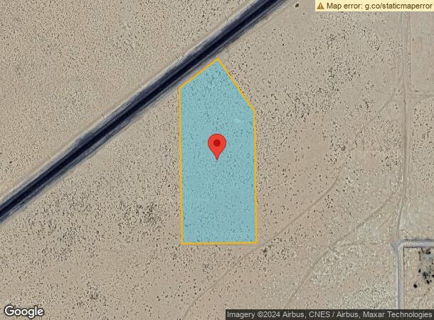
1651 W Nevada Highway 372
Pahrump, NV
Horgan Ros
36-391-30
T20S R53E S20 - PORTION OF LOT 23 MORE PARTICULARLY DESC AS FOLLOWS:COMMENCING AT THE SW COR OF P.23 OF ROS#21379 BEING THE TRUE POINT OF BEGINNING;THENCE N 0 3123W A DISTANCE OF 23.99; THENCE N52 0146E A DISTANCE OF 207.35; THENCE S34 5912E A DISTAN
Commercialnec
Nye
X
Nevada
32023C8825F
23
2024
5.48 AC
2025
Carson City/Nevada Area
960408
Other Market Areas
DEMOGRAPHICS near 1651 W Nevada Highway 372
1 Mile
3 Mile
5 Mile
2024 Total Population
1,481
16,841
27,295
2029 Population
1,728
19,603
31,725
Pop Growth 2024-2029
+ 16.68%
+ 16.40%
+ 16.23%
Average Age
50
49
49
2024 Total Households
636
7,338
11,589
HH Growth 2024-2029
+ 16.82%
+ 16.52%
+ 16.39%
Median Household Inc
$47,096
$51,284
$51,845
Avg Household Size
2.30
2.30
2.30
2024 Avg HH Vehicles
2.00
2.00
2.00
Median Home Value
$250,854
$237,590
$248,168
Median Year Built
1994
1996
1996
Nearby Places
Map Layers
Map Styles
 Street
 Aerial
- Restaurants
- Banks
- Shops
- Fitness
- Groceries
SALE & LEASE HISTORY
LISTING DATE
SALE/LEASE

May 01, 2019
For Sale
Nearby Properties
Address
Land Use
TOTAL SIZE
Lot Size
Zoning
Address
Land Use
TOTAL SIZE
Lot Size
Zoning
133,185 SF
41.60 AC
CF
Address
Land Use
TOTAL SIZE
Lot Size
Zoning
51,128 SF
24.15 AC
M
Address
Land Use
TOTAL SIZE
Lot Size
Zoning
156,375 SF
13.60 AC
GC
Address
Land Use
TOTAL SIZE
Lot Size
Zoning
10 SF
2.14 AC
OS
Address
Land Use
TOTAL SIZE
Lot Size
Zoning
12,000 SF
9.54 AC
CF
Address
Land Use
TOTAL SIZE
Lot Size
Zoning
38,606 SF
10 AC
CF
Address
Land Use
TOTAL SIZE
Lot Size
Zoning
16,466 SF
2.15 AC
GC
Address
Land Use
TOTAL SIZE
Lot Size
Zoning
13,885 SF
2.01 AC
M
Address
Land Use
TOTAL SIZE
Lot Size
Zoning
18,746 SF
5.08 AC
NC
Address
Land Use
TOTAL SIZE
Lot Size
Zoning
12,160 SF
1.26 AC
M
Address
Land Use
TOTAL SIZE
Lot Size
Zoning
25,000 SF
4.23 AC
GC
Address
Land Use
TOTAL SIZE
Lot Size
Zoning
14,027 SF
1.56 AC
GC
Address
Land Use
TOTAL SIZE
Lot Size
Zoning
12,000 SF
5 AC
CM
Address
Land Use
TOTAL SIZE
Lot Size
Zoning
8,400 SF
2.17 AC
GC
Address
Land Use
TOTAL SIZE
Lot Size
Zoning
19,097 SF
4.25 AC
GC
Address
Land Use
TOTAL SIZE
Lot Size
Zoning
9,564 SF
8.51 AC
CF
Address
Land Use
TOTAL SIZE
Lot Size
Zoning
8,750 SF
2.04 AC
CF
Address
Land Use
TOTAL SIZE
Lot Size
Zoning
10,899 SF
5 AC
NC
Address
Land Use
TOTAL SIZE
Lot Size
Zoning
6,000 SF
28 AC
SPLIT
Address
Land Use
TOTAL SIZE
Lot Size
Zoning
28,500 SF
5 AC
CM
Address
Land Use
TOTAL SIZE
Lot Size
Zoning
8,700 SF
1.22 AC
VR-10
Address
Land Use
TOTAL SIZE
Lot Size
Zoning
5,211 SF
5 AC
GC
Address
Land Use
TOTAL SIZE
Lot Size
Zoning
9,720 SF
1.57 AC
CM
Address
Land Use
TOTAL SIZE
Lot Size
Zoning
8,330 SF
2.06 AC
NC
Address
Land Use
TOTAL SIZE
Lot Size
Zoning
13,961 SF
3.88 AC
MU
Address
Land Use
TOTAL SIZE
Lot Size
Zoning
9,212 SF
1.04 AC
GC
Address
Land Use
TOTAL SIZE
Lot Size
Zoning
75.78 AC
GC
Address
Land Use
TOTAL SIZE
Lot Size
Zoning
9,636 SF
1.80 AC
NC
Address
Land Use
TOTAL SIZE
Lot Size
Zoning
67.55 AC
GC
Address
Land Use
TOTAL SIZE
Lot Size
Zoning
5,100 SF
2.19 AC
GC
The World's #1 Commercial Real Estate Marketplace
Connect with us
© 2025 CoStar Group
The information above has been obtained from sources believed reliable. While we do not doubt its accuracy we have not verified it and make no guarantee, warranty or representation about it. It is your responsibility to independently confirm its accuracy and completeness. Any projections, opinions, assumptions, or estimates used are for example only and do not represent the current or future performance of the property. The value of this transaction to you depends on tax and other factors which should be evaluated by your tax, financial, and legal advisors. You and your advisors should conduct a careful, independent investigation of the property to determine to your satisfaction the suitability of the property for your needs.