Property Record
16542 Riverside Dr, Saint Paul, VA 24283
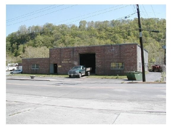


Property Detail
16542 Riverside Dr
R004674
L 6
Storebuilding
WISE
AE The base floodplain where base flood elevations are provided. AE Zones are now used on new format FIRMs instead of A1-A30 Zones.
Virginia
2025
6
2025
0.66 AC
931700
Virginia Regional
6,480 SF
Other Market Areas
NEARBY LISTINGS FOR SALE OR LEASE
DEMOGRAPHICS near 16542 Riverside Dr
1 mile
3 mile
5 mile
2024 Total Population
803
3,203
5,134
2029 Population
764
3,129
5,056
Pop Growth 2024-2029
(4.86%)
(2.31%)
(1.52%)
Average Age
44
44
44
2024 Total Households
353
1,368
2,188
HH Growth 2024-2029
(4.82%)
(2.34%)
(1.55%)
Median Household Inc
$38,999
$48,990
$47,051
Avg Household Size
2.30
2.30
2.30
2024 Avg HH Vehicles
2.00
2.00
2.00
Median Home Value
$150,781
$129,932
$117,538
Median Year Built
1972
1974
1975
Nearby Places
Map Layers
Map Styles
 Street
 Aerial
Transit
 Traffic
 Biking
Places
Listings with unknown addresses are not visible on the map
- Restaurants
- Banks
- Shops
- Fitness
- Groceries
SALE & LEASE HISTORY
LISTING DATE
SALE/LEASE

Sep 24, 2016
For Sale
Nearby Properties
Address
Land Use
TOTAL SIZE
Lot Size
Zoning
Address
Land Use
TOTAL SIZE
Lot Size
Zoning
13.01 AC
Address
Land Use
TOTAL SIZE
Lot Size
Zoning
13.01 AC
Address
Land Use
TOTAL SIZE
Lot Size
Zoning
25,212 SF
0.48 AC
Address
Land Use
TOTAL SIZE
Lot Size
Zoning
36,501 SF
5.07 AC
Address
Land Use
TOTAL SIZE
Lot Size
Zoning
18,337 SF
1.86 AC
Address
Land Use
TOTAL SIZE
Lot Size
Zoning
49,340 SF
2.96 AC
Address
Land Use
TOTAL SIZE
Lot Size
Zoning
2.15 AC
Address
Land Use
TOTAL SIZE
Lot Size
Zoning
4,320 SF
389.08 AC
Address
Land Use
TOTAL SIZE
Lot Size
Zoning
9,000 SF
2.72 AC
Address
Land Use
TOTAL SIZE
Lot Size
Zoning
2,769 SF
1 AC
Address
Land Use
TOTAL SIZE
Lot Size
Zoning
11,700 SF
0.21 AC
Address
Land Use
TOTAL SIZE
Lot Size
Zoning
1.10 AC
Address
Land Use
TOTAL SIZE
Lot Size
Zoning
13,104 SF
0.17 AC
Address
Land Use
TOTAL SIZE
Lot Size
Zoning
6,125 SF
1.03 AC
Address
Land Use
TOTAL SIZE
Lot Size
Zoning
0.58 AC
Address
Land Use
TOTAL SIZE
Lot Size
Zoning
13,944 SF
3.69 AC
Address
Land Use
TOTAL SIZE
Lot Size
Zoning
2,982 SF
0.91 AC
Address
Land Use
TOTAL SIZE
Lot Size
Zoning
Address
Land Use
TOTAL SIZE
Lot Size
Zoning
2,601 SF
224.02 AC
Address
Land Use
TOTAL SIZE
Lot Size
Zoning
2,072 SF
0.50 AC
Address
Land Use
TOTAL SIZE
Lot Size
Zoning
2,500 SF
1.34 AC
Address
Land Use
TOTAL SIZE
Lot Size
Zoning
6,888 SF
1.50 AC
Address
Land Use
TOTAL SIZE
Lot Size
Zoning
125.60 AC
Address
Land Use
TOTAL SIZE
Lot Size
Zoning
2,700 SF
1.12 AC
Address
Land Use
TOTAL SIZE
Lot Size
Zoning
6,860 SF
0.99 AC
Address
Land Use
TOTAL SIZE
Lot Size
Zoning
6,600 SF
1.01 AC
Address
Land Use
TOTAL SIZE
Lot Size
Zoning
3,870 SF
0.24 AC
Address
Land Use
TOTAL SIZE
Lot Size
Zoning
38,306 SF
0.91 AC
Address
Land Use
TOTAL SIZE
Lot Size
Zoning
2,560 SF
1.82 AC
Address
Land Use
TOTAL SIZE
Lot Size
Zoning
2,188 SF
42.15 AC
The World's #1 Commercial Real Estate Marketplace
Connect with us
© 2026 CoStar Group
The information above has been obtained from sources believed reliable. While we do not doubt its accuracy we have not verified it and make no guarantee, warranty or representation about it. It is your responsibility to independently confirm its accuracy and completeness. Any projections, opinions, assumptions, or estimates used are for example only and do not represent the current or future performance of the property. The value of this transaction to you depends on tax and other factors which should be evaluated by your tax, financial, and legal advisors. You and your advisors should conduct a careful, independent investigation of the property to determine to your satisfaction the suitability of the property for your needs.