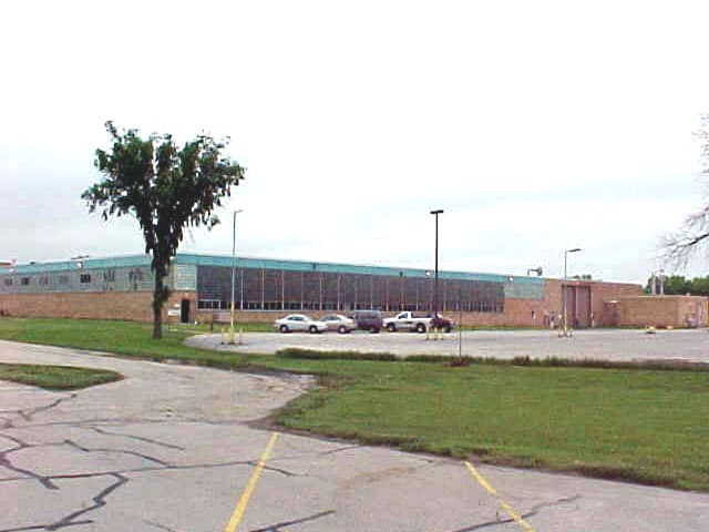
Property Record
1655 Bergstrom Rd, Neenah, WI 54956

NEARBY LISTINGS FOR SALE OR LEASE
Property Detail
1655 Bergstrom Rd
06-1650-0000
PRT SEC 5 T19N R17E; PRT SE &SW COM S1/4 COR, N2DG616W 45; N81DG46E338.19; N43DG26E5 67 .71; N20DG826E 216.5; N2 0DG 826E 870 TO POB; N69DG5 034 W1500; N21DG3712E 98 0+-; N89DG5016E589.91; N4 5DG911 E457.68; N89DG5016 E 480; TO ROW BERGSTROM RD.; S A
Industrialgeneral
Winnebago
AE
Wisconsin
55087C0450D
37.49 AC
2023
Appleton/Oshkosh
2024
Other Market Areas
003703
Oshkosh-Neenah, WI
DEMOGRAPHICS near 1655 Bergstrom Rd
1 Mile
3 Mile
5 Mile
2024 Total Population
3,315
28,286
44,617
2029 Population
3,302
28,222
44,576
Pop Growth 2024-2029
(0.39%)
(0.23%)
(0.09%)
Average Age
38
40
40
2024 Total Households
1,297
11,831
18,673
HH Growth 2024-2029
(0.62%)
(0.36%)
(0.24%)
Median Household Inc
$77,670
$71,173
$69,919
Avg Household Size
2.50
2.30
2.30
2024 Avg HH Vehicles
2.00
2.00
2.00
Median Home Value
$246,411
$187,228
$188,769
Median Year Built
1991
1971
1970
Nearby Places
Map Layers
Map Styles
 Street
 Aerial
- Restaurants
- Banks
- Shops
- Fitness
- Groceries
PUBLIC TRANSPORTATION
AIRPORT
Appleton International
DRIVE
WALK
Distance
Appleton International
19 min
10.8 mi
Green Bay/Austin Straubel International
DRIVE
WALK
Distance
Green Bay/Austin Straubel International
49 min
38.6 mi
Freight Ports
Port Milwaukee
DRIVE
WALK
Distance
Port Milwaukee
118 min
99.5 mi
Nearby Properties
Address
Land Use
TOTAL SIZE
Lot Size
Zoning
Address
Land Use
TOTAL SIZE
Lot Size
Zoning
1,975 SF
2.40 AC
M2
Address
Land Use
TOTAL SIZE
Lot Size
Zoning
800 SF
19.84 AC
I1
Address
Land Use
TOTAL SIZE
Lot Size
Zoning
59,584 SF
12.11 AC
C1
Address
Land Use
TOTAL SIZE
Lot Size
Zoning
32.54 AC
Address
Land Use
TOTAL SIZE
Lot Size
Zoning
105,852 SF
0.39 AC
PDD
Address
Land Use
TOTAL SIZE
Lot Size
Zoning
67.41 AC
I2
Address
Land Use
TOTAL SIZE
Lot Size
Zoning
29.32 AC
I1
Address
Land Use
TOTAL SIZE
Lot Size
Zoning
210,214 SF
16.44 AC
I1
Address
Land Use
TOTAL SIZE
Lot Size
Zoning
361,899 SF
18.54 AC
I2
Address
Land Use
TOTAL SIZE
Lot Size
Zoning
74,603 SF
4.96 AC
I1
Address
Land Use
TOTAL SIZE
Lot Size
Zoning
92,030 SF
7.79 AC
I1
Address
Land Use
TOTAL SIZE
Lot Size
Zoning
145,322 SF
11.20 AC
PDD
Address
Land Use
TOTAL SIZE
Lot Size
Zoning
92,039 SF
13.55 AC
I2
Address
Land Use
TOTAL SIZE
Lot Size
Zoning
9.27 AC
I1
Address
Land Use
TOTAL SIZE
Lot Size
Zoning
48,933 SF
2.80 AC
PDD
Address
Land Use
TOTAL SIZE
Lot Size
Zoning
22.72 AC
I1
Address
Land Use
TOTAL SIZE
Lot Size
Zoning
80,914 SF
1.30 AC
C2
Address
Land Use
TOTAL SIZE
Lot Size
Zoning
115,151 SF
11.71 AC
PDD
Address
Land Use
TOTAL SIZE
Lot Size
Zoning
37,672 SF
5.26 AC
PDD
Address
Land Use
TOTAL SIZE
Lot Size
Zoning
117,640 SF
7.45 AC
I1
Address
Land Use
TOTAL SIZE
Lot Size
Zoning
160,920 SF
7.98 AC
M2
Address
Land Use
TOTAL SIZE
Lot Size
Zoning
160,920 SF
7.89 AC
M2
Address
Land Use
TOTAL SIZE
Lot Size
Zoning
107,703 SF
4.63 AC
I2
Address
Land Use
TOTAL SIZE
Lot Size
Zoning
253,191 SF
18.75 AC
I2
Address
Land Use
TOTAL SIZE
Lot Size
Zoning
139,871 SF
11.14 AC
C1
Address
Land Use
TOTAL SIZE
Lot Size
Zoning
50,652 SF
8.51 AC
C1
Address
Land Use
TOTAL SIZE
Lot Size
Zoning
12,920 SF
4.96 AC
M2
Address
Land Use
TOTAL SIZE
Lot Size
Zoning
192,120 SF
11.41 AC
I1
Address
Land Use
TOTAL SIZE
Lot Size
Zoning
11.20 AC
Address
Land Use
TOTAL SIZE
Lot Size
Zoning
57,721 SF
7.51 AC
PDD
The World's #1 Commercial Real Estate Marketplace
Connect with us
© 2026 CoStar Group
The information above has been obtained from sources believed reliable. While we do not doubt its accuracy we have not verified it and make no guarantee, warranty or representation about it. It is your responsibility to independently confirm its accuracy and completeness. Any projections, opinions, assumptions, or estimates used are for example only and do not represent the current or future performance of the property. The value of this transaction to you depends on tax and other factors which should be evaluated by your tax, financial, and legal advisors. You and your advisors should conduct a careful, independent investigation of the property to determine to your satisfaction the suitability of the property for your needs.