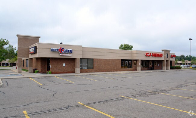
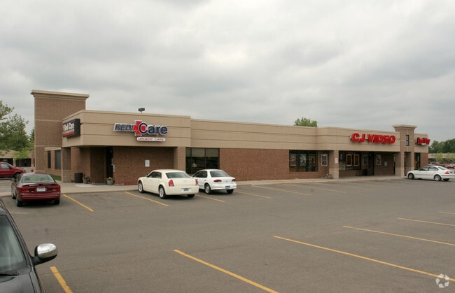
Property Record
1655 Haslett Rd, Haslett, MI 48840

Property Detail
1655 Haslett Rd
02-02-10-401-005
M10-33 COM AT CEN OF SEC 10 S 00 DEG 32' 45 E 386.2 FT ALNG NS 1/4 LN OF SEC 10 - N 87 DEG 58'26"E 305.57 FT ALNG S'LY R/W LN
Communitycenter
Ingham
C-2
Michigan
B and X Area of moderate flood hazard, usually the area between the limits of the 100-year and 500-year floods.
10.44 AC
0
East Lansing
2025
West Michigan
004801
Lansing-East Lansing, MI
71,018 SF
NEARBY LISTINGS FOR SALE OR LEASE
DEMOGRAPHICS near 1655 Haslett Rd
1 mile
3 mile
5 mile
2025 Total Population
7,054
40,138
110,529
2030 Population
7,092
40,826
113,981
Pop Growth 2025-2030
+ 0.54%
+ 1.71%
+ 3.12%
Average Age
42
40
35
2025 Total Households
3,454
17,598
43,834
HH Growth 2025-2030
+ 0.55%
+ 1.94%
+ 3.45%
Median Household Inc
$70,273
$81,230
$67,438
Avg Household Size
2.00
2.20
2.20
2025 Avg HH Vehicles
2.00
2.00
2.00
Median Home Value
$228,175
$296,525
$299,412
Median Year Built
1976
1981
1985
Nearby Places
Map Layers
Map Styles
 Street
 Aerial
Transit
 Traffic
 Biking
Places
Listings with unknown addresses are not visible on the map
- Restaurants
- Banks
- Shops
- Fitness
- Groceries
PUBLIC TRANSPORTATION
COMMUTER RAIL
East Lansing Amtrak Station (Blue Water - Amtrak)
Drive
Walk
Distance
East Lansing Amtrak Station (Blue Water - Amtrak)
15 min
6.8 mi
AIRPORT
Capital Region International
Drive
Walk
Distance
Capital Region International
23 min
10.8 mi
Freight Ports
Port of Toledo
Drive
Walk
Distance
Port of Toledo
148 min
117.5 mi
Nearby Properties
Address
Land Use
TOTAL SIZE
Lot Size
Zoning
Address
Land Use
TOTAL SIZE
Lot Size
Zoning
49,959 SF
15.71 AC
RP
Address
Land Use
TOTAL SIZE
Lot Size
Zoning
812,293 SF
62.18 AC
C-3
Address
Land Use
TOTAL SIZE
Lot Size
Zoning
149,799 SF
9.60 AC
Address
Land Use
TOTAL SIZE
Lot Size
Zoning
179,376 SF
6.03 AC
RM32
Address
Land Use
TOTAL SIZE
Lot Size
Zoning
32,946 SF
64.40 AC
RD
Address
Land Use
TOTAL SIZE
Lot Size
Zoning
51,122 SF
9.05 AC
RAA
Address
Land Use
TOTAL SIZE
Lot Size
Zoning
215,335 SF
38.10 AC
RM08
Address
Land Use
TOTAL SIZE
Lot Size
Zoning
129,030 SF
RP
Address
Land Use
TOTAL SIZE
Lot Size
Zoning
119,182 SF
19.33 AC
C-3
Address
Land Use
TOTAL SIZE
Lot Size
Zoning
35,523 SF
6.23 AC
C-2
Address
Land Use
TOTAL SIZE
Lot Size
Zoning
179,376 SF
5.68 AC
Address
Land Use
TOTAL SIZE
Lot Size
Zoning
9,280 SF
24.38 AC
RC
Address
Land Use
TOTAL SIZE
Lot Size
Zoning
4,784 SF
24.06 AC
RC
Address
Land Use
TOTAL SIZE
Lot Size
Zoning
189,280 SF
6.03 AC
RCC
Address
Land Use
TOTAL SIZE
Lot Size
Zoning
78,098 SF
5.33 AC
C-3
Address
Land Use
TOTAL SIZE
Lot Size
Zoning
11,374 SF
21.59 AC
RC
Address
Land Use
TOTAL SIZE
Lot Size
Zoning
15,918 SF
23.13 AC
RC
Address
Land Use
TOTAL SIZE
Lot Size
Zoning
119,182 SF
9.68 AC
Address
Land Use
TOTAL SIZE
Lot Size
Zoning
114,593 SF
26.07 AC
Address
Land Use
TOTAL SIZE
Lot Size
Zoning
158,696 SF
24.74 AC
DEVELOPMEN
Address
Land Use
TOTAL SIZE
Lot Size
Zoning
72,020 SF
2.50 AC
C-2
Address
Land Use
TOTAL SIZE
Lot Size
Zoning
70,456 SF
9.13 AC
PO
Address
Land Use
TOTAL SIZE
Lot Size
Zoning
53,177 SF
9.03 AC
RA
Address
Land Use
TOTAL SIZE
Lot Size
Zoning
223,026 SF
30.20 AC
C-2
Address
Land Use
TOTAL SIZE
Lot Size
Zoning
3,792 SF
34.73 AC
RD
Address
Land Use
TOTAL SIZE
Lot Size
Zoning
15,102 SF
19.59 AC
RC
Address
Land Use
TOTAL SIZE
Lot Size
Zoning
34,322 SF
16.53 AC
RC
Address
Land Use
TOTAL SIZE
Lot Size
Zoning
100,754 SF
23.79 AC
CS
Address
Land Use
TOTAL SIZE
Lot Size
Zoning
3,769 SF
6.38 AC
C-2
Address
Land Use
TOTAL SIZE
Lot Size
Zoning
9,094 SF
7.20 AC
C-3
The World's #1 Commercial Real Estate Marketplace
Connect with us
© 2026 CoStar Group
The information above has been obtained from sources believed reliable. While we do not doubt its accuracy we have not verified it and make no guarantee, warranty or representation about it. It is your responsibility to independently confirm its accuracy and completeness. Any projections, opinions, assumptions, or estimates used are for example only and do not represent the current or future performance of the property. The value of this transaction to you depends on tax and other factors which should be evaluated by your tax, financial, and legal advisors. You and your advisors should conduct a careful, independent investigation of the property to determine to your satisfaction the suitability of the property for your needs.