Property Record
1655 W Maple St, Mapleton, UT 84664
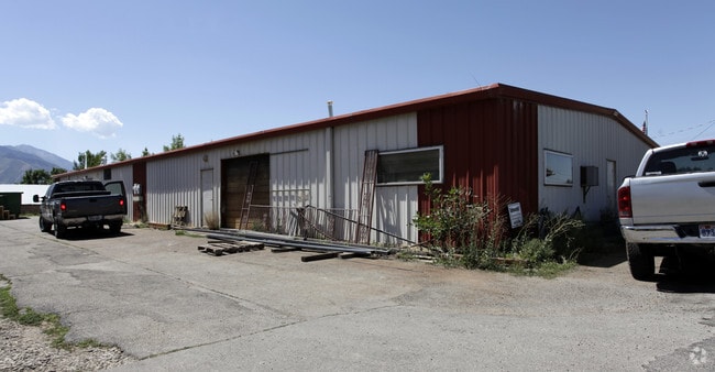


Property Detail
1655 W Maple St
Provo-Orem-Lehi, UT
COM S 0 DEG 18 38 E 54.9 FT & S 89 DEG 41 22 W 73 FT & S 88 DEG 42 22 W 97 FT & S 89 DEG 41 22 W 25 FT FR NE COR, SEC. 16, T8S, R3E, SLB&M.; S 0 DEG 18 38 E 162.03 FT; N 85 DEG 46 7 W 129.44 FT; N 0 DEG 26 54 W 151.78 FT; N 89 DEG 41 22 E 129.4 FT TO
27-007-0025
Utah
Industrialgeneral
Utah
2024
0.47 AC
2025
Utah County
010308
Salt Lake City
9,641 SF
NEARBY LISTINGS FOR SALE OR LEASE
DEMOGRAPHICS near 1655 W Maple St
1 mile
3 mile
5 mile
2025 Total Population
8,020
72,816
101,490
2030 Population
9,102
80,235
111,758
Pop Growth 2025-2030
+ 13.49%
+ 10.19%
+ 10.12%
Average Age
33
33
33
2025 Total Households
2,060
20,106
28,335
HH Growth 2025-2030
+ 14.13%
+ 10.82%
+ 10.79%
Median Household Inc
$119,230
$103,686
$103,738
Avg Household Size
3.90
3.60
3.60
2025 Avg HH Vehicles
3.00
3.00
3.00
Median Home Value
$736,164
$579,464
$549,090
Median Year Built
2010
2001
2001
Nearby Places
Map Layers
Map Styles
 Street
 Aerial
Transit
 Traffic
 Biking
Places
Listings with unknown addresses are not visible on the map
- Restaurants
- Banks
- Shops
- Fitness
- Groceries
PUBLIC TRANSPORTATION
COMMUTER RAIL
Drive
Walk
Distance
14 min
9.1 mi
Drive
Walk
Distance
15 min
9.1 mi
AIRPORT
Provo Municipal
Drive
Walk
Distance
Provo Municipal
18 min
11.1 mi
SALE & LEASE HISTORY
LISTING DATE
SALE/LEASE

Mar 30, 2017
For Lease
Apr 15, 2025
For Lease
Nearby Properties
Address
Land Use
TOTAL SIZE
Lot Size
Zoning
Address
Land Use
TOTAL SIZE
Lot Size
Zoning
44,552 SF
29.78 AC
Address
Land Use
TOTAL SIZE
Lot Size
Zoning
565,605 SF
20 AC
Address
Land Use
TOTAL SIZE
Lot Size
Zoning
243,888 SF
32.23 AC
Address
Land Use
TOTAL SIZE
Lot Size
Zoning
159,679 SF
12.91 AC
Address
Land Use
TOTAL SIZE
Lot Size
Zoning
322,432 SF
29.36 AC
Address
Land Use
TOTAL SIZE
Lot Size
Zoning
125,729 SF
12.84 AC
Address
Land Use
TOTAL SIZE
Lot Size
Zoning
149,046 SF
12.10 AC
Address
Land Use
TOTAL SIZE
Lot Size
Zoning
124,255 SF
9.87 AC
Address
Land Use
TOTAL SIZE
Lot Size
Zoning
112,094 SF
10.34 AC
Address
Land Use
TOTAL SIZE
Lot Size
Zoning
72,453 SF
14.17 AC
Address
Land Use
TOTAL SIZE
Lot Size
Zoning
181,993 SF
5.01 AC
Address
Land Use
TOTAL SIZE
Lot Size
Zoning
71,691 SF
5.52 AC
Address
Land Use
TOTAL SIZE
Lot Size
Zoning
96,879 SF
7.91 AC
Address
Land Use
TOTAL SIZE
Lot Size
Zoning
82,610 SF
2.46 AC
Address
Land Use
TOTAL SIZE
Lot Size
Zoning
82,610 SF
2.02 AC
Address
Land Use
TOTAL SIZE
Lot Size
Zoning
110,762 SF
6.08 AC
Address
Land Use
TOTAL SIZE
Lot Size
Zoning
62,203 SF
2.13 AC
Address
Land Use
TOTAL SIZE
Lot Size
Zoning
90,249 SF
4.33 AC
Address
Land Use
TOTAL SIZE
Lot Size
Zoning
37,031 SF
4.73 AC
Address
Land Use
TOTAL SIZE
Lot Size
Zoning
51,530 SF
4.58 AC
Address
Land Use
TOTAL SIZE
Lot Size
Zoning
92,026 SF
9.99 AC
Address
Land Use
TOTAL SIZE
Lot Size
Zoning
51,611 SF
9.81 AC
Address
Land Use
TOTAL SIZE
Lot Size
Zoning
89,591 SF
9.01 AC
Address
Land Use
TOTAL SIZE
Lot Size
Zoning
89,597 SF
5.92 AC
Address
Land Use
TOTAL SIZE
Lot Size
Zoning
14,844 SF
1.76 AC
Address
Land Use
TOTAL SIZE
Lot Size
Zoning
132,136 SF
6.52 AC
Address
Land Use
TOTAL SIZE
Lot Size
Zoning
61,727 SF
5.30 AC
I1
Address
Land Use
TOTAL SIZE
Lot Size
Zoning
121,701 SF
5.13 AC
Address
Land Use
TOTAL SIZE
Lot Size
Zoning
49,436 SF
6.30 AC
Address
Land Use
TOTAL SIZE
Lot Size
Zoning
69,508 SF
4.24 AC
The World's #1 Commercial Real Estate Marketplace
Connect with us
© 2026 CoStar Group
The information above has been obtained from sources believed reliable. While we do not doubt its accuracy we have not verified it and make no guarantee, warranty or representation about it. It is your responsibility to independently confirm its accuracy and completeness. Any projections, opinions, assumptions, or estimates used are for example only and do not represent the current or future performance of the property. The value of this transaction to you depends on tax and other factors which should be evaluated by your tax, financial, and legal advisors. You and your advisors should conduct a careful, independent investigation of the property to determine to your satisfaction the suitability of the property for your needs.