Property Record
16550 W Stratton Dr, New Berlin, WI 53151


NEARBY LISTINGS FOR SALE OR LEASE
Property Detail
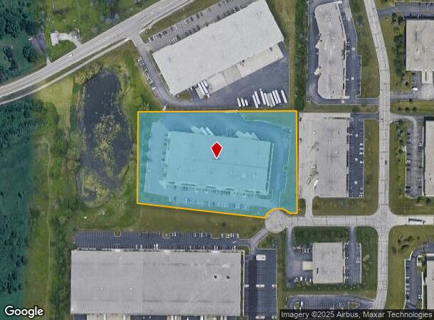
16550 W Stratton Dr
Milwaukee-Waukesha, WI
Towne Corporate Park
NBC-1259-993
LOT 1 C.S.M. #8699 V77 P92 DOC.#2403021 BEING A DIVISION OF LAND IN PT NE.25 SW.25 & SE.25 NW.25 SEC 27 T6N R20E #3533013 12/17/2007 EASE DOC #4041820 REC 09/11/2013 DOC #4329679 3/16/2018 DOCS #4334464 & 4334465 04/17/2018
Commercialnec
Waukesha
X
Wisconsin
55133C0353H
1
2024
5.90 AC
2024
SE/Muskego
201505
Milwaukee/Madison
79,844 SF
DEMOGRAPHICS near 16550 W Stratton Dr
1 Mile
3 Mile
5 Mile
2024 Total Population
1,956
35,327
104,781
2029 Population
2,032
36,258
106,300
Pop Growth 2024-2029
+ 3.89%
+ 2.64%
+ 1.45%
Average Age
45
45
44
2024 Total Households
768
14,398
44,210
HH Growth 2024-2029
+ 3.91%
+ 2.62%
+ 1.40%
Median Household Inc
$103,866
$97,153
$90,613
Avg Household Size
2.50
2.40
2.30
2024 Avg HH Vehicles
2.00
2.00
2.00
Median Home Value
$293,007
$334,380
$313,791
Median Year Built
1981
1982
1979
Nearby Places
Map Layers
Map Styles
 Street
 Aerial
- Restaurants
- Banks
- Shops
- Fitness
- Groceries
PUBLIC TRANSPORTATION
AIRPORT
General Mitchell International
DRIVE
WALK
Distance
General Mitchell International
24 min
13.4 mi
Freight Ports
Port Milwaukee
DRIVE
WALK
Distance
Port Milwaukee
23 min
15.3 mi
Nearby Properties
Address
Land Use
TOTAL SIZE
Lot Size
Zoning
Address
Land Use
TOTAL SIZE
Lot Size
Zoning
139,164 SF
25.94 AC
O2
Address
Land Use
TOTAL SIZE
Lot Size
Zoning
464,768 SF
34.90 AC
M1
Address
Land Use
TOTAL SIZE
Lot Size
Zoning
17.68 AC
Address
Land Use
TOTAL SIZE
Lot Size
Zoning
33.26 AC
Address
Land Use
TOTAL SIZE
Lot Size
Zoning
370,169 SF
23.69 AC
RM1
Address
Land Use
TOTAL SIZE
Lot Size
Zoning
Address
Land Use
TOTAL SIZE
Lot Size
Zoning
174,869 SF
17.40 AC
RM1
Address
Land Use
TOTAL SIZE
Lot Size
Zoning
15.24 AC
Address
Land Use
TOTAL SIZE
Lot Size
Zoning
154,897 SF
17.51 AC
O2
Address
Land Use
TOTAL SIZE
Lot Size
Zoning
52,000 SF
12.76 AC
I1
Address
Land Use
TOTAL SIZE
Lot Size
Zoning
74,309 SF
10.28 AC
O2
Address
Land Use
TOTAL SIZE
Lot Size
Zoning
Address
Land Use
TOTAL SIZE
Lot Size
Zoning
217,472 SF
21.27 AC
M1
Address
Land Use
TOTAL SIZE
Lot Size
Zoning
66,893 SF
6.75 AC
B2
Address
Land Use
TOTAL SIZE
Lot Size
Zoning
51.76 AC
Address
Land Use
TOTAL SIZE
Lot Size
Zoning
146,270 SF
18 AC
O2
Address
Land Use
TOTAL SIZE
Lot Size
Zoning
139,706 SF
16.50 AC
M1
Address
Land Use
TOTAL SIZE
Lot Size
Zoning
171,506 SF
11.85 AC
M1
Address
Land Use
TOTAL SIZE
Lot Size
Zoning
164,440 SF
11.63 AC
M1
Address
Land Use
TOTAL SIZE
Lot Size
Zoning
182,736 SF
7.88 AC
RM1
Address
Land Use
TOTAL SIZE
Lot Size
Zoning
172,772 SF
13.53 AC
M1
Address
Land Use
TOTAL SIZE
Lot Size
Zoning
99,648 SF
10.87 AC
B1
Address
Land Use
TOTAL SIZE
Lot Size
Zoning
199,064 SF
7.04 AC
RM1
Address
Land Use
TOTAL SIZE
Lot Size
Zoning
97,217 SF
18.38 AC
M1
Address
Land Use
TOTAL SIZE
Lot Size
Zoning
59,080 SF
18.96 AC
O1
Address
Land Use
TOTAL SIZE
Lot Size
Zoning
93,776 SF
7.94 AC
M1
Address
Land Use
TOTAL SIZE
Lot Size
Zoning
Address
Land Use
TOTAL SIZE
Lot Size
Zoning
56,052 SF
8.46 AC
O2
Address
Land Use
TOTAL SIZE
Lot Size
Zoning
36,432 SF
4.12 AC
O1
Address
Land Use
TOTAL SIZE
Lot Size
Zoning
122,604 SF
11.12 AC
M1
The World's #1 Commercial Real Estate Marketplace
Connect with us
© 2026 CoStar Group
The information above has been obtained from sources believed reliable. While we do not doubt its accuracy we have not verified it and make no guarantee, warranty or representation about it. It is your responsibility to independently confirm its accuracy and completeness. Any projections, opinions, assumptions, or estimates used are for example only and do not represent the current or future performance of the property. The value of this transaction to you depends on tax and other factors which should be evaluated by your tax, financial, and legal advisors. You and your advisors should conduct a careful, independent investigation of the property to determine to your satisfaction the suitability of the property for your needs.