Property Record
166 State Route 31, Hampton, NJ 08827

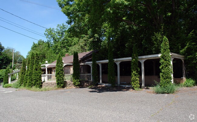
Property Detail
166 State Route 31
Newark, NJ
INCL BLK 21 LOTS 10 & 11
13-00021-0000-00010
HUNTERDON
Vacantlandnec
New Jersey
I-C
10
B and X Area of moderate flood hazard, usually the area between the limits of the 100-year and 500-year floods.
0.18 AC
2024
Route 78 West
2025
Northern New Jersey
010400
NEARBY LISTINGS FOR SALE OR LEASE
DEMOGRAPHICS near 166 State Route 31
1 mile
3 mile
5 mile
2025 Total Population
2,579
10,016
30,832
2030 Population
2,618
10,305
31,501
Pop Growth 2025-2030
+ 1.51%
+ 2.89%
+ 2.17%
Average Age
44
45
44
2025 Total Households
1,163
3,926
11,912
HH Growth 2025-2030
+ 1.46%
+ 2.85%
+ 2.12%
Median Household Inc
$84,299
$121,199
$113,300
Avg Household Size
2.20
2.50
2.50
2025 Avg HH Vehicles
2.00
2.00
2.00
Median Home Value
$317,353
$413,701
$387,684
Median Year Built
1973
1978
1972
Nearby Places
Map Layers
Map Styles
 Street
 Aerial
Transit
 Traffic
 Biking
Places
Listings with unknown addresses are not visible on the map
- Restaurants
- Banks
- Shops
- Fitness
- Groceries
PUBLIC TRANSPORTATION
COMMUTER RAIL
High Bridge (Raritan Valley Line - NJ Transit Commuter Rail (NJ Transit))
Drive
Walk
Distance
High Bridge (Raritan Valley Line - NJ Transit Commuter Rail (NJ Transit))
8 min
6.1 mi
Annandale (Raritan Valley Line - NJ Transit Commuter Rail (NJ Transit))
Drive
Walk
Distance
Annandale (Raritan Valley Line - NJ Transit Commuter Rail (NJ Transit))
11 min
8.1 mi
AIRPORT
Lehigh Valley International
Drive
Walk
Distance
Lehigh Valley International
51 min
31.8 mi
Freight Ports
New York Container Terminal
Drive
Walk
Distance
New York Container Terminal
68 min
52.2 mi
SALE & LEASE HISTORY
LISTING DATE
SALE/LEASE

May 15, 2017
For Sale
Jul 27, 2017
For Sale
Nearby Properties
Address
Land Use
TOTAL SIZE
Lot Size
Zoning
Address
Land Use
TOTAL SIZE
Lot Size
Zoning
52.10 AC
PCOS
Address
Land Use
TOTAL SIZE
Lot Size
Zoning
215.75 AC
RC
Address
Land Use
TOTAL SIZE
Lot Size
Zoning
800 SF
28.04 AC
MR
Address
Land Use
TOTAL SIZE
Lot Size
Zoning
22.84 AC
HC
Address
Land Use
TOTAL SIZE
Lot Size
Zoning
11.15 AC
MFG
Address
Land Use
TOTAL SIZE
Lot Size
Zoning
6.24 AC
PVD
Address
Land Use
TOTAL SIZE
Lot Size
Zoning
3.98 AC
B-4
Address
Land Use
TOTAL SIZE
Lot Size
Zoning
8.97 AC
Address
Land Use
TOTAL SIZE
Lot Size
Zoning
1,280 SF
240.85 AC
PVD
Address
Land Use
TOTAL SIZE
Lot Size
Zoning
1.87 AC
PVD
Address
Land Use
TOTAL SIZE
Lot Size
Zoning
5.40 AC
OR
Address
Land Use
TOTAL SIZE
Lot Size
Zoning
5.50 AC
OR
Address
Land Use
TOTAL SIZE
Lot Size
Zoning
5.08 AC
HC
Address
Land Use
TOTAL SIZE
Lot Size
Zoning
5,752 SF
2.09 AC
RA
Address
Land Use
TOTAL SIZE
Lot Size
Zoning
203 AC
MR
Address
Land Use
TOTAL SIZE
Lot Size
Zoning
6.04 AC
HC
Address
Land Use
TOTAL SIZE
Lot Size
Zoning
1.98 AC
PVD
Address
Land Use
TOTAL SIZE
Lot Size
Zoning
1.70 AC
HC
Address
Land Use
TOTAL SIZE
Lot Size
Zoning
7,500 SF
6.05 AC
HC
Address
Land Use
TOTAL SIZE
Lot Size
Zoning
3 AC
B-2
Address
Land Use
TOTAL SIZE
Lot Size
Zoning
7,640 SF
1.87 AC
R1.5
Address
Land Use
TOTAL SIZE
Lot Size
Zoning
11,220 SF
4.06 AC
GA
Address
Land Use
TOTAL SIZE
Lot Size
Zoning
5,720 SF
17.47 AC
OR
Address
Land Use
TOTAL SIZE
Lot Size
Zoning
0.25 AC
Address
Land Use
TOTAL SIZE
Lot Size
Zoning
9,706 SF
3.03 AC
Address
Land Use
TOTAL SIZE
Lot Size
Zoning
11,061 SF
0.27 AC
DB
Address
Land Use
TOTAL SIZE
Lot Size
Zoning
0.22 AC
DB
Address
Land Use
TOTAL SIZE
Lot Size
Zoning
43.52 AC
MR
Address
Land Use
TOTAL SIZE
Lot Size
Zoning
Address
Land Use
TOTAL SIZE
Lot Size
Zoning
3.89 AC
HC
The World's #1 Commercial Real Estate Marketplace
Connect with us
© 2026 CoStar Group
The information above has been obtained from sources believed reliable. While we do not doubt its accuracy we have not verified it and make no guarantee, warranty or representation about it. It is your responsibility to independently confirm its accuracy and completeness. Any projections, opinions, assumptions, or estimates used are for example only and do not represent the current or future performance of the property. The value of this transaction to you depends on tax and other factors which should be evaluated by your tax, financial, and legal advisors. You and your advisors should conduct a careful, independent investigation of the property to determine to your satisfaction the suitability of the property for your needs.