Property Record
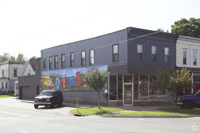
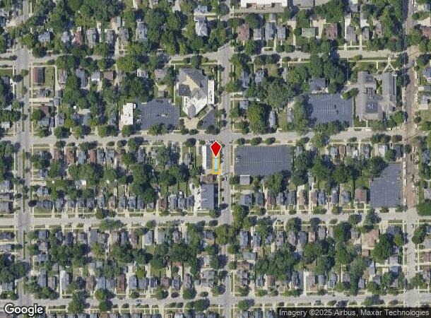
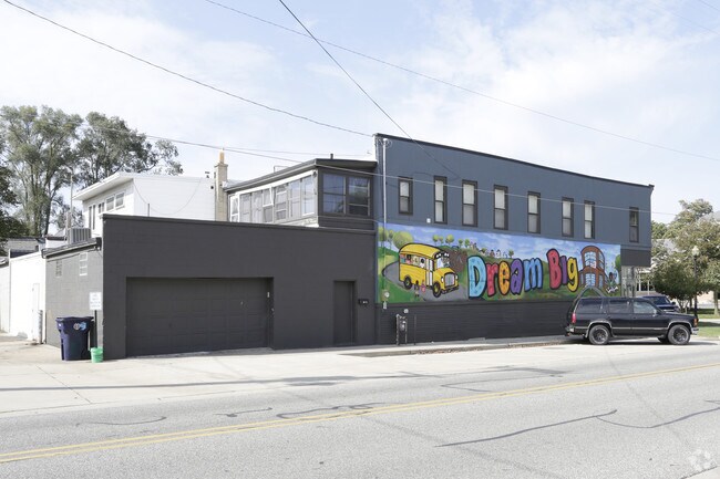
166 W 13Th St, Holland, MI 49423
NEARBY LISTINGS FOR SALE OR LEASE
Property Detail
166 W 13Th St
Grand Rapids-Wyoming, MI
South West Addition
70-16-29-353-018
E 24 FT OF N 106 FT OF LOT 1 BLK 11 SOUTH WEST ADDITION SEC 29 T5N R15W
Retailwithmorethanonenonretailuse
Ottawa
X
Michigan
26005C0040G
1
2024
0.06 AC
2025
Holland West
024901
West Michigan
3,600 SF
DEMOGRAPHICS near 166 W 13Th St
1 Mile
3 Mile
5 Mile
2024 Total Population
13,905
56,143
97,434
2029 Population
14,580
58,452
101,722
Pop Growth 2024-2029
+ 4.85%
+ 4.11%
+ 4.40%
Average Age
35
39
39
2024 Total Households
4,644
21,236
36,516
HH Growth 2024-2029
+ 5.38%
+ 4.24%
+ 4.55%
Median Household Inc
$71,954
$67,505
$74,406
Avg Household Size
2.50
2.50
2.50
2024 Avg HH Vehicles
2.00
2.00
2.00
Median Home Value
$189,090
$224,969
$246,208
Median Year Built
1948
1974
1983
Nearby Places
Map Layers
Map Styles
 Street
 Aerial
- Restaurants
- Banks
- Shops
- Fitness
- Groceries
PUBLIC TRANSPORTATION
COMMUTER RAIL
Holland Amtrak Station (Pere Marquette - Amtrak)
DRIVE
WALK
Distance
Holland Amtrak Station (Pere Marquette - Amtrak)
3 min
1.3 mi
Freight Ports
Port Milwaukee
DRIVE
WALK
Distance
Port Milwaukee
277 min
235.2 mi
Nearby Properties
Address
Land Use
TOTAL SIZE
Lot Size
Zoning
Address
Land Use
TOTAL SIZE
Lot Size
Zoning
572,832 SF
10.89 AC
PUD
Address
Land Use
TOTAL SIZE
Lot Size
Zoning
1,788,352 SF
173.33 AC
Address
Land Use
TOTAL SIZE
Lot Size
Zoning
682,378 SF
99.60 AC
NA
Address
Land Use
TOTAL SIZE
Lot Size
Zoning
198,712 SF
Address
Land Use
TOTAL SIZE
Lot Size
Zoning
556,819 SF
85.45 AC
Address
Land Use
TOTAL SIZE
Lot Size
Zoning
660,002 SF
32.13 AC
I-2
Address
Land Use
TOTAL SIZE
Lot Size
Zoning
320,270 SF
33.25 AC
PUD
Address
Land Use
TOTAL SIZE
Lot Size
Zoning
329,784 SF
38.51 AC
I-2
Address
Land Use
TOTAL SIZE
Lot Size
Zoning
226,347 SF
19.44 AC
I-2
Address
Land Use
TOTAL SIZE
Lot Size
Zoning
674,052 SF
79.30 AC
Address
Land Use
TOTAL SIZE
Lot Size
Zoning
239,465 SF
Address
Land Use
TOTAL SIZE
Lot Size
Zoning
589,649 SF
92.65 AC
Address
Land Use
TOTAL SIZE
Lot Size
Zoning
94,790 SF
1.74 AC
C-2
Address
Land Use
TOTAL SIZE
Lot Size
Zoning
58,710 SF
6.96 AC
C-2
Address
Land Use
TOTAL SIZE
Lot Size
Zoning
209,455 SF
17 AC
C-2
Address
Land Use
TOTAL SIZE
Lot Size
Zoning
177,800 SF
12.34 AC
I-2
Address
Land Use
TOTAL SIZE
Lot Size
Zoning
114,088 SF
10.79 AC
PRD
Address
Land Use
TOTAL SIZE
Lot Size
Zoning
134,490 SF
15.76 AC
C-2
Address
Land Use
TOTAL SIZE
Lot Size
Zoning
181,754 SF
13.44 AC
R3
Address
Land Use
TOTAL SIZE
Lot Size
Zoning
136,520 SF
13.55 AC
PUD
Address
Land Use
TOTAL SIZE
Lot Size
Zoning
65.75 AC
PUD
Address
Land Use
TOTAL SIZE
Lot Size
Zoning
228,876 SF
49.31 AC
GMU
Address
Land Use
TOTAL SIZE
Lot Size
Zoning
372,017 SF
17.60 AC
R-2
Address
Land Use
TOTAL SIZE
Lot Size
Zoning
217,226 SF
20.82 AC
I-2
Address
Land Use
TOTAL SIZE
Lot Size
Zoning
397,258 SF
36.66 AC
I2
Address
Land Use
TOTAL SIZE
Lot Size
Zoning
127,432 SF
3.77 AC
C-2
Address
Land Use
TOTAL SIZE
Lot Size
Zoning
158,661 SF
17.28 AC
Address
Land Use
TOTAL SIZE
Lot Size
Zoning
122,026 SF
15.03 AC
R3
Address
Land Use
TOTAL SIZE
Lot Size
Zoning
146,357 SF
20.04 AC
Address
Land Use
TOTAL SIZE
Lot Size
Zoning
90,865 SF
4.14 AC
C-2
The World's #1 Commercial Real Estate Marketplace
Connect with us
© 2025 CoStar Group
The information above has been obtained from sources believed reliable. While we do not doubt its accuracy we have not verified it and make no guarantee, warranty or representation about it. It is your responsibility to independently confirm its accuracy and completeness. Any projections, opinions, assumptions, or estimates used are for example only and do not represent the current or future performance of the property. The value of this transaction to you depends on tax and other factors which should be evaluated by your tax, financial, and legal advisors. You and your advisors should conduct a careful, independent investigation of the property to determine to your satisfaction the suitability of the property for your needs.