Property Record
16600 N Rm 620 Rd, Round Rock, TX 78681


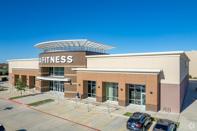
Property Detail
16600 N Rm 620 Rd
Austin-Round Rock-San Marcos, TX
COMMERCIAL REFERENCE OLNLY-S10435 - BECK COMMONS, BLOCK A, LOT 3A, ACRES 3.451CAD,F91,GWI,J01,M12,RFM,SRR,W09/R606310
R524644
WILLIAMSON
Commercialnec
Texas
0
3a
2025
3.45 AC
020507
Round Rock
35,868 SF
Austin
NEARBY LISTINGS FOR SALE OR LEASE
DEMOGRAPHICS near 16600 N Rm 620 Rd
1 mile
3 mile
5 mile
2024 Total Population
10,852
82,456
257,353
2029 Population
13,538
103,793
317,764
Pop Growth 2024-2029
+ 24.75%
+ 25.88%
+ 23.47%
Average Age
37
37
36
2024 Total Households
3,767
29,174
100,922
HH Growth 2024-2029
+ 25.09%
+ 26.54%
+ 23.70%
Median Household Inc
$126,861
$113,488
$91,336
Avg Household Size
2.80
2.80
2.50
2024 Avg HH Vehicles
2.00
2.00
2.00
Median Home Value
$441,007
$452,868
$405,420
Median Year Built
1999
1999
2000
Nearby Places
Map Layers
Map Styles
 Street
 Aerial
Transit
 Traffic
 Biking
Places
Listings with unknown addresses are not visible on the map
- Restaurants
- Banks
- Shops
- Fitness
- Groceries
PUBLIC TRANSPORTATION
AIRPORT
Austin-Bergstrom International
Drive
Walk
Distance
Austin-Bergstrom International
44 min
30.1 mi
Freight Ports
Calhoun Port
Drive
Walk
Distance
Calhoun Port
206 min
179.4 mi
Nearby Properties
Address
Land Use
TOTAL SIZE
Lot Size
Zoning
Address
Land Use
TOTAL SIZE
Lot Size
Zoning
536,741 SF
80.32 AC
SF2
Address
Land Use
TOTAL SIZE
Lot Size
Zoning
757,866 SF
33.21 AC
Address
Land Use
TOTAL SIZE
Lot Size
Zoning
325,797 SF
36.36 AC
Address
Land Use
TOTAL SIZE
Lot Size
Zoning
466,256 SF
38.33 AC
Address
Land Use
TOTAL SIZE
Lot Size
Zoning
493,699 SF
28.29 AC
Address
Land Use
TOTAL SIZE
Lot Size
Zoning
420,181 SF
18.86 AC
Address
Land Use
TOTAL SIZE
Lot Size
Zoning
543,958 SF
60.19 AC
Address
Land Use
TOTAL SIZE
Lot Size
Zoning
470,992 SF
25.92 AC
Address
Land Use
TOTAL SIZE
Lot Size
Zoning
323,284 SF
14.21 AC
Address
Land Use
TOTAL SIZE
Lot Size
Zoning
477,454 SF
22.28 AC
Address
Land Use
TOTAL SIZE
Lot Size
Zoning
408,335 SF
31.16 AC
Address
Land Use
TOTAL SIZE
Lot Size
Zoning
332,752 SF
10.30 AC
Address
Land Use
TOTAL SIZE
Lot Size
Zoning
337,685 SF
14.35 AC
Address
Land Use
TOTAL SIZE
Lot Size
Zoning
140,409 SF
17.15 AC
Address
Land Use
TOTAL SIZE
Lot Size
Zoning
216,198 SF
9.47 AC
Address
Land Use
TOTAL SIZE
Lot Size
Zoning
673,809 SF
9.03 AC
PUD
Address
Land Use
TOTAL SIZE
Lot Size
Zoning
356,499 SF
9.39 AC
Address
Land Use
TOTAL SIZE
Lot Size
Zoning
379,953 SF
11.74 AC
PUD
Address
Land Use
TOTAL SIZE
Lot Size
Zoning
322,935 SF
20 AC
Address
Land Use
TOTAL SIZE
Lot Size
Zoning
351,168 SF
19.69 AC
Address
Land Use
TOTAL SIZE
Lot Size
Zoning
283,866 SF
12.18 AC
Address
Land Use
TOTAL SIZE
Lot Size
Zoning
303,414 SF
12 AC
Address
Land Use
TOTAL SIZE
Lot Size
Zoning
338,958 SF
10.41 AC
PUD
Address
Land Use
TOTAL SIZE
Lot Size
Zoning
344,286 SF
19.40 AC
Address
Land Use
TOTAL SIZE
Lot Size
Zoning
308,610 SF
22.99 AC
Address
Land Use
TOTAL SIZE
Lot Size
Zoning
112.40 AC
PF3
Address
Land Use
TOTAL SIZE
Lot Size
Zoning
370,410 SF
46.86 AC
Address
Land Use
TOTAL SIZE
Lot Size
Zoning
278,392 SF
10.72 AC
Address
Land Use
TOTAL SIZE
Lot Size
Zoning
216,547 SF
20.63 AC
PUD
Address
Land Use
TOTAL SIZE
Lot Size
Zoning
195,621 SF
7.25 AC
PUD
The World's #1 Commercial Real Estate Marketplace
Connect with us
© 2026 CoStar Group
The information above has been obtained from sources believed reliable. While we do not doubt its accuracy we have not verified it and make no guarantee, warranty or representation about it. It is your responsibility to independently confirm its accuracy and completeness. Any projections, opinions, assumptions, or estimates used are for example only and do not represent the current or future performance of the property. The value of this transaction to you depends on tax and other factors which should be evaluated by your tax, financial, and legal advisors. You and your advisors should conduct a careful, independent investigation of the property to determine to your satisfaction the suitability of the property for your needs.