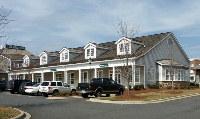
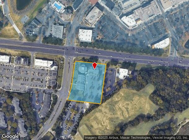
Property Record
8650 Sam Furr Rd, Huntersville, NC 28078
Current Lease Availabilities
NEARBY LISTINGS FOR SALE OR LEASE
Property Detail
8650 Sam Furr Rd
Charlotte-Concord-Gastonia, NC-SC
Birkdale Office Buildings Condominium
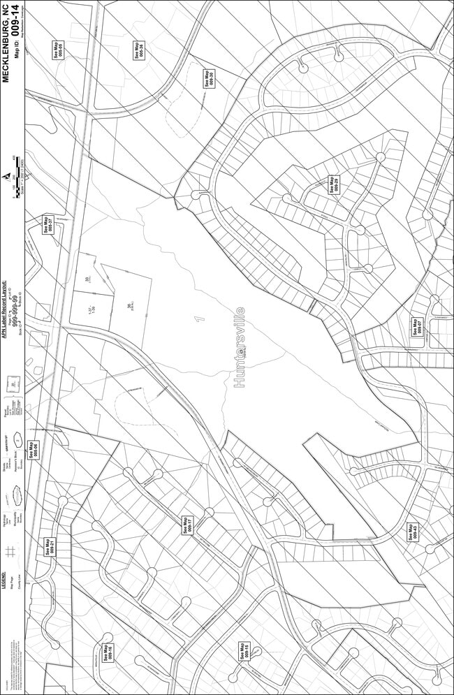
009-141-39
UNIT 3 BLDG 3 U/F 966-1
Officecondo
Mecklenburg
X
North Carolina
3710463200K
99
0
3.02 AC
2025
Northeast/I-77
006212
Charlotte
5,456 SF
DEMOGRAPHICS near 8650 Sam Furr Rd
1 Mile
3 Mile
5 Mile
2024 Total Population
8,875
52,668
102,489
2029 Population
9,313
55,365
108,486
Pop Growth 2024-2029
+ 4.94%
+ 5.12%
+ 5.85%
Average Age
40
39
40
2024 Total Households
3,995
21,295
40,254
HH Growth 2024-2029
+ 4.98%
+ 5.18%
+ 5.89%
Median Household Inc
$108,008
$100,590
$108,001
Avg Household Size
2.20
2.50
2.50
2024 Avg HH Vehicles
2.00
2.00
2.00
Median Home Value
$441,620
$392,192
$406,177
Median Year Built
2000
2000
2001
Nearby Places
- Restaurants
- Banks
- Shops
- Fitness
- Groceries
PUBLIC TRANSPORTATION
AIRPORT
Concord-Padgett Regional
DRIVE
WALK
Distance
Concord-Padgett Regional
21 min
14.7 mi
Charlotte/Douglas International
DRIVE
WALK
Distance
Charlotte/Douglas International
32 min
22.7 mi
Freight Ports
North Charleston Terminal
DRIVE
WALK
Distance
North Charleston Terminal
244 min
214.8 mi
Nearby Properties
Address
Land Use
TOTAL SIZE
Lot Size
Zoning
Address
Land Use
TOTAL SIZE
Lot Size
Zoning
417,671 SF
30.58 AC
CICD
Address
Land Use
TOTAL SIZE
Lot Size
Zoning
395,706 SF
23.38 AC
NRCD
Address
Land Use
TOTAL SIZE
Lot Size
Zoning
4,552 SF
92.49 AC
HC(CD)
Address
Land Use
TOTAL SIZE
Lot Size
Zoning
222,382 SF
31.89 AC
NR
Address
Land Use
TOTAL SIZE
Lot Size
Zoning
280,344 SF
21.36 AC
NRCD
Address
Land Use
TOTAL SIZE
Lot Size
Zoning
339,268 SF
21.80 AC
NR
Address
Land Use
TOTAL SIZE
Lot Size
Zoning
223,720 SF
18.42 AC
VC
Address
Land Use
TOTAL SIZE
Lot Size
Zoning
187,250 SF
22.35 AC
NR
Address
Land Use
TOTAL SIZE
Lot Size
Zoning
292,144 SF
25.33 AC
NRCD
Address
Land Use
TOTAL SIZE
Lot Size
Zoning
360,243 SF
26.30 AC
HCCD
Address
Land Use
TOTAL SIZE
Lot Size
Zoning
541,689 SF
60.98 AC
CB(CD)
Address
Land Use
TOTAL SIZE
Lot Size
Zoning
217,845 SF
9.58 AC
CB
Address
Land Use
TOTAL SIZE
Lot Size
Zoning
127,866 SF
3.72 AC
Address
Land Use
TOTAL SIZE
Lot Size
Zoning
200,768 SF
3.86 AC
HCCD
Address
Land Use
TOTAL SIZE
Lot Size
Zoning
239,596 SF
19.24 AC
NMX
Address
Land Use
TOTAL SIZE
Lot Size
Zoning
202,245 SF
14.55 AC
NRCD
Address
Land Use
TOTAL SIZE
Lot Size
Zoning
177,149 SF
15.21 AC
CB
Address
Land Use
TOTAL SIZE
Lot Size
Zoning
139,697 SF
19.75 AC
NR
Address
Land Use
TOTAL SIZE
Lot Size
Zoning
120,661 SF
10.50 AC
HC(CD)
Address
Land Use
TOTAL SIZE
Lot Size
Zoning
167,122 SF
5.62 AC
Address
Land Use
TOTAL SIZE
Lot Size
Zoning
156,092 SF
17.20 AC
NRCD
Address
Land Use
TOTAL SIZE
Lot Size
Zoning
442,024 SF
37.16 AC
CB
Address
Land Use
TOTAL SIZE
Lot Size
Zoning
204,216 SF
3.29 AC
HCCD
Address
Land Use
TOTAL SIZE
Lot Size
Zoning
180,542 SF
3.50 AC
HCCD
Address
Land Use
TOTAL SIZE
Lot Size
Zoning
113,792 SF
174 SF
CI(CD)
Address
Land Use
TOTAL SIZE
Lot Size
Zoning
108,153 SF
4.70 AC
TND-U(CD)
Address
Land Use
TOTAL SIZE
Lot Size
Zoning
Address
Land Use
TOTAL SIZE
Lot Size
Zoning
139,665 SF
14.37 AC
HC
Address
Land Use
TOTAL SIZE
Lot Size
Zoning
109,316 SF
7.03 AC
NR
Address
Land Use
TOTAL SIZE
Lot Size
Zoning
107,528 SF
6.90 AC
HCCD
The World's #1 Commercial Real Estate Marketplace
Connect with us
© 2025 CoStar Group
The information above has been obtained from sources believed reliable. While we do not doubt its accuracy we have not verified it and make no guarantee, warranty or representation about it. It is your responsibility to independently confirm its accuracy and completeness. Any projections, opinions, assumptions, or estimates used are for example only and do not represent the current or future performance of the property. The value of this transaction to you depends on tax and other factors which should be evaluated by your tax, financial, and legal advisors. You and your advisors should conduct a careful, independent investigation of the property to determine to your satisfaction the suitability of the property for your needs.