Property Record
16615 Deshler Rd, North Baltimore, OH 45872
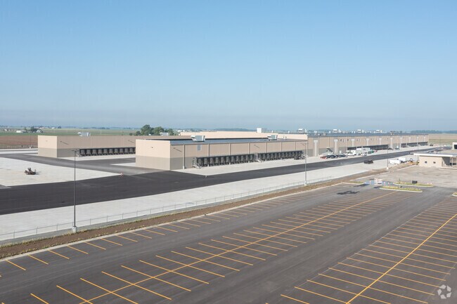

Property Detail
16615 Deshler Rd
F22-310-3300-00-007.500
W659.99 E1319.68 N660.32 NE 10AC
Warehouse
WOOD
B and X Area of moderate flood hazard, usually the area between the limits of the 100-year and 500-year floods.
Ohio
2025
62.42 AC
2025
Perrysburg/Northwood
022400
Toledo
436,850 SF
Toledo, OH
NEARBY LISTINGS FOR SALE OR LEASE
-
-
View all North Baltimore listings for lease on LoopNet.com
DEMOGRAPHICS near 16615 Deshler Rd
1 mile
3 mile
5 mile
2025 Total Population
19
3,189
5,724
2030 Population
19
3,212
5,750
Pop Growth 2025-2030
0.00%
+ 0.72%
+ 0.45%
Average Age
39
40
40
2025 Total Households
7
1,275
2,231
HH Growth 2025-2030
0.00%
+ 0.63%
+ 0.36%
Median Household Inc
$74,999
$63,010
$65,372
Avg Household Size
2.70
2.40
2.50
2025 Avg HH Vehicles
2.00
2.00
2.00
Median Home Value
$199,999
$133,535
$146,623
Median Year Built
1959
1958
1966
Nearby Places
Map Layers
Map Styles
 Street
 Aerial
Layers
 Traffic
 Biking
Places
Listings with unknown addresses are not visible on the map
- Restaurants
- Banks
- Shops
- Fitness
- Groceries
PUBLIC TRANSPORTATION
AIRPORT
Eugene F Kranz Toledo Express
Drive
Walk
Distance
Eugene F Kranz Toledo Express
63 min
43.2 mi
Freight Ports
Port of Toledo
Drive
Walk
Distance
Port of Toledo
61 min
43.8 mi
SALE & LEASE HISTORY
LISTING DATE
SALE/LEASE

Mar 19, 2019
For Lease
Nearby Properties
Address
Land Use
TOTAL SIZE
Lot Size
Zoning
Address
Land Use
TOTAL SIZE
Lot Size
Zoning
3,740 SF
75.23 AC
Address
Land Use
TOTAL SIZE
Lot Size
Zoning
80,438 SF
59.32 AC
Address
Land Use
TOTAL SIZE
Lot Size
Zoning
55,476 SF
5.59 AC
Address
Land Use
TOTAL SIZE
Lot Size
Zoning
31,732 SF
10 AC
Address
Land Use
TOTAL SIZE
Lot Size
Zoning
11,384 SF
120 AC
Address
Land Use
TOTAL SIZE
Lot Size
Zoning
207,893 SF
4.80 AC
Address
Land Use
TOTAL SIZE
Lot Size
Zoning
21,707 SF
5.29 AC
Address
Land Use
TOTAL SIZE
Lot Size
Zoning
52,420 SF
1.83 AC
Address
Land Use
TOTAL SIZE
Lot Size
Zoning
6,526 SF
1.60 AC
Address
Land Use
TOTAL SIZE
Lot Size
Zoning
15,895 SF
0.21 AC
Address
Land Use
TOTAL SIZE
Lot Size
Zoning
34,590 SF
4.01 AC
Address
Land Use
TOTAL SIZE
Lot Size
Zoning
Address
Land Use
TOTAL SIZE
Lot Size
Zoning
1,184 SF
157.35 AC
Address
Land Use
TOTAL SIZE
Lot Size
Zoning
Address
Land Use
TOTAL SIZE
Lot Size
Zoning
1,515 SF
158.75 AC
Address
Land Use
TOTAL SIZE
Lot Size
Zoning
Address
Land Use
TOTAL SIZE
Lot Size
Zoning
4,819 SF
80 AC
Address
Land Use
TOTAL SIZE
Lot Size
Zoning
7,600 SF
0.50 AC
Address
Land Use
TOTAL SIZE
Lot Size
Zoning
5,298 SF
77.48 AC
Address
Land Use
TOTAL SIZE
Lot Size
Zoning
13,640 SF
1.14 AC
Address
Land Use
TOTAL SIZE
Lot Size
Zoning
Address
Land Use
TOTAL SIZE
Lot Size
Zoning
118.85 AC
Address
Land Use
TOTAL SIZE
Lot Size
Zoning
7,175 SF
0.48 AC
Address
Land Use
TOTAL SIZE
Lot Size
Zoning
2,681 SF
105.46 AC
Address
Land Use
TOTAL SIZE
Lot Size
Zoning
9,382 SF
0.20 AC
Address
Land Use
TOTAL SIZE
Lot Size
Zoning
Address
Land Use
TOTAL SIZE
Lot Size
Zoning
5,254 SF
20.71 AC
Address
Land Use
TOTAL SIZE
Lot Size
Zoning
Address
Land Use
TOTAL SIZE
Lot Size
Zoning
The World's #1 Commercial Real Estate Marketplace
Connect with us
© 2026 CoStar Group
The information above has been obtained from sources believed reliable. While we do not doubt its accuracy we have not verified it and make no guarantee, warranty or representation about it. It is your responsibility to independently confirm its accuracy and completeness. Any projections, opinions, assumptions, or estimates used are for example only and do not represent the current or future performance of the property. The value of this transaction to you depends on tax and other factors which should be evaluated by your tax, financial, and legal advisors. You and your advisors should conduct a careful, independent investigation of the property to determine to your satisfaction the suitability of the property for your needs.