Property Record
16615 E Admiral Pl, Tulsa, OK 74116


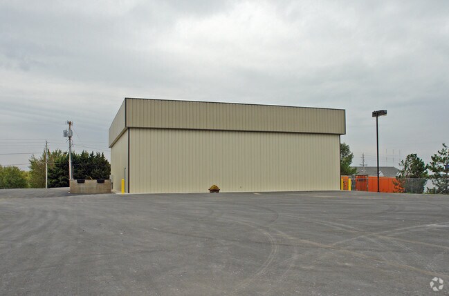
Property Detail
16615 E Admiral Pl
03468-94-02-11500
LT 1 BLK 1
Lightindustrial
Tulsa
IL
Oklahoma
B and X Area of moderate flood hazard, usually the area between the limits of the 100-year and 500-year floods.
1
2025
2.76 AC
2025
East Tulsa
007308
Tulsa
35,040 SF
Tulsa, OK
NEARBY LISTINGS FOR SALE OR LEASE
DEMOGRAPHICS near 16615 E Admiral Pl
1 mile
3 mile
5 mile
2025 Total Population
1,923
17,261
92,560
2030 Population
2,004
17,987
96,163
Pop Growth 2025-2030
+ 4.21%
+ 4.21%
+ 3.89%
Average Age
41
37
36
2025 Total Households
736
6,343
32,912
HH Growth 2025-2030
+ 4.21%
+ 4.34%
+ 3.93%
Median Household Inc
$80,618
$62,005
$65,148
Avg Household Size
2.60
2.70
2.70
2025 Avg HH Vehicles
2.00
2.00
2.00
Median Home Value
$225,515
$172,270
$185,956
Median Year Built
1973
1975
1978
Nearby Places
Map Layers
Map Styles
 Street
 Aerial
Transit
 Traffic
 Biking
Places
Listings with unknown addresses are not visible on the map
- Restaurants
- Banks
- Shops
- Fitness
- Groceries
PUBLIC TRANSPORTATION
AIRPORT
Tulsa International
Drive
Walk
Distance
Tulsa International
16 min
10.6 mi
Freight Ports
Tulsa Port Of Catoosa
Drive
Walk
Distance
Tulsa Port Of Catoosa
13 min
7.7 mi
Nearby Properties
Address
Land Use
TOTAL SIZE
Lot Size
Zoning
Address
Land Use
TOTAL SIZE
Lot Size
Zoning
349,823 SF
203.39 AC
IL
Address
Land Use
TOTAL SIZE
Lot Size
Zoning
112,556 SF
11.07 AC
CH
Address
Land Use
TOTAL SIZE
Lot Size
Zoning
11,184 SF
638.56 AC
Address
Land Use
TOTAL SIZE
Lot Size
Zoning
106,270 SF
9.47 AC
RM0
Address
Land Use
TOTAL SIZE
Lot Size
Zoning
32,370 SF
45.90 AC
AG
Address
Land Use
TOTAL SIZE
Lot Size
Zoning
39,375 SF
70 AC
AG
Address
Land Use
TOTAL SIZE
Lot Size
Zoning
28,465 SF
6.71 AC
RS3
Address
Land Use
TOTAL SIZE
Lot Size
Zoning
498,836 SF
50.22 AC
CS
Address
Land Use
TOTAL SIZE
Lot Size
Zoning
40,202 SF
2.93 AC
RM0
Address
Land Use
TOTAL SIZE
Lot Size
Zoning
265,350 SF
11.85 AC
RM1
Address
Land Use
TOTAL SIZE
Lot Size
Zoning
129,087 SF
43.40 AC
IR
Address
Land Use
TOTAL SIZE
Lot Size
Zoning
492,786 SF
76.58 AC
IL
Address
Land Use
TOTAL SIZE
Lot Size
Zoning
3,720 SF
158.66 AC
Address
Land Use
TOTAL SIZE
Lot Size
Zoning
2,852 SF
12.13 AC
Address
Land Use
TOTAL SIZE
Lot Size
Zoning
219,538 SF
20.13 AC
IL
Address
Land Use
TOTAL SIZE
Lot Size
Zoning
10,674 SF
14.18 AC
RS3
Address
Land Use
TOTAL SIZE
Lot Size
Zoning
6,000 SF
346.13 AC
Address
Land Use
TOTAL SIZE
Lot Size
Zoning
16,250 SF
76.36 AC
AG
Address
Land Use
TOTAL SIZE
Lot Size
Zoning
6,000 SF
0.38 AC
Address
Land Use
TOTAL SIZE
Lot Size
Zoning
20,174 SF
1.12 AC
RS3
Address
Land Use
TOTAL SIZE
Lot Size
Zoning
64.90 AC
AG
Address
Land Use
TOTAL SIZE
Lot Size
Zoning
62,644 SF
12 AC
Address
Land Use
TOTAL SIZE
Lot Size
Zoning
2,842 SF
89.24 AC
AG
Address
Land Use
TOTAL SIZE
Lot Size
Zoning
153,297 SF
16.29 AC
Address
Land Use
TOTAL SIZE
Lot Size
Zoning
19,800 SF
5.05 AC
RS2
Address
Land Use
TOTAL SIZE
Lot Size
Zoning
103,820 SF
2.50 AC
Address
Land Use
TOTAL SIZE
Lot Size
Zoning
12,404 SF
4.34 AC
RS2
Address
Land Use
TOTAL SIZE
Lot Size
Zoning
7,584 SF
16.13 AC
AG
Address
Land Use
TOTAL SIZE
Lot Size
Zoning
9,439 SF
6.09 AC
OL
Address
Land Use
TOTAL SIZE
Lot Size
Zoning
1 SF
80 AC
AG
The World's #1 Commercial Real Estate Marketplace
Connect with us
© 2026 CoStar Group
The information above has been obtained from sources believed reliable. While we do not doubt its accuracy we have not verified it and make no guarantee, warranty or representation about it. It is your responsibility to independently confirm its accuracy and completeness. Any projections, opinions, assumptions, or estimates used are for example only and do not represent the current or future performance of the property. The value of this transaction to you depends on tax and other factors which should be evaluated by your tax, financial, and legal advisors. You and your advisors should conduct a careful, independent investigation of the property to determine to your satisfaction the suitability of the property for your needs.