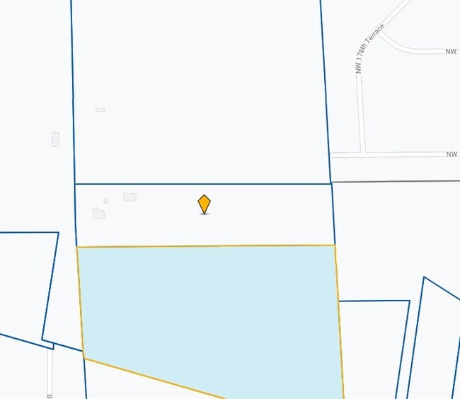
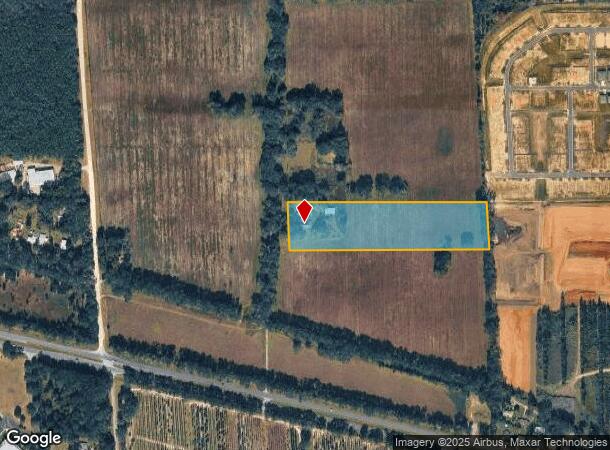
Property Record
16615 Nw Us Highway 441, Alachua, FL 32615
NEARBY LISTINGS FOR SALE OR LEASE
Property Detail
16615 Nw Us Highway 441
Gainesville, FL
Alachua
03045-000-000
Florida
Sfr
10 AC
X
Gainesville
12001C0120D
Other Market Areas
3,532 SF
DEMOGRAPHICS near 16615 Nw Us Highway 441
1 Mile
3 Mile
5 Mile
2024 Total Population
1,121
8,179
19,646
2029 Population
1,197
8,703
20,909
Pop Growth 2024-2029
+ 6.78%
+ 6.41%
+ 6.43%
Average Age
41
41
41
2024 Total Households
441
3,268
7,752
HH Growth 2024-2029
+ 6.80%
+ 6.49%
+ 6.55%
Median Household Inc
$73,660
$80,641
$76,434
Avg Household Size
2.50
2.50
2.50
2024 Avg HH Vehicles
2.00
2.00
2.00
Median Home Value
$263,366
$270,572
$255,970
Median Year Built
2003
1997
1995
Nearby Places
Map Layers
Map Styles
 Street
 Aerial
- Restaurants
- Banks
- Shops
- Fitness
- Groceries
PUBLIC TRANSPORTATION
AIRPORT
Gainesville Regional
DRIVE
WALK
Distance
Gainesville Regional
34 min
20.2 mi
Freight Ports
Jacksonville Port
DRIVE
WALK
Distance
Jacksonville Port
117 min
83.0 mi
SALE & LEASE HISTORY
LISTING DATE
SALE/LEASE

Jun 12, 2019
For Sale
Nearby Properties
Address
Land Use
TOTAL SIZE
Lot Size
Zoning
Address
Land Use
TOTAL SIZE
Lot Size
Zoning
1,296,224 SF
67.06 AC
A
Address
Land Use
TOTAL SIZE
Lot Size
Zoning
318,416 SF
22.90 AC
RMF-15
Address
Land Use
TOTAL SIZE
Lot Size
Zoning
99,873 SF
34 AC
A
Address
Land Use
TOTAL SIZE
Lot Size
Zoning
56,468 SF
4.25 AC
Address
Land Use
TOTAL SIZE
Lot Size
Zoning
64,076 SF
2.73 AC
CI
Address
Land Use
TOTAL SIZE
Lot Size
Zoning
42,695 SF
10.66 AC
CI
Address
Land Use
TOTAL SIZE
Lot Size
Zoning
125,982 SF
23.50 AC
CI
Address
Land Use
TOTAL SIZE
Lot Size
Zoning
38,024 SF
3.17 AC
CI
Address
Land Use
TOTAL SIZE
Lot Size
Zoning
9,113 SF
36.19 AC
A
Address
Land Use
TOTAL SIZE
Lot Size
Zoning
25,077 SF
20.38 AC
C-3
Address
Land Use
TOTAL SIZE
Lot Size
Zoning
35,745 SF
9.73 AC
GF
Address
Land Use
TOTAL SIZE
Lot Size
Zoning
47,612 SF
7.33 AC
CI
Address
Land Use
TOTAL SIZE
Lot Size
Zoning
40,173 SF
105.68 AC
GF
Address
Land Use
TOTAL SIZE
Lot Size
Zoning
40.49 AC
IG
Address
Land Use
TOTAL SIZE
Lot Size
Zoning
25,876 SF
4.13 AC
RSF-3
Address
Land Use
TOTAL SIZE
Lot Size
Zoning
49,655 SF
7.44 AC
CI
Address
Land Use
TOTAL SIZE
Lot Size
Zoning
3.19 AC
CI
Address
Land Use
TOTAL SIZE
Lot Size
Zoning
1,848 SF
3.69 AC
CI
Address
Land Use
TOTAL SIZE
Lot Size
Zoning
15,268 SF
2.92 AC
CI
Address
Land Use
TOTAL SIZE
Lot Size
Zoning
25,566 SF
17.76 AC
A
Address
Land Use
TOTAL SIZE
Lot Size
Zoning
22,455 SF
1.73 AC
CI
Address
Land Use
TOTAL SIZE
Lot Size
Zoning
3,160 SF
1.55 AC
CI
Address
Land Use
TOTAL SIZE
Lot Size
Zoning
3.66 AC
CI
Address
Land Use
TOTAL SIZE
Lot Size
Zoning
27,324 SF
2 AC
CBD
Address
Land Use
TOTAL SIZE
Lot Size
Zoning
7,280 SF
1.53 AC
CI
Address
Land Use
TOTAL SIZE
Lot Size
Zoning
20,843 SF
1.96 AC
CBD
Address
Land Use
TOTAL SIZE
Lot Size
Zoning
3,145 SF
2.07 AC
CI
Address
Land Use
TOTAL SIZE
Lot Size
Zoning
110,796 SF
7.08 AC
I
Address
Land Use
TOTAL SIZE
Lot Size
Zoning
12,538 SF
1.43 AC
CI
Address
Land Use
TOTAL SIZE
Lot Size
Zoning
2,928 SF
1.17 AC
CI
The World's #1 Commercial Real Estate Marketplace
Connect with us
© 2025 CoStar Group
The information above has been obtained from sources believed reliable. While we do not doubt its accuracy we have not verified it and make no guarantee, warranty or representation about it. It is your responsibility to independently confirm its accuracy and completeness. Any projections, opinions, assumptions, or estimates used are for example only and do not represent the current or future performance of the property. The value of this transaction to you depends on tax and other factors which should be evaluated by your tax, financial, and legal advisors. You and your advisors should conduct a careful, independent investigation of the property to determine to your satisfaction the suitability of the property for your needs.