Property Record
1662 W 9000 S, West Jordan, UT 84088
NEARBY LISTINGS FOR SALE OR LEASE
Property Detail
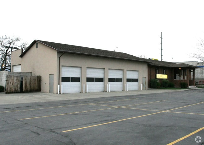
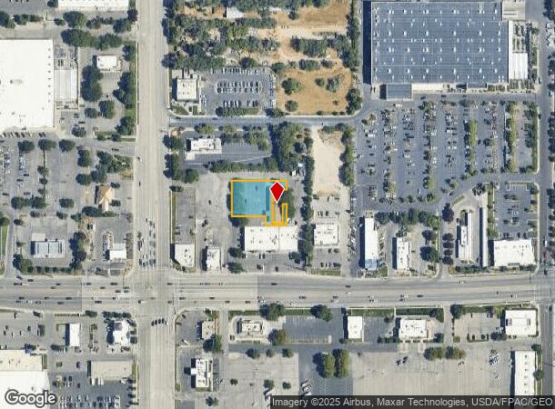
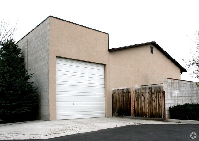
1662 W 9000 S
27-03-255-003-0000
Bladen-Gailey Condominium
Officebuilding
BEG N 895345 E 255.75 FT & N 00325 W 238.54 FT FR SW COR OF NE 1/4 SEC 3, T 3S, R 1W, SLM; N 00325 W 113.46 FT; N 895345 E 178.15 FT; S 21044 E 32.77 FT; S 03406 W 110.92 FT; S 895345 W 67.42 FT; N 00325 W 30.20 FT; S 895345 W 110.73 FT TO BEG. 0.50
X
Salt Lake
49035C0433G
Utah
0
0.50 AC
2025
West Jordan
112918
Salt Lake City
3,998 SF
Salt Lake City, UT
DEMOGRAPHICS near 1662 W 9000 S
1 Mile
3 Mile
5 Mile
2024 Total Population
14,946
113,971
349,505
2029 Population
15,130
115,387
354,469
Pop Growth 2024-2029
+ 1.23%
+ 1.24%
+ 1.42%
Average Age
38
37
37
2024 Total Households
4,996
38,890
115,544
HH Growth 2024-2029
+ 1.08%
+ 1.36%
+ 1.37%
Median Household Inc
$83,983
$82,236
$89,157
Avg Household Size
2.90
2.90
3.00
2024 Avg HH Vehicles
2.00
2.00
2.00
Median Home Value
$474,193
$431,507
$445,267
Median Year Built
1995
1993
1993
Nearby Places
Map Layers
Map Styles
 Street
 Aerial
- Restaurants
- Banks
- Shops
- Fitness
- Groceries
PUBLIC TRANSPORTATION
COMMUTER RAIL
DRIVE
WALK
Distance
8 min
3.7 mi
DRIVE
WALK
Distance
14 min
7.9 mi
AIRPORT
Salt Lake City International
DRIVE
WALK
Distance
Salt Lake City International
25 min
16.2 mi
Provo Municipal
DRIVE
WALK
Distance
Provo Municipal
43 min
34.8 mi
Nearby Properties
Address
Land Use
TOTAL SIZE
Lot Size
Zoning
Address
Land Use
TOTAL SIZE
Lot Size
Zoning
733,215 SF
58.65 AC
M-1
Address
Land Use
TOTAL SIZE
Lot Size
Zoning
258,000 SF
13.25 AC
1D
Address
Land Use
TOTAL SIZE
Lot Size
Zoning
198,801 SF
8.36 AC
R-3-20
Address
Land Use
TOTAL SIZE
Lot Size
Zoning
427,884 SF
18.22 AC
JB-4
Address
Land Use
TOTAL SIZE
Lot Size
Zoning
153,245 SF
27.10 AC
PUD137
Address
Land Use
TOTAL SIZE
Lot Size
Zoning
566,327 SF
7.02 AC
CBD-O
Address
Land Use
TOTAL SIZE
Lot Size
Zoning
224,049 SF
5.29 AC
MU
Address
Land Use
TOTAL SIZE
Lot Size
Zoning
497,522 SF
16.43 AC
MH
Address
Land Use
TOTAL SIZE
Lot Size
Zoning
372,355 SF
13.80 AC
C-F
Address
Land Use
TOTAL SIZE
Lot Size
Zoning
500,249 SF
3.16 AC
MU
Address
Land Use
TOTAL SIZE
Lot Size
Zoning
106,318 SF
4.46 AC
CBD-O
Address
Land Use
TOTAL SIZE
Lot Size
Zoning
500,249 SF
3.16 AC
MU
Address
Land Use
TOTAL SIZE
Lot Size
Zoning
679,800 SF
18.14 AC
BJ-1-3
Address
Land Use
TOTAL SIZE
Lot Size
Zoning
280,668 SF
12 AC
CBD
Address
Land Use
TOTAL SIZE
Lot Size
Zoning
448,232 SF
9.08 AC
PC
Address
Land Use
TOTAL SIZE
Lot Size
Zoning
74,120 SF
12.61 AC
BJ
Address
Land Use
TOTAL SIZE
Lot Size
Zoning
321,397 SF
11.16 AC
BJ
Address
Land Use
TOTAL SIZE
Lot Size
Zoning
410,435 SF
2.43 AC
P-C
Address
Land Use
TOTAL SIZE
Lot Size
Zoning
77,525 SF
2.35 AC
P-C
Address
Land Use
TOTAL SIZE
Lot Size
Zoning
45,924 SF
18.15 AC
R-3-20
Address
Land Use
TOTAL SIZE
Lot Size
Zoning
192,626 SF
5.72 AC
CF
Address
Land Use
TOTAL SIZE
Lot Size
Zoning
143,314 SF
2.30 AC
P-C
Address
Land Use
TOTAL SIZE
Lot Size
Zoning
289,838 SF
24.11 AC
BJ-3
Address
Land Use
TOTAL SIZE
Lot Size
Zoning
117,521 SF
57.92 AC
PF
Address
Land Use
TOTAL SIZE
Lot Size
Zoning
28,515 SF
6.77 AC
PC
Address
Land Use
TOTAL SIZE
Lot Size
Zoning
551,648 SF
31.71 AC
C B D
Address
Land Use
TOTAL SIZE
Lot Size
Zoning
198,479 SF
2.52 AC
MU
Address
Land Use
TOTAL SIZE
Lot Size
Zoning
168,488 SF
21.11 AC
1107
Address
Land Use
TOTAL SIZE
Lot Size
Zoning
203,064 SF
5.91 AC
PC
Address
Land Use
TOTAL SIZE
Lot Size
Zoning
120,929 SF
7.23 AC
PC
The World's #1 Commercial Real Estate Marketplace
Connect with us
© 2025 CoStar Group
The information above has been obtained from sources believed reliable. While we do not doubt its accuracy we have not verified it and make no guarantee, warranty or representation about it. It is your responsibility to independently confirm its accuracy and completeness. Any projections, opinions, assumptions, or estimates used are for example only and do not represent the current or future performance of the property. The value of this transaction to you depends on tax and other factors which should be evaluated by your tax, financial, and legal advisors. You and your advisors should conduct a careful, independent investigation of the property to determine to your satisfaction the suitability of the property for your needs.