Property Record
1663 Range Rd, Smiths Creek, MI 48074

Property Detail
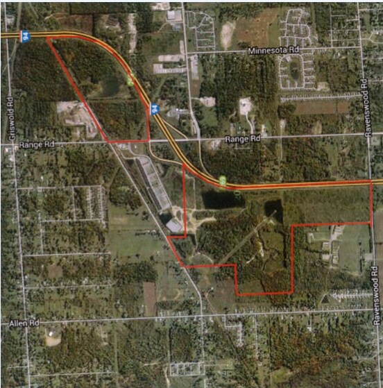
1663 Range Rd
25-013-3006-200
BEG AT S 1/4 COR, TH S 87D 8M 50S W 843.23', TH N 0D 7M W 546.64', TH N 59D 16M 47S E 1539', TH S 24D 22M 5S E 256.50', TH S 63D 18M 47S W 356.01', TH S 28D 7M 6S E 971.37', TH S 86D 47M 45S W 726.41' TO BEG SECTION 13 T6N R16E 27.97 A
Commercialacreage
ST. CLAIR
C-2 COMM
Michigan
B and X Area of moderate flood hazard, usually the area between the limits of the 100-year and 500-year floods.
28 AC
2025
St Clair & Lapeer Counties
2025
Detroit
634600
Detroit-Warren-Dearborn, MI
118,772 SF
NEARBY LISTINGS FOR SALE OR LEASE
DEMOGRAPHICS near 1663 Range Rd
1 mile
3 mile
5 mile
2025 Total Population
1,311
24,267
61,605
2030 Population
1,314
24,133
61,346
Pop Growth 2025-2030
+ 0.23%
(0.55%)
(0.42%)
Average Age
39
40
41
2025 Total Households
497
9,396
24,950
HH Growth 2025-2030
+ 0.20%
(0.71%)
(0.51%)
Median Household Inc
$50,156
$59,140
$60,712
Avg Household Size
2.50
2.50
2.40
2025 Avg HH Vehicles
2.00
2.00
2.00
Median Home Value
$136,813
$175,449
$180,774
Median Year Built
1979
1976
1970
Nearby Places
Map Layers
Map Styles
 Street
 Aerial
Layers
 Traffic
 Biking
Places
Listings with unknown addresses are not visible on the map
- Restaurants
- Banks
- Shops
- Fitness
- Groceries
PUBLIC TRANSPORTATION
COMMUTER RAIL
Port Huron Amtrak Station (Blue Water - Amtrak)
Drive
Walk
Distance
Port Huron Amtrak Station (Blue Water - Amtrak)
11 min
5.9 mi
Freight Ports
Port of Toledo
Drive
Walk
Distance
Port of Toledo
142 min
117.4 mi
SALE & LEASE HISTORY
LISTING DATE
SALE/LEASE

Sep 24, 2016
For Sale
Nearby Properties
Address
Land Use
TOTAL SIZE
Lot Size
Zoning
Address
Land Use
TOTAL SIZE
Lot Size
Zoning
134,379 SF
15 AC
RM-2
Address
Land Use
TOTAL SIZE
Lot Size
Zoning
39,747 SF
3.11 AC
R-2 RES
Address
Land Use
TOTAL SIZE
Lot Size
Zoning
77,868 SF
8.91 AC
RM-2
Address
Land Use
TOTAL SIZE
Lot Size
Zoning
73,882 SF
6.50 AC
B-3
Address
Land Use
TOTAL SIZE
Lot Size
Zoning
85,200 SF
4.23 AC
M1
Address
Land Use
TOTAL SIZE
Lot Size
Zoning
69,440 SF
12.30 AC
C-2
Address
Land Use
TOTAL SIZE
Lot Size
Zoning
61,855 SF
4.51 AC
M1
Address
Land Use
TOTAL SIZE
Lot Size
Zoning
5,359 SF
42.87 AC
R-4 RES
Address
Land Use
TOTAL SIZE
Lot Size
Zoning
47,332 SF
19.33 AC
M-1
Address
Land Use
TOTAL SIZE
Lot Size
Zoning
213,967 SF
9.27 AC
M-1
Address
Land Use
TOTAL SIZE
Lot Size
Zoning
125,367 SF
19.45 AC
M1
Address
Land Use
TOTAL SIZE
Lot Size
Zoning
7,785 SF
35.62 AC
C-2 COMM
Address
Land Use
TOTAL SIZE
Lot Size
Zoning
4,480 SF
40 AC
MH
Address
Land Use
TOTAL SIZE
Lot Size
Zoning
37,998 SF
6.04 AC
C-2
Address
Land Use
TOTAL SIZE
Lot Size
Zoning
58,656 SF
12.03 AC
I-H
Address
Land Use
TOTAL SIZE
Lot Size
Zoning
42,720 SF
6.21 AC
C-2 COMM
Address
Land Use
TOTAL SIZE
Lot Size
Zoning
16,621 SF
3.63 AC
C-3
Address
Land Use
TOTAL SIZE
Lot Size
Zoning
39,926 SF
8.94 AC
I-L
Address
Land Use
TOTAL SIZE
Lot Size
Zoning
59,876 SF
4.03 AC
M1
Address
Land Use
TOTAL SIZE
Lot Size
Zoning
29,312 SF
2 AC
R1-A
Address
Land Use
TOTAL SIZE
Lot Size
Zoning
72,284 SF
8.07 AC
C-2
Address
Land Use
TOTAL SIZE
Lot Size
Zoning
896 SF
41.22 AC
RMH
Address
Land Use
TOTAL SIZE
Lot Size
Zoning
90,124 SF
13.30 AC
C-2
Address
Land Use
TOTAL SIZE
Lot Size
Zoning
10,366 SF
2.39 AC
C-3
Address
Land Use
TOTAL SIZE
Lot Size
Zoning
43.44 AC
RMH
Address
Land Use
TOTAL SIZE
Lot Size
Zoning
9,926 SF
67.26 AC
M-1
Address
Land Use
TOTAL SIZE
Lot Size
Zoning
18,109 SF
120 AC
AG
Address
Land Use
TOTAL SIZE
Lot Size
Zoning
35,942 SF
2.15 AC
I-H
Address
Land Use
TOTAL SIZE
Lot Size
Zoning
92,819 SF
31.18 AC
C-2 COMM
Address
Land Use
TOTAL SIZE
Lot Size
Zoning
44,576 SF
4.40 AC
B-3
The World's #1 Commercial Real Estate Marketplace
Connect with us
© 2026 CoStar Group
The information above has been obtained from sources believed reliable. While we do not doubt its accuracy we have not verified it and make no guarantee, warranty or representation about it. It is your responsibility to independently confirm its accuracy and completeness. Any projections, opinions, assumptions, or estimates used are for example only and do not represent the current or future performance of the property. The value of this transaction to you depends on tax and other factors which should be evaluated by your tax, financial, and legal advisors. You and your advisors should conduct a careful, independent investigation of the property to determine to your satisfaction the suitability of the property for your needs.