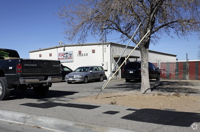
Property Record
16630 Spruce St, Hesperia, CA 92345


Property Detail
16630 Spruce St
Riverside-San Bernardino-Ontario, CA
TOWN OF HESPERIA LOTS 1 THRU 6 INCL BLK 9 AND N 1/2 SPRUCE ST VAC ADJ ON S LYING ELY OF SLY PROLONGATION W LI SD LOT 9 AND PTN VAC ALLEY ADJ ON E EX WATER RTS AND EX MNL RTS RESERVATION OF RECORD EX ST
0410-161-37
San Bernardino
Autorepair
California
B and X Area of moderate flood hazard, usually the area between the limits of the 100-year and 500-year floods.
1
2025
0.69 AC
2025
Mojave River Valley
010028
Inland Empire (California)
3,200 SF
NEARBY LISTINGS FOR SALE OR LEASE
DEMOGRAPHICS near 16630 Spruce St
1 mile
3 mile
5 mile
2025 Total Population
9,176
61,344
145,152
2030 Population
9,318
61,962
147,526
Pop Growth 2025-2030
+ 1.55%
+ 1.01%
+ 1.64%
Average Age
35
36
38
2025 Total Households
2,971
18,074
44,708
HH Growth 2025-2030
+ 1.41%
+ 0.96%
+ 1.58%
Median Household Inc
$44,699
$67,871
$74,613
Avg Household Size
3.10
3.30
3.20
2025 Avg HH Vehicles
2.00
2.00
2.00
Median Home Value
$295,627
$389,497
$408,862
Median Year Built
1978
1983
1988
Nearby Places
Map Layers
Map Styles
 Street
 Aerial
Layers
 Traffic
 Biking
Places
Listings with unknown addresses are not visible on the map
- Restaurants
- Banks
- Shops
- Fitness
- Groceries
PUBLIC TRANSPORTATION
COMMUTER RAIL
Drive
Walk
Distance
17 min
9.4 mi
AIRPORT
Ontario International
Drive
Walk
Distance
Ontario International
53 min
42.0 mi
Nearby Properties
Address
Land Use
TOTAL SIZE
Lot Size
Zoning
Address
Land Use
TOTAL SIZE
Lot Size
Zoning
213,482 SF
19.98 AC
Address
Land Use
TOTAL SIZE
Lot Size
Zoning
158,417 SF
9.66 AC
Address
Land Use
TOTAL SIZE
Lot Size
Zoning
174,855 SF
15.46 AC
Address
Land Use
TOTAL SIZE
Lot Size
Zoning
142,661 SF
14.21 AC
Address
Land Use
TOTAL SIZE
Lot Size
Zoning
80,080 SF
4.88 AC
Address
Land Use
TOTAL SIZE
Lot Size
Zoning
119,525 SF
6.42 AC
Address
Land Use
TOTAL SIZE
Lot Size
Zoning
125,694 SF
10.51 AC
Address
Land Use
TOTAL SIZE
Lot Size
Zoning
65,440 SF
12.70 AC
Address
Land Use
TOTAL SIZE
Lot Size
Zoning
41,249 SF
4.84 AC
Address
Land Use
TOTAL SIZE
Lot Size
Zoning
98,624 SF
8.23 AC
Address
Land Use
TOTAL SIZE
Lot Size
Zoning
59,841 SF
3.99 AC
Address
Land Use
TOTAL SIZE
Lot Size
Zoning
102,120 SF
11 AC
Address
Land Use
TOTAL SIZE
Lot Size
Zoning
70,023 SF
4.52 AC
Address
Land Use
TOTAL SIZE
Lot Size
Zoning
69,000 SF
3.17 AC
Address
Land Use
TOTAL SIZE
Lot Size
Zoning
86,852 SF
4.86 AC
Address
Land Use
TOTAL SIZE
Lot Size
Zoning
41,640 SF
4.06 AC
Address
Land Use
TOTAL SIZE
Lot Size
Zoning
82,584 SF
4.91 AC
Address
Land Use
TOTAL SIZE
Lot Size
Zoning
78,412 SF
4 AC
Address
Land Use
TOTAL SIZE
Lot Size
Zoning
37,601 SF
11.80 AC
Address
Land Use
TOTAL SIZE
Lot Size
Zoning
54,134 SF
5.10 AC
Address
Land Use
TOTAL SIZE
Lot Size
Zoning
97,236 SF
3.91 AC
Address
Land Use
TOTAL SIZE
Lot Size
Zoning
Address
Land Use
TOTAL SIZE
Lot Size
Zoning
37,907 SF
1.24 AC
Address
Land Use
TOTAL SIZE
Lot Size
Zoning
68,877 SF
4.25 AC
Address
Land Use
TOTAL SIZE
Lot Size
Zoning
88,870 SF
5.97 AC
Address
Land Use
TOTAL SIZE
Lot Size
Zoning
41,278 SF
18.34 AC
Address
Land Use
TOTAL SIZE
Lot Size
Zoning
33,600 SF
2.82 AC
Address
Land Use
TOTAL SIZE
Lot Size
Zoning
14,488 SF
1.62 AC
Address
Land Use
TOTAL SIZE
Lot Size
Zoning
14,377 SF
1.20 AC
Address
Land Use
TOTAL SIZE
Lot Size
Zoning
9,788 SF
5.33 AC
The World's #1 Commercial Real Estate Marketplace
Connect with us
© 2026 CoStar Group
The information above has been obtained from sources believed reliable. While we do not doubt its accuracy we have not verified it and make no guarantee, warranty or representation about it. It is your responsibility to independently confirm its accuracy and completeness. Any projections, opinions, assumptions, or estimates used are for example only and do not represent the current or future performance of the property. The value of this transaction to you depends on tax and other factors which should be evaluated by your tax, financial, and legal advisors. You and your advisors should conduct a careful, independent investigation of the property to determine to your satisfaction the suitability of the property for your needs.