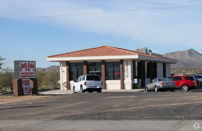
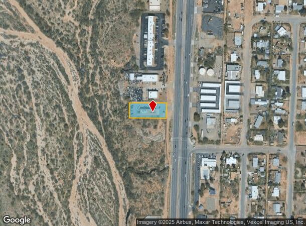
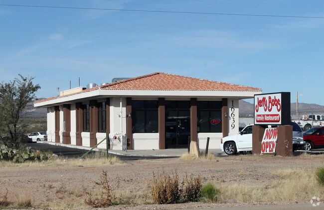
Property Record
16639 N Oracle Rd, Tucson, AZ 85739
NEARBY LISTINGS FOR SALE OR LEASE
-
-
View all Tucson listings for sale on LoopNet.com
Property Detail
16639 N Oracle Rd
Tucson, AZ
Bonanza Heights
222-17-0050
BONANZA HEIGHTS S100 N1159.35 LOT 1
Restaurantbuilding
Pima
X
Arizona
04019C0495L
1
2025
0.55 AC
2026
North/Oro Valley
004727
Tucson
3,000 SF
DEMOGRAPHICS near 16639 N Oracle Rd
1 Mile
3 Mile
5 Mile
2024 Total Population
3,001
14,658
28,556
2029 Population
3,432
16,564
32,440
Pop Growth 2024-2029
+ 14.36%
+ 13.00%
+ 13.60%
Average Age
48
55
59
2024 Total Households
1,243
6,645
13,579
HH Growth 2024-2029
+ 14.56%
+ 13.65%
+ 14.17%
Median Household Inc
$67,102
$75,595
$86,536
Avg Household Size
2.40
2.20
2.10
2024 Avg HH Vehicles
2.00
2.00
2.00
Median Home Value
$325,633
$359,743
$396,474
Median Year Built
2002
1999
1997
Nearby Places
Map Layers
Map Styles
 Street
 Aerial
- Restaurants
- Banks
- Shops
- Fitness
- Groceries
PUBLIC TRANSPORTATION
AIRPORT
Tucson International
DRIVE
WALK
Distance
Tucson International
51 min
29.8 mi
Freight Ports
Port of San Diego
DRIVE
WALK
Distance
Port of San Diego
444 min
409.3 mi
Nearby Properties
Address
Land Use
TOTAL SIZE
Lot Size
Zoning
Address
Land Use
TOTAL SIZE
Lot Size
Zoning
130,249 SF
175.94 AC
SP
Address
Land Use
TOTAL SIZE
Lot Size
Zoning
30,340 SF
5.17 AC
CB1
Address
Land Use
TOTAL SIZE
Lot Size
Zoning
171,794 SF
45.61 AC
GR1
Address
Land Use
TOTAL SIZE
Lot Size
Zoning
66,253 SF
7.07 AC
CB1
Address
Land Use
TOTAL SIZE
Lot Size
Zoning
38,076 SF
8.86 AC
GR1
Address
Land Use
TOTAL SIZE
Lot Size
Zoning
21,734 SF
4.68 AC
Address
Land Use
TOTAL SIZE
Lot Size
Zoning
Address
Land Use
TOTAL SIZE
Lot Size
Zoning
576 SF
3.99 AC
GR1
Address
Land Use
TOTAL SIZE
Lot Size
Zoning
22,734 SF
4.16 AC
CB1
Address
Land Use
TOTAL SIZE
Lot Size
Zoning
18,964 SF
10.18 AC
RH
Address
Land Use
TOTAL SIZE
Lot Size
Zoning
24,033 SF
5.06 AC
GR1
Address
Land Use
TOTAL SIZE
Lot Size
Zoning
16.46 AC
CB1
Address
Land Use
TOTAL SIZE
Lot Size
Zoning
2,664 SF
1.10 AC
CB2
Address
Land Use
TOTAL SIZE
Lot Size
Zoning
52,500 SF
3.25 AC
CB2
Address
Land Use
TOTAL SIZE
Lot Size
Zoning
19,598 SF
3.25 AC
CB2
Address
Land Use
TOTAL SIZE
Lot Size
Zoning
160 SF
3.32 AC
GR1
Address
Land Use
TOTAL SIZE
Lot Size
Zoning
2,542 SF
9.09 AC
Address
Land Use
TOTAL SIZE
Lot Size
Zoning
4,994 SF
0.36 AC
CB2
Address
Land Use
TOTAL SIZE
Lot Size
Zoning
20,304 SF
1.76 AC
CB2
Address
Land Use
TOTAL SIZE
Lot Size
Zoning
9,100 SF
1.09 AC
Address
Land Use
TOTAL SIZE
Lot Size
Zoning
10.30 AC
CB1
Address
Land Use
TOTAL SIZE
Lot Size
Zoning
17,002 SF
1.73 AC
CB1
Address
Land Use
TOTAL SIZE
Lot Size
Zoning
1,750 SF
1.14 AC
GR1
Address
Land Use
TOTAL SIZE
Lot Size
Zoning
3,137 SF
1.12 AC
CB1
Address
Land Use
TOTAL SIZE
Lot Size
Zoning
1,152 SF
2.32 AC
GR1
Address
Land Use
TOTAL SIZE
Lot Size
Zoning
10,083 SF
5.03 AC
GR1
Address
Land Use
TOTAL SIZE
Lot Size
Zoning
3,562 SF
0.92 AC
CB1
Address
Land Use
TOTAL SIZE
Lot Size
Zoning
5,310 SF
137.94 AC
CR3
Address
Land Use
TOTAL SIZE
Lot Size
Zoning
4,606 SF
2.25 AC
CB2
Address
Land Use
TOTAL SIZE
Lot Size
Zoning
11,025 SF
1.20 AC
CB1
The World's #1 Commercial Real Estate Marketplace
Connect with us
© 2026 CoStar Group
The information above has been obtained from sources believed reliable. While we do not doubt its accuracy we have not verified it and make no guarantee, warranty or representation about it. It is your responsibility to independently confirm its accuracy and completeness. Any projections, opinions, assumptions, or estimates used are for example only and do not represent the current or future performance of the property. The value of this transaction to you depends on tax and other factors which should be evaluated by your tax, financial, and legal advisors. You and your advisors should conduct a careful, independent investigation of the property to determine to your satisfaction the suitability of the property for your needs.