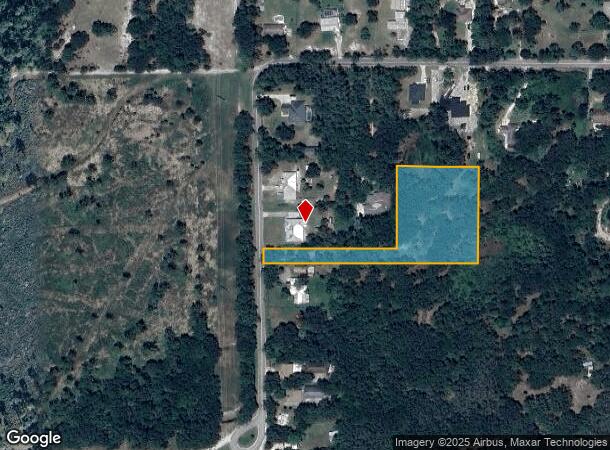
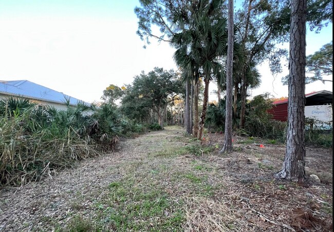
Property Record
1665 Arch Rd, Mims, FL 32754


NEARBY LISTINGS FOR SALE OR LEASE
Property Detail
1665 Arch Rd
21-34-26-00-00002.0-0000.00
N 1/2 OF NW 1/4 OF NE 1/4 EXC ORB 4170 PG 2795, 4623 PG 3977, 4624 PGS 29, 113, 5368 PGS 4320, 4801, 5443 PGS 3165, 3167, 5451 PG 7996, 5466 PG 6984, 5491 PG 8743 & RD R/W
Recreationalacreage
Brevard
X
Florida
12009C0100G
2.60 AC
2024
Brevard County
2025
Orlando
060202
Palm Bay-Melbourne-Titusville, FL
DEMOGRAPHICS near 1665 Arch Rd
1 Mile
3 Mile
5 Mile
2024 Total Population
849
12,978
32,193
2029 Population
920
14,112
35,297
Pop Growth 2024-2029
+ 8.36%
+ 8.74%
+ 9.64%
Average Age
45
44
45
2024 Total Households
341
5,183
13,284
HH Growth 2024-2029
+ 8.21%
+ 8.57%
+ 9.47%
Median Household Inc
$84,574
$68,952
$55,629
Avg Household Size
2.40
2.40
2.30
2024 Avg HH Vehicles
2.00
2.00
2.00
Median Home Value
$261,742
$232,304
$217,599
Median Year Built
1986
1982
1981
Nearby Places
Map Layers
Map Styles
 Street
 Aerial
- Restaurants
- Banks
- Shops
- Fitness
- Groceries
PUBLIC TRANSPORTATION
AIRPORT
Orlando International
DRIVE
WALK
Distance
Orlando International
60 min
46.8 mi
Freight Ports
Port Canaveral
DRIVE
WALK
Distance
Port Canaveral
48 min
34.4 mi
SALE & LEASE HISTORY
LISTING DATE
SALE/LEASE

Feb 02, 2023
For Sale
Nearby Properties
Address
Land Use
TOTAL SIZE
Lot Size
Zoning
Address
Land Use
TOTAL SIZE
Lot Size
Zoning
267,207 SF
36.82 AC
P
Address
Land Use
TOTAL SIZE
Lot Size
Zoning
113,576 SF
19.98 AC
P
Address
Land Use
TOTAL SIZE
Lot Size
Zoning
46.75 AC
GML
Address
Land Use
TOTAL SIZE
Lot Size
Zoning
97,463 SF
19.50 AC
P
Address
Land Use
TOTAL SIZE
Lot Size
Zoning
68,385 SF
12 AC
P
Address
Land Use
TOTAL SIZE
Lot Size
Zoning
10,248 SF
41.06 AC
RU-1-7
Address
Land Use
TOTAL SIZE
Lot Size
Zoning
87,836 SF
8.89 AC
CC
Address
Land Use
TOTAL SIZE
Lot Size
Zoning
24,364 SF
14.08 AC
Address
Land Use
TOTAL SIZE
Lot Size
Zoning
114.31 AC
GU
Address
Land Use
TOTAL SIZE
Lot Size
Zoning
48,519 SF
3.75 AC
RC
Address
Land Use
TOTAL SIZE
Lot Size
Zoning
9,961 SF
13.71 AC
RVP
Address
Land Use
TOTAL SIZE
Lot Size
Zoning
24,088 SF
9.50 AC
IN(L)
Address
Land Use
TOTAL SIZE
Lot Size
Zoning
79.16 AC
RU-1-11
Address
Land Use
TOTAL SIZE
Lot Size
Zoning
73,022 SF
5.34 AC
IU
Address
Land Use
TOTAL SIZE
Lot Size
Zoning
0.80 AC
GML
Address
Land Use
TOTAL SIZE
Lot Size
Zoning
5,873 SF
11.67 AC
AU
Address
Land Use
TOTAL SIZE
Lot Size
Zoning
10,060 SF
5.35 AC
CC
Address
Land Use
TOTAL SIZE
Lot Size
Zoning
35,064 SF
4.64 AC
IN(L)
Address
Land Use
TOTAL SIZE
Lot Size
Zoning
15,220 SF
6.37 AC
RU215
Address
Land Use
TOTAL SIZE
Lot Size
Zoning
15,508 SF
4.70 AC
GU
Address
Land Use
TOTAL SIZE
Lot Size
Zoning
12.31 AC
TU-2
Address
Land Use
TOTAL SIZE
Lot Size
Zoning
195.85 AC
AU
Address
Land Use
TOTAL SIZE
Lot Size
Zoning
4,000 SF
476.97 AC
GU
Address
Land Use
TOTAL SIZE
Lot Size
Zoning
11,021 SF
8 AC
R1B
Address
Land Use
TOTAL SIZE
Lot Size
Zoning
81,333 SF
5.57 AC
BU2
Address
Land Use
TOTAL SIZE
Lot Size
Zoning
9,302 SF
1.41 AC
BU1
Address
Land Use
TOTAL SIZE
Lot Size
Zoning
95.29 AC
AU
Address
Land Use
TOTAL SIZE
Lot Size
Zoning
4,739 SF
39.83 AC
GML
Address
Land Use
TOTAL SIZE
Lot Size
Zoning
8,400 SF
2.18 AC
Address
Land Use
TOTAL SIZE
Lot Size
Zoning
7,840 SF
3.45 AC
IN(L)
The World's #1 Commercial Real Estate Marketplace
Connect with us
© 2025 CoStar Group
The information above has been obtained from sources believed reliable. While we do not doubt its accuracy we have not verified it and make no guarantee, warranty or representation about it. It is your responsibility to independently confirm its accuracy and completeness. Any projections, opinions, assumptions, or estimates used are for example only and do not represent the current or future performance of the property. The value of this transaction to you depends on tax and other factors which should be evaluated by your tax, financial, and legal advisors. You and your advisors should conduct a careful, independent investigation of the property to determine to your satisfaction the suitability of the property for your needs.