Property Record
1665 S Highway 27, Carrollton, GA 30117
NEARBY LISTINGS FOR SALE OR LEASE
Property Detail
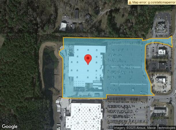
1665 S Highway 27
C07-0420106
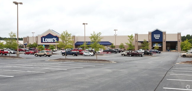
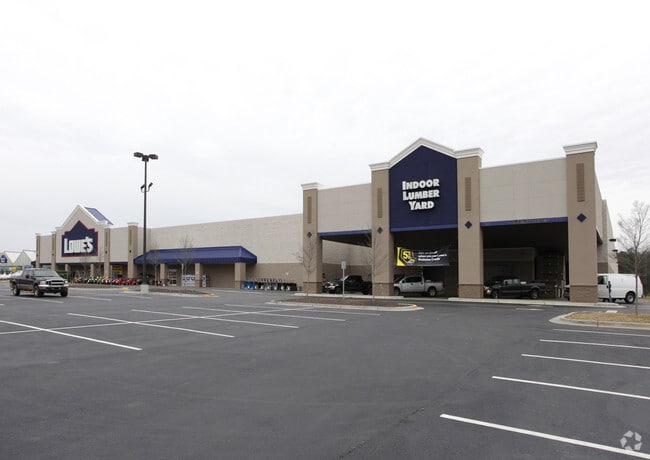
Wal-Mart Stores East Lp
Storebuilding
LOWES/15.27AC HWY 27 CTY90
X
Carroll
13045C0262D
Georgia
2025
15.27 AC
2025
W Carroll County
911101
Atlanta
138,903 SF
Atlanta-Sandy Springs-Roswell, GA
DEMOGRAPHICS near 1665 S Highway 27
1 Mile
3 Mile
5 Mile
2024 Total Population
2,318
22,942
41,460
2029 Population
2,617
25,517
45,927
Pop Growth 2024-2029
+ 12.90%
+ 11.22%
+ 10.77%
Average Age
39
35
36
2024 Total Households
929
8,192
15,030
HH Growth 2024-2029
+ 13.24%
+ 11.61%
+ 11.01%
Median Household Inc
$66,762
$46,410
$48,564
Avg Household Size
2.40
2.50
2.50
2024 Avg HH Vehicles
3.00
2.00
2.00
Median Home Value
$268,541
$253,279
$237,421
Median Year Built
1994
1985
1986
Nearby Places
Map Layers
Map Styles
 Street
 Aerial
- Restaurants
- Banks
- Shops
- Fitness
- Groceries
Nearby Properties
Address
Land Use
TOTAL SIZE
Lot Size
Zoning
Address
Land Use
TOTAL SIZE
Lot Size
Zoning
53.04 AC
OI
Address
Land Use
TOTAL SIZE
Lot Size
Zoning
50,000 SF
28.63 AC
HS
Address
Land Use
TOTAL SIZE
Lot Size
Zoning
106,769 SF
11.26 AC
HS
Address
Land Use
TOTAL SIZE
Lot Size
Zoning
1,542,912 SF
118.16 AC
M2
Address
Land Use
TOTAL SIZE
Lot Size
Zoning
261,905 SF
64.74 AC
R2
Address
Land Use
TOTAL SIZE
Lot Size
Zoning
152,962 SF
108.90 AC
OI
Address
Land Use
TOTAL SIZE
Lot Size
Zoning
351,903 SF
30.04 AC
C2
Address
Land Use
TOTAL SIZE
Lot Size
Zoning
39,268 SF
12.05 AC
RM-10
Address
Land Use
TOTAL SIZE
Lot Size
Zoning
134,113 SF
2.80 AC
OI
Address
Land Use
TOTAL SIZE
Lot Size
Zoning
32,778 SF
3.89 AC
OI
Address
Land Use
TOTAL SIZE
Lot Size
Zoning
35.33 AC
OI
Address
Land Use
TOTAL SIZE
Lot Size
Zoning
354,354 SF
51.15 AC
I
Address
Land Use
TOTAL SIZE
Lot Size
Zoning
159,860 SF
20.74 AC
C2
Address
Land Use
TOTAL SIZE
Lot Size
Zoning
142,740 SF
8.13 AC
C2
Address
Land Use
TOTAL SIZE
Lot Size
Zoning
217,766 SF
28.46 AC
C2
Address
Land Use
TOTAL SIZE
Lot Size
Zoning
13,585 SF
14.93 AC
R3
Address
Land Use
TOTAL SIZE
Lot Size
Zoning
56,458 SF
21.87 AC
R3
Address
Land Use
TOTAL SIZE
Lot Size
Zoning
83,421 SF
4.28 AC
C2
Address
Land Use
TOTAL SIZE
Lot Size
Zoning
19,960 SF
0.53 AC
HS
Address
Land Use
TOTAL SIZE
Lot Size
Zoning
97,509 SF
15.50 AC
001
Address
Land Use
TOTAL SIZE
Lot Size
Zoning
7,700 SF
7.08 AC
R3
Address
Land Use
TOTAL SIZE
Lot Size
Zoning
276,510 SF
6.78 AC
M1
Address
Land Use
TOTAL SIZE
Lot Size
Zoning
109,900 SF
11.39 AC
C2
Address
Land Use
TOTAL SIZE
Lot Size
Zoning
3,240 SF
13.42 AC
C2
Address
Land Use
TOTAL SIZE
Lot Size
Zoning
19,840 SF
10.37 AC
R2
Address
Land Use
TOTAL SIZE
Lot Size
Zoning
119,925 SF
10.10 AC
OI/PUD
Address
Land Use
TOTAL SIZE
Lot Size
Zoning
42,905 SF
9.76 AC
002
Address
Land Use
TOTAL SIZE
Lot Size
Zoning
90,485 SF
10.35 AC
C2
Address
Land Use
TOTAL SIZE
Lot Size
Zoning
28,554 SF
0.74 AC
002
The World's #1 Commercial Real Estate Marketplace
Connect with us
© 2025 CoStar Group
The information above has been obtained from sources believed reliable. While we do not doubt its accuracy we have not verified it and make no guarantee, warranty or representation about it. It is your responsibility to independently confirm its accuracy and completeness. Any projections, opinions, assumptions, or estimates used are for example only and do not represent the current or future performance of the property. The value of this transaction to you depends on tax and other factors which should be evaluated by your tax, financial, and legal advisors. You and your advisors should conduct a careful, independent investigation of the property to determine to your satisfaction the suitability of the property for your needs.