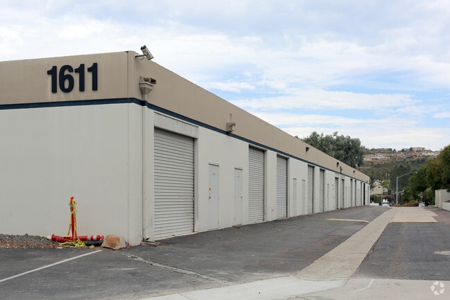
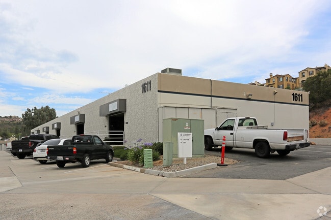
Property Record
1611 S Rancho Santa Fe Rd, San Marcos, CA 92078


Current Lease Availabilities
NEARBY LISTINGS FOR SALE OR LEASE
Property Detail
1611 S Rancho Santa Fe Rd
San Diego-Carlsbad, CA
San Marcos The Quorum
223-030-95
LOT 5 PAR A PER DOC06-660435 IN PAR B OF PM12104&IN POR OF TR 014508
Warehouse
San Diego
X
California
06073C1055G
5
2025
8.38 AC
2025
San Marcos
020042
San Diego
99,999 SF
DEMOGRAPHICS near 1611 S Rancho Santa Fe Rd
1 Mile
3 Mile
5 Mile
2024 Total Population
10,639
78,991
202,820
2029 Population
10,502
78,269
200,905
Pop Growth 2024-2029
(1.29%)
(0.91%)
(0.94%)
Average Age
40
42
41
2024 Total Households
3,978
28,463
72,360
HH Growth 2024-2029
(1.41%)
(1.02%)
(1.09%)
Median Household Inc
$134,150
$137,558
$120,180
Avg Household Size
2.60
2.70
2.70
2024 Avg HH Vehicles
2.00
2.00
2.00
Median Home Value
$1,000,554
$968,102
$920,118
Median Year Built
2002
1993
1989
Nearby Places
Map Layers
Map Styles
 Street
 Aerial
- Restaurants
- Banks
- Shops
- Fitness
- Groceries
PUBLIC TRANSPORTATION
COMMUTER RAIL
Carlsbad Poinsettia (Coaster - San Diego North County Transit District (Coaster/Sprinter/Breeze))
DRIVE
WALK
Distance
Carlsbad Poinsettia (Coaster - San Diego North County Transit District (Coaster/Sprinter/Breeze))
15 min
7.1 mi
Encinitas (Coaster - San Diego North County Transit District (Coaster/Sprinter/Breeze))
DRIVE
WALK
Distance
Encinitas (Coaster - San Diego North County Transit District (Coaster/Sprinter/Breeze))
15 min
7.8 mi
AIRPORT
San Diego International
DRIVE
WALK
Distance
San Diego International
43 min
31.5 mi
Freight Ports
Port of San Diego
DRIVE
WALK
Distance
Port of San Diego
48 min
35.9 mi
Nearby Properties
Address
Land Use
TOTAL SIZE
Lot Size
Zoning
Address
Land Use
TOTAL SIZE
Lot Size
Zoning
55.06 AC
P-C
Address
Land Use
TOTAL SIZE
Lot Size
Zoning
13.92 AC
P-M
Address
Land Use
TOTAL SIZE
Lot Size
Zoning
8.76 AC
P-C
Address
Land Use
TOTAL SIZE
Lot Size
Zoning
14.32 AC
P-M
Address
Land Use
TOTAL SIZE
Lot Size
Zoning
7.31 AC
P-C
Address
Land Use
TOTAL SIZE
Lot Size
Zoning
12.49 AC
P-C
Address
Land Use
TOTAL SIZE
Lot Size
Zoning
28.45 AC
O-S
Address
Land Use
TOTAL SIZE
Lot Size
Zoning
9.41 AC
SPI
Address
Land Use
TOTAL SIZE
Lot Size
Zoning
16.91 AC
C
Address
Land Use
TOTAL SIZE
Lot Size
Zoning
11.49 AC
P-M
Address
Land Use
TOTAL SIZE
Lot Size
Zoning
14.73 AC
C-L
Address
Land Use
TOTAL SIZE
Lot Size
Zoning
4.76 AC
C34
Address
Land Use
TOTAL SIZE
Lot Size
Zoning
87,181 SF
7.19 AC
P-C
Address
Land Use
TOTAL SIZE
Lot Size
Zoning
91,431 SF
8.69 AC
C-2
Address
Land Use
TOTAL SIZE
Lot Size
Zoning
11.10 AC
RD-M-Q
Address
Land Use
TOTAL SIZE
Lot Size
Zoning
13.20 AC
P-M
Address
Land Use
TOTAL SIZE
Lot Size
Zoning
9.80 AC
I
Address
Land Use
TOTAL SIZE
Lot Size
Zoning
7.91 AC
SPI
Address
Land Use
TOTAL SIZE
Lot Size
Zoning
19.35 AC
P-M
Address
Land Use
TOTAL SIZE
Lot Size
Zoning
27.30 AC
SPI
Address
Land Use
TOTAL SIZE
Lot Size
Zoning
10.44 AC
P-M
Address
Land Use
TOTAL SIZE
Lot Size
Zoning
19.68 AC
SPI
Address
Land Use
TOTAL SIZE
Lot Size
Zoning
9.99 AC
MU-1
Address
Land Use
TOTAL SIZE
Lot Size
Zoning
4.65 AC
SPI
Address
Land Use
TOTAL SIZE
Lot Size
Zoning
8.07 AC
SPI
Address
Land Use
TOTAL SIZE
Lot Size
Zoning
7.54 AC
SPA
Address
Land Use
TOTAL SIZE
Lot Size
Zoning
Address
Land Use
TOTAL SIZE
Lot Size
Zoning
99,840 SF
5.20 AC
SPI
Address
Land Use
TOTAL SIZE
Lot Size
Zoning
56,724 SF
5.66 AC
P-C
Address
Land Use
TOTAL SIZE
Lot Size
Zoning
15.59 AC
SPI
The World's #1 Commercial Real Estate Marketplace
Connect with us
© 2026 CoStar Group
The information above has been obtained from sources believed reliable. While we do not doubt its accuracy we have not verified it and make no guarantee, warranty or representation about it. It is your responsibility to independently confirm its accuracy and completeness. Any projections, opinions, assumptions, or estimates used are for example only and do not represent the current or future performance of the property. The value of this transaction to you depends on tax and other factors which should be evaluated by your tax, financial, and legal advisors. You and your advisors should conduct a careful, independent investigation of the property to determine to your satisfaction the suitability of the property for your needs.