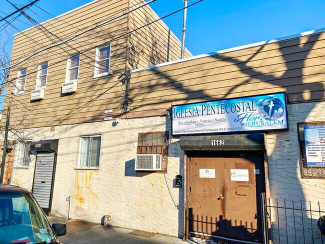
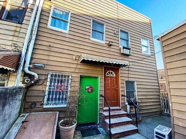
Property Record
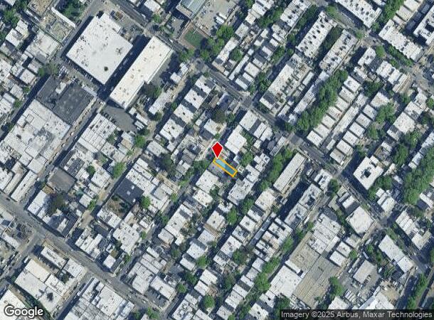
1666 Stephen St, Ridgewood, NY 11385
NEARBY LISTINGS FOR SALE OR LEASE
Property Detail
1666 Stephen St
03553-0044
Queens
Commercialofficeresidentialmixeduse
New York
X
44
3604970209F
0.06 AC
2024
Ridgewood
2025
Long Island (New York)
055500
New York-Jersey City-White Plains, NY-NJ
3,400 SF
DEMOGRAPHICS near 1666 Stephen St
1 mile
3 mile
5 mile
2024 Total Population
121,539
992,213
2,805,768
2029 Population
111,691
922,615
2,630,177
Pop Growth 2024-2029
(8.10%)
(7.01%)
(6.26%)
Average Age
37
38
39
2024 Total Households
42,609
351,946
1,066,441
HH Growth 2024-2029
(8.69%)
(7.48%)
(6.43%)
Median Household Inc
$70,344
$61,250
$72,867
Avg Household Size
2.70
2.70
2.50
2024 Avg HH Vehicles
1.00
1.00
1.00
Median Home Value
$870,774
$777,702
$744,627
Median Year Built
1947
1948
1949
Nearby Places
Map Layers
Map Styles
 Street
 Aerial
Transit
 Traffic
 Biking
Places
Listings with unknown addresses are not visible on the map
- Restaurants
- Banks
- Shops
- Fitness
- Groceries
PUBLIC TRANSPORTATION
TRANSIT/SUBWAY
Halsey Street (L Line) (L - New York MTA Subway (The Subway))
Drive
Walk
Distance
Halsey Street (L Line) (L - New York MTA Subway (The Subway))
1 min
3 min
0.1 mi
Seneca Avenue (M - New York MTA Subway (The Subway))
Drive
Walk
Distance
Seneca Avenue (M - New York MTA Subway (The Subway))
4 min
12 min
0.6 mi
Myrtle-Wyckoff Avenues (L - New York MTA Subway (The Subway), M - New York MTA Subway (The Subway))
Drive
Walk
Distance
Myrtle-Wyckoff Avenues (L - New York MTA Subway (The Subway), M - New York MTA Subway (The Subway))
3 min
13 min
0.6 mi
Forest Avenue (M - New York MTA Subway (The Subway))
Drive
Walk
Distance
Forest Avenue (M - New York MTA Subway (The Subway))
5 min
13 min
0.7 mi
Fresh Pond Road (M - New York MTA Subway (The Subway))
Drive
Walk
Distance
Fresh Pond Road (M - New York MTA Subway (The Subway))
6 min
19 min
0.9 mi
COMMUTER RAIL
East New York Station (Far Rockaway Branch - Long Island Rail Road, Long Beach Branch - Long Island Rail Road, West Hempstead Branch - Long Island Rail Road)
Drive
Walk
Distance
East New York Station (Far Rockaway Branch - Long Island Rail Road, Long Beach Branch - Long Island Rail Road, West Hempstead Branch - Long Island Rail Road)
7 min
2.5 mi
Nostrand Avenue Station (Far Rockaway Branch - Long Island Rail Road, Hempstead Branch - Long Island Rail Road, Long Beach Branch - Long Island Rail Road, West Hempstead Branch - Long Island Rail Road)
Drive
Walk
Distance
Nostrand Avenue Station (Far Rockaway Branch - Long Island Rail Road, Hempstead Branch - Long Island Rail Road, Long Beach Branch - Long Island Rail Road, West Hempstead Branch - Long Island Rail Road)
14 min
4.2 mi
AIRPORT
John F Kennedy International
Drive
Walk
Distance
John F Kennedy International
18 min
9.4 mi
LaGuardia
Drive
Walk
Distance
LaGuardia
16 min
11.5 mi
Newark Liberty International
Drive
Walk
Distance
Newark Liberty International
30 min
18.8 mi
SALE & LEASE HISTORY
LISTING DATE
SALE/LEASE

Oct 26, 2021
For Sale
Nearby Properties
Address
Land Use
TOTAL SIZE
Lot Size
Zoning
Address
Land Use
TOTAL SIZE
Lot Size
Zoning
2,812,739 SF
2.10 AC
C5-3
Address
Land Use
TOTAL SIZE
Lot Size
Zoning
54,170 SF
229.57 AC
PARK
Address
Land Use
TOTAL SIZE
Lot Size
Zoning
835,231 SF
11.32 AC
R6
Address
Land Use
TOTAL SIZE
Lot Size
Zoning
126.85 AC
PARK
Address
Land Use
TOTAL SIZE
Lot Size
Zoning
264,691 SF
5.17 AC
M1-2
Address
Land Use
TOTAL SIZE
Lot Size
Zoning
1,000 SF
210.07 AC
R3-2
Address
Land Use
TOTAL SIZE
Lot Size
Zoning
1,572,198 SF
22.06 AC
M1-2
Address
Land Use
TOTAL SIZE
Lot Size
Zoning
511,776 SF
2.33 AC
R6
Address
Land Use
TOTAL SIZE
Lot Size
Zoning
826,915 SF
8.83 AC
M3-1
Address
Land Use
TOTAL SIZE
Lot Size
Zoning
446,763 SF
12.52 AC
R6
Address
Land Use
TOTAL SIZE
Lot Size
Zoning
1,150,500 SF
15.17 AC
R6
Address
Land Use
TOTAL SIZE
Lot Size
Zoning
307,038 SF
7.84 AC
M1-1
Address
Land Use
TOTAL SIZE
Lot Size
Zoning
894,000 SF
4.14 AC
R6
Address
Land Use
TOTAL SIZE
Lot Size
Zoning
894,000 SF
4.14 AC
R6
Address
Land Use
TOTAL SIZE
Lot Size
Zoning
894,000 SF
4.14 AC
R6
Address
Land Use
TOTAL SIZE
Lot Size
Zoning
894,000 SF
4.14 AC
R6
Address
Land Use
TOTAL SIZE
Lot Size
Zoning
894,000 SF
4.14 AC
R6
Address
Land Use
TOTAL SIZE
Lot Size
Zoning
474,715 SF
1.72 AC
M14R8A
Address
Land Use
TOTAL SIZE
Lot Size
Zoning
458,778 SF
2.09 AC
R6
Address
Land Use
TOTAL SIZE
Lot Size
Zoning
490,600 SF
12.01 AC
M1-1
Address
Land Use
TOTAL SIZE
Lot Size
Zoning
758,750 SF
5.95 AC
R6
Address
Land Use
TOTAL SIZE
Lot Size
Zoning
758,750 SF
5.95 AC
R6
Address
Land Use
TOTAL SIZE
Lot Size
Zoning
751,412 SF
5.91 AC
R6
Address
Land Use
TOTAL SIZE
Lot Size
Zoning
751,412 SF
5.91 AC
R6
Address
Land Use
TOTAL SIZE
Lot Size
Zoning
751,412 SF
5.91 AC
R6
Address
Land Use
TOTAL SIZE
Lot Size
Zoning
248,200 SF
1.25 AC
R6
Address
Land Use
TOTAL SIZE
Lot Size
Zoning
257,660 SF
1.94 AC
R7A
Address
Land Use
TOTAL SIZE
Lot Size
Zoning
447,000 SF
1.98 AC
R6
Address
Land Use
TOTAL SIZE
Lot Size
Zoning
447,000 SF
1.98 AC
R6
Address
Land Use
TOTAL SIZE
Lot Size
Zoning
447,000 SF
1.98 AC
R6
The World's #1 Commercial Real Estate Marketplace
Connect with us
© 2026 CoStar Group
The information above has been obtained from sources believed reliable. While we do not doubt its accuracy we have not verified it and make no guarantee, warranty or representation about it. It is your responsibility to independently confirm its accuracy and completeness. Any projections, opinions, assumptions, or estimates used are for example only and do not represent the current or future performance of the property. The value of this transaction to you depends on tax and other factors which should be evaluated by your tax, financial, and legal advisors. You and your advisors should conduct a careful, independent investigation of the property to determine to your satisfaction the suitability of the property for your needs.