Property Record
1668 Appling Harlem Rd, Appling, GA 30802


NEARBY LISTINGS FOR SALE OR LEASE
-
-
View all Appling listings for sale on LoopNet.com
Property Detail
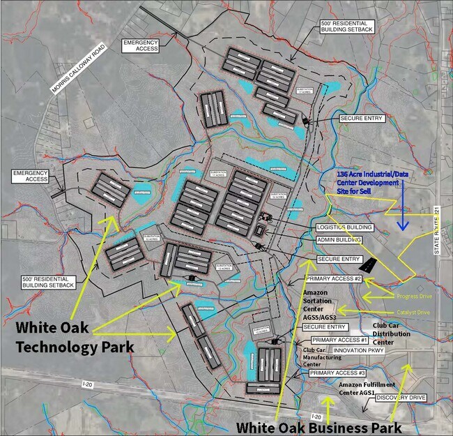
1668 Appling Harlem Rd
028-026C
41.29 ACS
Vacantlandnec
Columbia
A
Georgia
13073C0115E
45.96 AC
2025
Outlying Columbia County
2025
Augusta/Richmond County
030404
Augusta-Richmond County, GA-SC
DEMOGRAPHICS near 1668 Appling Harlem Rd
1 mile
3 mile
5 mile
2024 Total Population
123
3,488
11,096
2029 Population
137
3,925
12,481
Pop Growth 2024-2029
+ 11.38%
+ 12.53%
+ 12.48%
Average Age
41
41
39
2024 Total Households
39
1,160
3,752
HH Growth 2024-2029
+ 10.26%
+ 11.81%
+ 11.62%
Median Household Inc
$80,555
$87,011
$85,813
Avg Household Size
2.80
2.80
2.80
2024 Avg HH Vehicles
2.00
3.00
3.00
Median Home Value
$350,000
$330,851
$303,942
Median Year Built
1991
1994
2002
Nearby Places
Map Layers
Map Styles
 Street
 Aerial
Transit
 Traffic
 Biking
Places
Listings with unknown addresses are not visible on the map
- Restaurants
- Banks
- Shops
- Fitness
- Groceries
PUBLIC TRANSPORTATION
AIRPORT
Augusta Regional at Bush Field
Drive
Walk
Distance
Augusta Regional at Bush Field
39 min
27.8 mi
Freight Ports
Georgia Ports - Savannah
Drive
Walk
Distance
Georgia Ports - Savannah
173 min
137.0 mi
SALE & LEASE HISTORY
LISTING DATE
SALE/LEASE

Nov 24, 2020
For Sale
Feb 11, 2025
For Sale
Aug 25, 2021
For Sale
Aug 04, 2022
For Sale
Nearby Properties
Address
Land Use
TOTAL SIZE
Lot Size
Zoning
Address
Land Use
TOTAL SIZE
Lot Size
Zoning
2,407,745 SF
77.79 AC
Address
Land Use
TOTAL SIZE
Lot Size
Zoning
55,100 SF
49.78 AC
R-A;RES-AG
Address
Land Use
TOTAL SIZE
Lot Size
Zoning
132,734 SF
27.82 AC
Address
Land Use
TOTAL SIZE
Lot Size
Zoning
261,950 SF
46.38 AC
M-1;LIGHT
Address
Land Use
TOTAL SIZE
Lot Size
Zoning
7,246 SF
21.47 AC
S-1;SPECIA
Address
Land Use
TOTAL SIZE
Lot Size
Zoning
1,624.50 AC
R-A;RES-AG
Address
Land Use
TOTAL SIZE
Lot Size
Zoning
97,600 SF
11.68 AC
M-1;LIGHT
Address
Land Use
TOTAL SIZE
Lot Size
Zoning
2,016 SF
533 AC
Address
Land Use
TOTAL SIZE
Lot Size
Zoning
1,828 SF
628 AC
RA
Address
Land Use
TOTAL SIZE
Lot Size
Zoning
1,632 SF
631.67 AC
RA
Address
Land Use
TOTAL SIZE
Lot Size
Zoning
6,878 SF
3.86 AC
S-1;SPECIA
Address
Land Use
TOTAL SIZE
Lot Size
Zoning
49,950 SF
19.38 AC
Address
Land Use
TOTAL SIZE
Lot Size
Zoning
440.77 AC
RA
Address
Land Use
TOTAL SIZE
Lot Size
Zoning
872 SF
379.12 AC
Address
Land Use
TOTAL SIZE
Lot Size
Zoning
1,460 SF
163.01 AC
RA
Address
Land Use
TOTAL SIZE
Lot Size
Zoning
77.79 AC
Address
Land Use
TOTAL SIZE
Lot Size
Zoning
240.38 AC
RA
Address
Land Use
TOTAL SIZE
Lot Size
Zoning
17.91 AC
R-A;RES-AG
Address
Land Use
TOTAL SIZE
Lot Size
Zoning
12,124 SF
2.16 AC
Address
Land Use
TOTAL SIZE
Lot Size
Zoning
2,640 SF
148.32 AC
RA
Address
Land Use
TOTAL SIZE
Lot Size
Zoning
22.20 AC
Address
Land Use
TOTAL SIZE
Lot Size
Zoning
7,254 SF
13.34 AC
C-2;GEN CO
Address
Land Use
TOTAL SIZE
Lot Size
Zoning
1,933 SF
172.64 AC
R-A;RES-AG
Address
Land Use
TOTAL SIZE
Lot Size
Zoning
12.53 AC
M-1;LIGHT
Address
Land Use
TOTAL SIZE
Lot Size
Zoning
1,600 SF
173.02 AC
RA
Address
Land Use
TOTAL SIZE
Lot Size
Zoning
164.22 AC
Address
Land Use
TOTAL SIZE
Lot Size
Zoning
1,014 SF
52.95 AC
Address
Land Use
TOTAL SIZE
Lot Size
Zoning
8,128 SF
3.29 AC
R-A;RES-AG
Address
Land Use
TOTAL SIZE
Lot Size
Zoning
246.38 AC
Address
Land Use
TOTAL SIZE
Lot Size
Zoning
5,440 SF
2.60 AC
The World's #1 Commercial Real Estate Marketplace
Connect with us
© 2026 CoStar Group
The information above has been obtained from sources believed reliable. While we do not doubt its accuracy we have not verified it and make no guarantee, warranty or representation about it. It is your responsibility to independently confirm its accuracy and completeness. Any projections, opinions, assumptions, or estimates used are for example only and do not represent the current or future performance of the property. The value of this transaction to you depends on tax and other factors which should be evaluated by your tax, financial, and legal advisors. You and your advisors should conduct a careful, independent investigation of the property to determine to your satisfaction the suitability of the property for your needs.