Property Record
1668 Baxter Rd Se, Salem, OR 97306
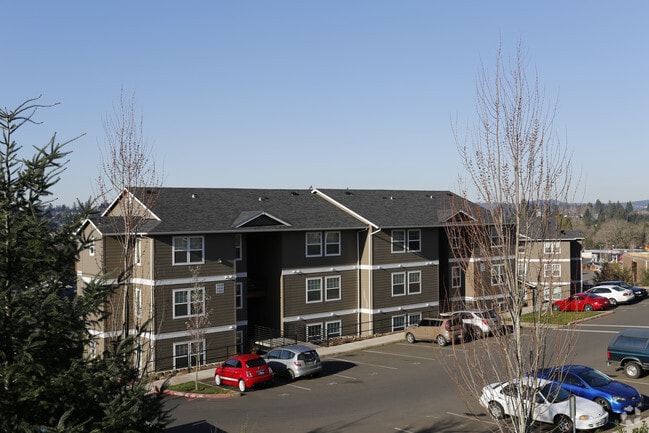
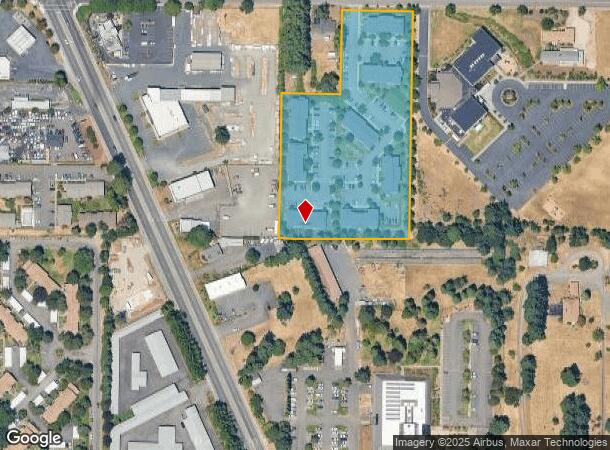
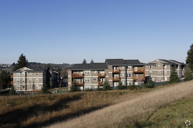
Property Detail
1668 Baxter Rd Se
Salem, OR
Grabenhorst Fruit Farms
575428
GRABENHORST FRUIT FARMS LOT FR 54 ACRES 4.39
Multifamilydwelling
Marion
X
Oregon
41053C0300F
54
2024
4.39 AC
2025
South Gateway
002001
Portland
89,970 SF
NEARBY LISTINGS FOR SALE OR LEASE
DEMOGRAPHICS near 1668 Baxter Rd Se
1 mile
3 mile
5 mile
2024 Total Population
18,745
65,838
130,446
2029 Population
19,021
66,609
132,533
Pop Growth 2024-2029
+ 1.47%
+ 1.17%
+ 1.60%
Average Age
39
40
40
2024 Total Households
7,193
24,934
48,353
HH Growth 2024-2029
+ 1.49%
+ 1.22%
+ 1.71%
Median Household Inc
$74,463
$76,647
$69,777
Avg Household Size
2.50
2.50
2.50
2024 Avg HH Vehicles
2.00
2.00
2.00
Median Home Value
$366,589
$379,128
$363,309
Median Year Built
1993
1982
1977
Nearby Places
Map Layers
Map Styles
 Street
 Aerial
Transit
 Traffic
 Biking
Places
Listings with unknown addresses are not visible on the map
- Restaurants
- Banks
- Shops
- Fitness
- Groceries
PUBLIC TRANSPORTATION
COMMUTER RAIL
Salem (Amtrak Cascades - Amtrak, Coast Starlight - Amtrak)
Drive
Walk
Distance
Salem (Amtrak Cascades - Amtrak, Coast Starlight - Amtrak)
8 min
4.3 mi
Freight Ports
Port of Portland
Drive
Walk
Distance
Port of Portland
71 min
55.0 mi
SALE & LEASE HISTORY
LISTING DATE
SALE/LEASE

Feb 26, 2018
For Sale
Nearby Properties
Address
Land Use
TOTAL SIZE
Lot Size
Zoning
Address
Land Use
TOTAL SIZE
Lot Size
Zoning
158,880 SF
8.80 AC
RM2; RM1;
Address
Land Use
TOTAL SIZE
Lot Size
Zoning
209,780 SF
19.85 AC
IC
Address
Land Use
TOTAL SIZE
Lot Size
Zoning
62,708 SF
30.21 AC
PH
Address
Land Use
TOTAL SIZE
Lot Size
Zoning
114,647 SF
5.72 AC
RM2; RM1
Address
Land Use
TOTAL SIZE
Lot Size
Zoning
102,124 SF
10.53 AC
CR
Address
Land Use
TOTAL SIZE
Lot Size
Zoning
193,237 SF
9.98 AC
IG
Address
Land Use
TOTAL SIZE
Lot Size
Zoning
1,769,016 SF
20.58 AC
CR
Address
Land Use
TOTAL SIZE
Lot Size
Zoning
108,723 SF
7.12 AC
IC
Address
Land Use
TOTAL SIZE
Lot Size
Zoning
204,178 SF
10.43 AC
RM2; PA
Address
Land Use
TOTAL SIZE
Lot Size
Zoning
Address
Land Use
TOTAL SIZE
Lot Size
Zoning
118,239 SF
10.69 AC
IG
Address
Land Use
TOTAL SIZE
Lot Size
Zoning
140,505 SF
5.84 AC
RM2; RS
Address
Land Use
TOTAL SIZE
Lot Size
Zoning
74,710 SF
9.83 AC
PS
Address
Land Use
TOTAL SIZE
Lot Size
Zoning
72,325 SF
7.79 AC
IBC
Address
Land Use
TOTAL SIZE
Lot Size
Zoning
144,616 SF
7.07 AC
RM2; CO
Address
Land Use
TOTAL SIZE
Lot Size
Zoning
0.78 AC
PS
Address
Land Use
TOTAL SIZE
Lot Size
Zoning
143,684 SF
9.43 AC
CR; RS
Address
Land Use
TOTAL SIZE
Lot Size
Zoning
174,632 SF
4.58 AC
CO
Address
Land Use
TOTAL SIZE
Lot Size
Zoning
120,648 SF
16.05 AC
CR
Address
Land Use
TOTAL SIZE
Lot Size
Zoning
Address
Land Use
TOTAL SIZE
Lot Size
Zoning
Address
Land Use
TOTAL SIZE
Lot Size
Zoning
Address
Land Use
TOTAL SIZE
Lot Size
Zoning
124,947 SF
6.27 AC
RM2
Address
Land Use
TOTAL SIZE
Lot Size
Zoning
109,373 SF
4.30 AC
FMU
Address
Land Use
TOTAL SIZE
Lot Size
Zoning
130,360 SF
6.34 AC
RM2
Address
Land Use
TOTAL SIZE
Lot Size
Zoning
88,524 SF
PS
Address
Land Use
TOTAL SIZE
Lot Size
Zoning
115,612 SF
5.87 AC
RM2
Address
Land Use
TOTAL SIZE
Lot Size
Zoning
132,655 SF
6.78 AC
FMU
The World's #1 Commercial Real Estate Marketplace
Connect with us
© 2026 CoStar Group
The information above has been obtained from sources believed reliable. While we do not doubt its accuracy we have not verified it and make no guarantee, warranty or representation about it. It is your responsibility to independently confirm its accuracy and completeness. Any projections, opinions, assumptions, or estimates used are for example only and do not represent the current or future performance of the property. The value of this transaction to you depends on tax and other factors which should be evaluated by your tax, financial, and legal advisors. You and your advisors should conduct a careful, independent investigation of the property to determine to your satisfaction the suitability of the property for your needs.