Property Record
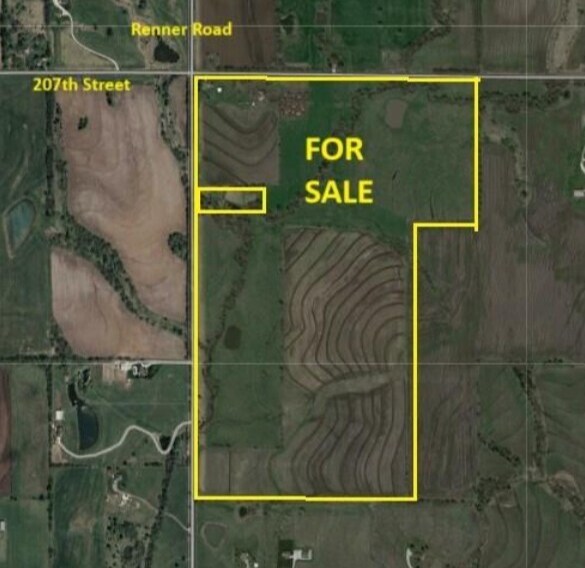
16685 W 207Th St, Spring Hill, KS 66083


NEARBY LISTINGS FOR SALE OR LEASE
Property Detail
16685 W 207Th St
9F241517-1005
17-15-24 BG 23 RODS E NW CR NW 1/4 S 20 RODS X E 27 RODS EX .307 AC IN ST 3.073 ACS M/L SP 255
Farms
Johnson
X
Kansas
20091C0140G
8.68 AC
2024
South Johnson County
2024
Kansas City
053801
Kansas City, MO-KS
4,110 SF
DEMOGRAPHICS near 16685 W 207Th St
1 mile
3 mile
5 mile
2024 Total Population
274
8,355
18,088
2029 Population
294
8,925
19,407
Pop Growth 2024-2029
+ 7.30%
+ 6.82%
+ 7.29%
Average Age
38
38
39
2024 Total Households
88
2,871
6,321
HH Growth 2024-2029
+ 6.82%
+ 6.93%
+ 7.40%
Median Household Inc
$137,500
$102,751
$110,220
Avg Household Size
3.10
2.90
2.80
2024 Avg HH Vehicles
2.00
2.00
2.00
Median Home Value
$343,421
$303,766
$355,125
Median Year Built
2010
2003
2005
Nearby Places
Map Layers
Map Styles
 Street
 Aerial
Transit
 Traffic
 Biking
Places
Listings with unknown addresses are not visible on the map
- Restaurants
- Banks
- Shops
- Fitness
- Groceries
SALE & LEASE HISTORY
LISTING DATE
SALE/LEASE

Apr 30, 2023
For Sale
Nearby Properties
Address
Land Use
TOTAL SIZE
Lot Size
Zoning
Address
Land Use
TOTAL SIZE
Lot Size
Zoning
327,169 SF
141.81 AC
R-R
Address
Land Use
TOTAL SIZE
Lot Size
Zoning
102,280 SF
30.53 AC
RP-4
Address
Land Use
TOTAL SIZE
Lot Size
Zoning
71,221 SF
14.16 AC
Address
Land Use
TOTAL SIZE
Lot Size
Zoning
97,479 SF
18.50 AC
R-1
Address
Land Use
TOTAL SIZE
Lot Size
Zoning
4,608 SF
45.43 AC
Address
Land Use
TOTAL SIZE
Lot Size
Zoning
62,610 SF
35.28 AC
R-1
Address
Land Use
TOTAL SIZE
Lot Size
Zoning
476,083 SF
63.47 AC
M-1
Address
Land Use
TOTAL SIZE
Lot Size
Zoning
109,026 SF
11.21 AC
M-1
Address
Land Use
TOTAL SIZE
Lot Size
Zoning
24,622 SF
4.72 AC
R-1
Address
Land Use
TOTAL SIZE
Lot Size
Zoning
231,750 SF
22.02 AC
M-1
Address
Land Use
TOTAL SIZE
Lot Size
Zoning
39,800 SF
4.75 AC
M-1
Address
Land Use
TOTAL SIZE
Lot Size
Zoning
12,556 SF
2.60 AC
M-1
Address
Land Use
TOTAL SIZE
Lot Size
Zoning
15,210 SF
2.79 AC
C-2
Address
Land Use
TOTAL SIZE
Lot Size
Zoning
204,744 SF
13.37 AC
M-1
Address
Land Use
TOTAL SIZE
Lot Size
Zoning
4,112 SF
4.55 AC
Address
Land Use
TOTAL SIZE
Lot Size
Zoning
168,500 SF
11.19 AC
M-1
Address
Land Use
TOTAL SIZE
Lot Size
Zoning
5.23 AC
RUR
Address
Land Use
TOTAL SIZE
Lot Size
Zoning
12,112 SF
2 AC
R-1
Address
Land Use
TOTAL SIZE
Lot Size
Zoning
168,730 SF
15.32 AC
M-1
Address
Land Use
TOTAL SIZE
Lot Size
Zoning
8,744 SF
1.07 AC
R-1
Address
Land Use
TOTAL SIZE
Lot Size
Zoning
8,400 SF
1.87 AC
R-1
Address
Land Use
TOTAL SIZE
Lot Size
Zoning
3,568 SF
0.29 AC
C-2
Address
Land Use
TOTAL SIZE
Lot Size
Zoning
12,048 SF
14 AC
M-1
Address
Land Use
TOTAL SIZE
Lot Size
Zoning
4,944 SF
7.76 AC
CP-2
Address
Land Use
TOTAL SIZE
Lot Size
Zoning
6,314 SF
0.64 AC
C-2
Address
Land Use
TOTAL SIZE
Lot Size
Zoning
7,151 SF
0.65 AC
R-4
Address
Land Use
TOTAL SIZE
Lot Size
Zoning
4,438 SF
2.83 AC
RLD
Address
Land Use
TOTAL SIZE
Lot Size
Zoning
0.34 AC
M-1
Address
Land Use
TOTAL SIZE
Lot Size
Zoning
50,000 SF
4.26 AC
M-1
Address
Land Use
TOTAL SIZE
Lot Size
Zoning
8,400 SF
6.83 AC
RUR
The World's #1 Commercial Real Estate Marketplace
Connect with us
© 2026 CoStar Group
The information above has been obtained from sources believed reliable. While we do not doubt its accuracy we have not verified it and make no guarantee, warranty or representation about it. It is your responsibility to independently confirm its accuracy and completeness. Any projections, opinions, assumptions, or estimates used are for example only and do not represent the current or future performance of the property. The value of this transaction to you depends on tax and other factors which should be evaluated by your tax, financial, and legal advisors. You and your advisors should conduct a careful, independent investigation of the property to determine to your satisfaction the suitability of the property for your needs.