Property Record
167 N Ridge Rd E, Lorain, OH 44055
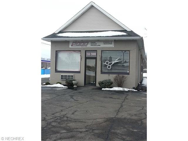

Property Detail
167 N Ridge Rd E
Cleveland-Elyria, OH
20020801340
03-00-113-103-003
Lorain
Storebuilding
Ohio
B and X Area of moderate flood hazard, usually the area between the limits of the 100-year and 500-year floods.
113
2024
0.48 AC
2024
Lorain/Avon Lake
024000
Cleveland
1,958 SF
NEARBY LISTINGS FOR SALE OR LEASE
-
-
View all Lorain listings for sale on LoopNet.com
DEMOGRAPHICS near 167 N Ridge Rd E
1 mile
3 mile
5 mile
2025 Total Population
4,112
55,378
133,690
2030 Population
4,200
56,791
137,172
Pop Growth 2025-2030
+ 2.14%
+ 2.55%
+ 2.60%
Average Age
42
41
41
2025 Total Households
1,812
22,717
56,253
HH Growth 2025-2030
+ 2.15%
+ 2.55%
+ 2.65%
Median Household Inc
$47,085
$50,562
$57,774
Avg Household Size
2.20
2.30
2.30
2025 Avg HH Vehicles
2.00
2.00
2.00
Median Home Value
$159,259
$141,822
$161,897
Median Year Built
1965
1961
1962
Nearby Places
Map Layers
Map Styles
 Street
 Aerial
Transit
 Traffic
 Biking
Places
Listings with unknown addresses are not visible on the map
- Restaurants
- Banks
- Shops
- Fitness
- Groceries
PUBLIC TRANSPORTATION
COMMUTER RAIL
Elyria Amtrak (Capitol Limited - Amtrak, Lake Shore Limited - Amtrak)
Drive
Walk
Distance
Elyria Amtrak (Capitol Limited - Amtrak, Lake Shore Limited - Amtrak)
12 min
7.2 mi
AIRPORT
Cleveland-Hopkins International
Drive
Walk
Distance
Cleveland-Hopkins International
32 min
21.4 mi
Freight Ports
Port of Toledo
Drive
Walk
Distance
Port of Toledo
107 min
87.9 mi
SALE & LEASE HISTORY
LISTING DATE
SALE/LEASE

Sep 24, 2016
For Sale
Nearby Properties
Address
Land Use
TOTAL SIZE
Lot Size
Zoning
Address
Land Use
TOTAL SIZE
Lot Size
Zoning
85,502 SF
15.47 AC
Address
Land Use
TOTAL SIZE
Lot Size
Zoning
87,851 SF
15.44 AC
Address
Land Use
TOTAL SIZE
Lot Size
Zoning
187,340 SF
42.98 AC
Address
Land Use
TOTAL SIZE
Lot Size
Zoning
41,842 SF
10.38 AC
Address
Land Use
TOTAL SIZE
Lot Size
Zoning
41,684 SF
3.51 AC
Address
Land Use
TOTAL SIZE
Lot Size
Zoning
53,266 SF
3 AC
Address
Land Use
TOTAL SIZE
Lot Size
Zoning
112,888 SF
8.92 AC
Address
Land Use
TOTAL SIZE
Lot Size
Zoning
52,392 SF
2.71 AC
Address
Land Use
TOTAL SIZE
Lot Size
Zoning
41,372 SF
2.42 AC
Address
Land Use
TOTAL SIZE
Lot Size
Zoning
43,773 SF
3.41 AC
Address
Land Use
TOTAL SIZE
Lot Size
Zoning
160,080 SF
14.89 AC
Address
Land Use
TOTAL SIZE
Lot Size
Zoning
191,168 SF
20.70 AC
Address
Land Use
TOTAL SIZE
Lot Size
Zoning
194,787 SF
19.04 AC
Address
Land Use
TOTAL SIZE
Lot Size
Zoning
89,540 SF
4.62 AC
Address
Land Use
TOTAL SIZE
Lot Size
Zoning
53,266 SF
12.90 AC
Address
Land Use
TOTAL SIZE
Lot Size
Zoning
60,452 SF
0.61 AC
Address
Land Use
TOTAL SIZE
Lot Size
Zoning
178,140 SF
15.67 AC
Address
Land Use
TOTAL SIZE
Lot Size
Zoning
118,800 SF
1.01 AC
Address
Land Use
TOTAL SIZE
Lot Size
Zoning
1,887 SF
435.37 AC
Address
Land Use
TOTAL SIZE
Lot Size
Zoning
22,894 SF
9.60 AC
Address
Land Use
TOTAL SIZE
Lot Size
Zoning
52,602 SF
9.31 AC
Address
Land Use
TOTAL SIZE
Lot Size
Zoning
80,852 SF
9.41 AC
Address
Land Use
TOTAL SIZE
Lot Size
Zoning
46,708 SF
8.56 AC
Address
Land Use
TOTAL SIZE
Lot Size
Zoning
79,705 SF
1.60 AC
Address
Land Use
TOTAL SIZE
Lot Size
Zoning
99,979 SF
3.54 AC
Address
Land Use
TOTAL SIZE
Lot Size
Zoning
52,176 SF
0.31 AC
Address
Land Use
TOTAL SIZE
Lot Size
Zoning
25,923 SF
5.16 AC
Address
Land Use
TOTAL SIZE
Lot Size
Zoning
235,786 SF
12.06 AC
Address
Land Use
TOTAL SIZE
Lot Size
Zoning
138,499 SF
10.07 AC
Address
Land Use
TOTAL SIZE
Lot Size
Zoning
17,787 SF
3.67 AC
The World's #1 Commercial Real Estate Marketplace
Connect with us
© 2026 CoStar Group
The information above has been obtained from sources believed reliable. While we do not doubt its accuracy we have not verified it and make no guarantee, warranty or representation about it. It is your responsibility to independently confirm its accuracy and completeness. Any projections, opinions, assumptions, or estimates used are for example only and do not represent the current or future performance of the property. The value of this transaction to you depends on tax and other factors which should be evaluated by your tax, financial, and legal advisors. You and your advisors should conduct a careful, independent investigation of the property to determine to your satisfaction the suitability of the property for your needs.