Property Record
1670 Us Highway 601 N, Mocksville, NC 27028
NEARBY LISTINGS FOR SALE OR LEASE
-
-
View all Mocksville listings for sale on LoopNet.com
Property Detail
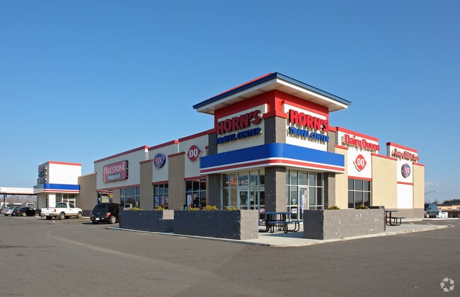
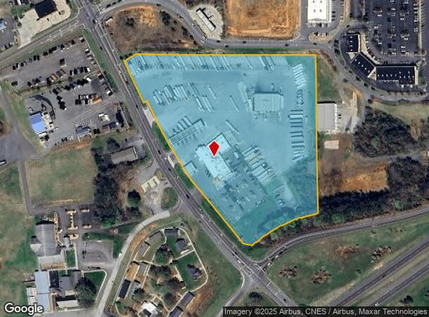
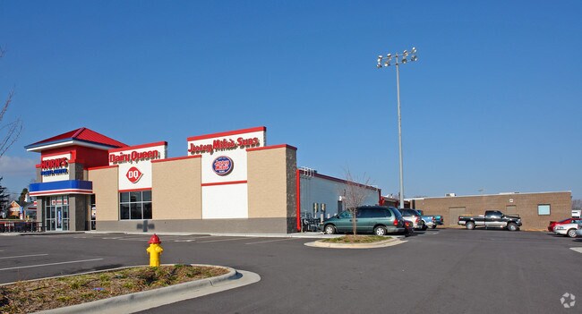
1670 Us Highway 601 N
H4-000-00-009-04
11.783 AC HWY 601
Restaurantbuilding
Davie
X
North Carolina
3710572900J
11.84 AC
2025
Davie County
2025
Greensboro/Winston-Salem
080600
Winston-Salem, NC
16,547 SF
DEMOGRAPHICS near 1670 Us Highway 601 N
1 Mile
3 Mile
5 Mile
2024 Total Population
534
6,793
14,209
2029 Population
584
7,421
15,496
Pop Growth 2024-2029
+ 9.36%
+ 9.24%
+ 9.06%
Average Age
42
42
42
2024 Total Households
219
2,730
5,629
HH Growth 2024-2029
+ 9.13%
+ 8.94%
+ 8.76%
Median Household Inc
$49,166
$52,863
$57,418
Avg Household Size
2.40
2.40
2.50
2024 Avg HH Vehicles
2.00
2.00
2.00
Median Home Value
$231,818
$211,319
$197,316
Median Year Built
1988
1988
1989
Nearby Places
Map Layers
Map Styles
 Street
 Aerial
- Restaurants
- Banks
- Shops
- Fitness
- Groceries
Nearby Properties
Address
Land Use
TOTAL SIZE
Lot Size
Zoning
Address
Land Use
TOTAL SIZE
Lot Size
Zoning
739,182 SF
82.62 AC
Address
Land Use
TOTAL SIZE
Lot Size
Zoning
498,960 SF
31.06 AC
Address
Land Use
TOTAL SIZE
Lot Size
Zoning
324,000 SF
23.65 AC
Address
Land Use
TOTAL SIZE
Lot Size
Zoning
253,050 SF
31.05 AC
Address
Land Use
TOTAL SIZE
Lot Size
Zoning
151,423 SF
93.36 AC
TC
Address
Land Use
TOTAL SIZE
Lot Size
Zoning
178,986 SF
21.99 AC
HC
Address
Land Use
TOTAL SIZE
Lot Size
Zoning
130,560 SF
16.29 AC
Address
Land Use
TOTAL SIZE
Lot Size
Zoning
55,920 SF
41.96 AC
Address
Land Use
TOTAL SIZE
Lot Size
Zoning
129,600 SF
16.80 AC
Address
Land Use
TOTAL SIZE
Lot Size
Zoning
206,876 SF
13.32 AC
CB
Address
Land Use
TOTAL SIZE
Lot Size
Zoning
130,655 SF
17.73 AC
HB
Address
Land Use
TOTAL SIZE
Lot Size
Zoning
108,000 SF
13.78 AC
Address
Land Use
TOTAL SIZE
Lot Size
Zoning
104,027 SF
12.43 AC
TC
Address
Land Use
TOTAL SIZE
Lot Size
Zoning
37,437 SF
3.24 AC
TC
Address
Land Use
TOTAL SIZE
Lot Size
Zoning
76,806 SF
60.98 AC
HC
Address
Land Use
TOTAL SIZE
Lot Size
Zoning
130,548 SF
16.26 AC
Address
Land Use
TOTAL SIZE
Lot Size
Zoning
29,427 SF
4.60 AC
NR
Address
Land Use
TOTAL SIZE
Lot Size
Zoning
109,418 SF
13.52 AC
Address
Land Use
TOTAL SIZE
Lot Size
Zoning
78,300 SF
7 AC
TC
Address
Land Use
TOTAL SIZE
Lot Size
Zoning
25,060 SF
5.24 AC
HC
Address
Land Use
TOTAL SIZE
Lot Size
Zoning
2,194 SF
8.96 AC
TND
Address
Land Use
TOTAL SIZE
Lot Size
Zoning
62,800 SF
21.61 AC
CI
Address
Land Use
TOTAL SIZE
Lot Size
Zoning
394,265 SF
46.94 AC
TC
Address
Land Use
TOTAL SIZE
Lot Size
Zoning
92,880 SF
14.30 AC
TC
Address
Land Use
TOTAL SIZE
Lot Size
Zoning
83,440 SF
10.04 AC
TC
Address
Land Use
TOTAL SIZE
Lot Size
Zoning
25,966 SF
0.55 AC
TC
Address
Land Use
TOTAL SIZE
Lot Size
Zoning
49,836 SF
8.97 AC
HC
Address
Land Use
TOTAL SIZE
Lot Size
Zoning
110,892 SF
11.91 AC
I2
Address
Land Use
TOTAL SIZE
Lot Size
Zoning
74,280 SF
13.72 AC
RA
Address
Land Use
TOTAL SIZE
Lot Size
Zoning
35,145 SF
11.54 AC
CI
The World's #1 Commercial Real Estate Marketplace
Connect with us
© 2026 CoStar Group
The information above has been obtained from sources believed reliable. While we do not doubt its accuracy we have not verified it and make no guarantee, warranty or representation about it. It is your responsibility to independently confirm its accuracy and completeness. Any projections, opinions, assumptions, or estimates used are for example only and do not represent the current or future performance of the property. The value of this transaction to you depends on tax and other factors which should be evaluated by your tax, financial, and legal advisors. You and your advisors should conduct a careful, independent investigation of the property to determine to your satisfaction the suitability of the property for your needs.