Property Record
16707 Ne 66Th Way, Vancouver, WA 98682


NEARBY LISTINGS FOR SALE OR LEASE
Property Detail
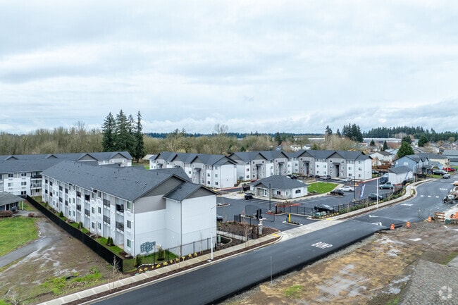
16707 Ne 66Th Way
159091-000
#1 SEC 12 T2N R2EWM 7.44A FOR ASSESSOR USE ONLY A PARCEL OF LAND LOCATED IN GOVERNMENT LOT 2 IN NORTHEAST QUARTER OF THE SOUTHEAST QUARTER OF SECTION 12, TOWNSHIP 2 NORTH, RANGE 2 EAST, OF THE WILLAMETTE MERIDIAN, CLARK COUNTY, WASHINGTON, DESCRIBED
Multifamilydwelling
Clark
X
Washington
53011C0392D
2
2025
7.44 AC
2025
Fisher's Village
041334
Portland
232,163 SF
Portland-Vancouver-Hillsboro, OR-WA
DEMOGRAPHICS near 16707 Ne 66Th Way
1 Mile
3 Mile
5 Mile
2024 Total Population
6,843
76,527
203,182
2029 Population
7,576
82,393
219,412
Pop Growth 2024-2029
+ 10.71%
+ 7.67%
+ 7.99%
Average Age
39
39
39
2024 Total Households
2,161
25,766
75,070
HH Growth 2024-2029
+ 10.78%
+ 7.70%
+ 8.04%
Median Household Inc
$103,304
$89,703
$81,910
Avg Household Size
3.10
2.90
2.60
2024 Avg HH Vehicles
3.00
2.00
2.00
Median Home Value
$498,427
$401,740
$407,350
Median Year Built
1998
1995
1994
Nearby Places
Map Layers
Map Styles
 Street
 Aerial
- Restaurants
- Banks
- Shops
- Fitness
- Groceries
PUBLIC TRANSPORTATION
AIRPORT
Portland International
DRIVE
WALK
Distance
Portland International
23 min
13.1 mi
Freight Ports
Port of Vancouver
DRIVE
WALK
Distance
Port of Vancouver
22 min
11.5 mi
Nearby Properties
Address
Land Use
TOTAL SIZE
Lot Size
Zoning
Address
Land Use
TOTAL SIZE
Lot Size
Zoning
2,279,068 SF
137.78 AC
IL
Address
Land Use
TOTAL SIZE
Lot Size
Zoning
681,799 SF
36.22 AC
IL
Address
Land Use
TOTAL SIZE
Lot Size
Zoning
399,563 SF
12.98 AC
CC
Address
Land Use
TOTAL SIZE
Lot Size
Zoning
613,468 SF
45.44 AC
R1-6
Address
Land Use
TOTAL SIZE
Lot Size
Zoning
304,876 SF
11.34 AC
R-18
Address
Land Use
TOTAL SIZE
Lot Size
Zoning
237,558 SF
15.48 AC
R-22
Address
Land Use
TOTAL SIZE
Lot Size
Zoning
282,460 SF
7.85 AC
R-18
Address
Land Use
TOTAL SIZE
Lot Size
Zoning
244,812 SF
16.33 AC
CC
Address
Land Use
TOTAL SIZE
Lot Size
Zoning
100,476 SF
5.51 AC
R-18
Address
Land Use
TOTAL SIZE
Lot Size
Zoning
310,100 SF
15.42 AC
R-22
Address
Land Use
TOTAL SIZE
Lot Size
Zoning
510,468 SF
24.42 AC
IL
Address
Land Use
TOTAL SIZE
Lot Size
Zoning
148,960 SF
7.63 AC
R-18
Address
Land Use
TOTAL SIZE
Lot Size
Zoning
363,734 SF
40.47 AC
R-6
Address
Land Use
TOTAL SIZE
Lot Size
Zoning
160,086 SF
16.99 AC
IL
Address
Land Use
TOTAL SIZE
Lot Size
Zoning
247,476 SF
10.40 AC
R1-7.5
Address
Land Use
TOTAL SIZE
Lot Size
Zoning
153,330 SF
4.23 AC
R-18
Address
Land Use
TOTAL SIZE
Lot Size
Zoning
125,960 SF
5.70 AC
R-22
Address
Land Use
TOTAL SIZE
Lot Size
Zoning
188,598 SF
10.25 AC
CC
Address
Land Use
TOTAL SIZE
Lot Size
Zoning
155,698 SF
18.05 AC
CG
Address
Land Use
TOTAL SIZE
Lot Size
Zoning
254,380 SF
27.77 AC
R-9
Address
Land Use
TOTAL SIZE
Lot Size
Zoning
138,892 SF
11.81 AC
R-18
Address
Land Use
TOTAL SIZE
Lot Size
Zoning
121,164 SF
11.81 AC
CG
Address
Land Use
TOTAL SIZE
Lot Size
Zoning
177,042 SF
7.25 AC
GC
Address
Land Use
TOTAL SIZE
Lot Size
Zoning
61,245 SF
10.64 AC
R1-6
Address
Land Use
TOTAL SIZE
Lot Size
Zoning
123,704 SF
16.40 AC
R-9
Address
Land Use
TOTAL SIZE
Lot Size
Zoning
59,810 SF
4.06 AC
CC
Address
Land Use
TOTAL SIZE
Lot Size
Zoning
75,748 SF
17.36 AC
R-22
Address
Land Use
TOTAL SIZE
Lot Size
Zoning
117,304 SF
2.09 AC
CC
Address
Land Use
TOTAL SIZE
Lot Size
Zoning
105,525 SF
5.96 AC
IL
The World's #1 Commercial Real Estate Marketplace
Connect with us
© 2026 CoStar Group
The information above has been obtained from sources believed reliable. While we do not doubt its accuracy we have not verified it and make no guarantee, warranty or representation about it. It is your responsibility to independently confirm its accuracy and completeness. Any projections, opinions, assumptions, or estimates used are for example only and do not represent the current or future performance of the property. The value of this transaction to you depends on tax and other factors which should be evaluated by your tax, financial, and legal advisors. You and your advisors should conduct a careful, independent investigation of the property to determine to your satisfaction the suitability of the property for your needs.