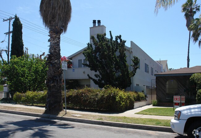
Property Record
1675 Thomas Ave, San Diego, CA 92109


NEARBY LISTINGS FOR SALE OR LEASE
Property Detail
1675 Thomas Ave
San Diego-Chula Vista-Carlsbad, CA
Pacific Beach
424-152-13
BLK 270 LOTS 19 & 20 TR 000854
Multifamilydwelling
San Diego
X
California
06073C1611H
19,20
2024
0.14 AC
2025
Pacific Beach
007907
San Diego
4,184 SF
DEMOGRAPHICS near 1675 Thomas Ave
1 mile
3 mile
5 mile
2024 Total Population
31,264
101,704
300,821
2029 Population
31,534
102,412
301,255
Pop Growth 2024-2029
+ 0.86%
+ 0.70%
+ 0.14%
Average Age
36
41
40
2024 Total Households
15,860
46,330
127,731
HH Growth 2024-2029
+ 0.90%
+ 0.76%
+ 0.17%
Median Household Inc
$96,691
$106,884
$100,349
Avg Household Size
1.90
2.10
2.20
2024 Avg HH Vehicles
2.00
2.00
2.00
Median Home Value
$1,005,229
$1,039,436
$943,765
Median Year Built
1973
1970
1971
Nearby Places
Map Layers
Map Styles
 Street
 Aerial
Transit
 Traffic
 Biking
Places
Listings with unknown addresses are not visible on the map
- Restaurants
- Banks
- Shops
- Fitness
- Groceries
PUBLIC TRANSPORTATION
COMMUTER RAIL
Old Town Transit Center (Coaster - San Diego North County Transit District (Coaster/Sprinter/Breeze))
Drive
Walk
Distance
Old Town Transit Center (Coaster - San Diego North County Transit District (Coaster/Sprinter/Breeze))
9 min
5.3 mi
San Diego (Santa Fe Depot) (Coaster - San Diego North County Transit District (Coaster/Sprinter/Breeze))
Drive
Walk
Distance
San Diego (Santa Fe Depot) (Coaster - San Diego North County Transit District (Coaster/Sprinter/Breeze))
13 min
8.4 mi
AIRPORT
San Diego International
Drive
Walk
Distance
San Diego International
11 min
7.0 mi
Freight Ports
Port of San Diego
Drive
Walk
Distance
Port of San Diego
17 min
11.5 mi
Nearby Properties
Address
Land Use
TOTAL SIZE
Lot Size
Zoning
Address
Land Use
TOTAL SIZE
Lot Size
Zoning
189.30 AC
M
Address
Land Use
TOTAL SIZE
Lot Size
Zoning
42.78 AC
M
Address
Land Use
TOTAL SIZE
Lot Size
Zoning
11.60 AC
RM-3-7
Address
Land Use
TOTAL SIZE
Lot Size
Zoning
18.33 AC
RS-1-7
Address
Land Use
TOTAL SIZE
Lot Size
Zoning
35.76 AC
RS-1-4
Address
Land Use
TOTAL SIZE
Lot Size
Zoning
283,689 SF
18.02 AC
M
Address
Land Use
TOTAL SIZE
Lot Size
Zoning
5.67 AC
RS-1-7
Address
Land Use
TOTAL SIZE
Lot Size
Zoning
7.04 AC
MBPD-VC-N
Address
Land Use
TOTAL SIZE
Lot Size
Zoning
25.46 AC
IL-3-1
Address
Land Use
TOTAL SIZE
Lot Size
Zoning
1.12 AC
CC-4-2
Address
Land Use
TOTAL SIZE
Lot Size
Zoning
1.56 AC
CC-4-2
Address
Land Use
TOTAL SIZE
Lot Size
Zoning
14.02 AC
IP-2-1
Address
Land Use
TOTAL SIZE
Lot Size
Zoning
7.09 AC
IP-2-1
Address
Land Use
TOTAL SIZE
Lot Size
Zoning
2.56 AC
CC-4-2
Address
Land Use
TOTAL SIZE
Lot Size
Zoning
15.50 AC
RM-4-10
Address
Land Use
TOTAL SIZE
Lot Size
Zoning
12.90 AC
RS-1-7
Address
Land Use
TOTAL SIZE
Lot Size
Zoning
8.56 AC
C
Address
Land Use
TOTAL SIZE
Lot Size
Zoning
22.44 AC
CC-1-3
Address
Land Use
TOTAL SIZE
Lot Size
Zoning
98,561 SF
2.42 AC
RM-2-5
Address
Land Use
TOTAL SIZE
Lot Size
Zoning
74,984 SF
2.75 AC
RM-1-1
Address
Land Use
TOTAL SIZE
Lot Size
Zoning
7.97 AC
RM-1-3
Address
Land Use
TOTAL SIZE
Lot Size
Zoning
5.49 AC
CC-4-2
Address
Land Use
TOTAL SIZE
Lot Size
Zoning
12.52 AC
CC-1-3
Address
Land Use
TOTAL SIZE
Lot Size
Zoning
41,476 SF
1.40 AC
RM-2-5
Address
Land Use
TOTAL SIZE
Lot Size
Zoning
13,237 SF
0.47 AC
RS-1-5
Address
Land Use
TOTAL SIZE
Lot Size
Zoning
31,412 SF
3.48 AC
CC-1-3
Address
Land Use
TOTAL SIZE
Lot Size
Zoning
57,686 SF
0.14 AC
CC-4-2
Address
Land Use
TOTAL SIZE
Lot Size
Zoning
51,777 SF
1.46 AC
RM-3-7
Address
Land Use
TOTAL SIZE
Lot Size
Zoning
56,214 SF
1.78 AC
CV-1-2
Address
Land Use
TOTAL SIZE
Lot Size
Zoning
4.84 AC
RM-3-7
The World's #1 Commercial Real Estate Marketplace
Connect with us
© 2026 CoStar Group
The information above has been obtained from sources believed reliable. While we do not doubt its accuracy we have not verified it and make no guarantee, warranty or representation about it. It is your responsibility to independently confirm its accuracy and completeness. Any projections, opinions, assumptions, or estimates used are for example only and do not represent the current or future performance of the property. The value of this transaction to you depends on tax and other factors which should be evaluated by your tax, financial, and legal advisors. You and your advisors should conduct a careful, independent investigation of the property to determine to your satisfaction the suitability of the property for your needs.