Property Record
1676 Falmouth Rd, Centerville, MA 02632
NEARBY LISTINGS FOR SALE OR LEASE
Property Detail
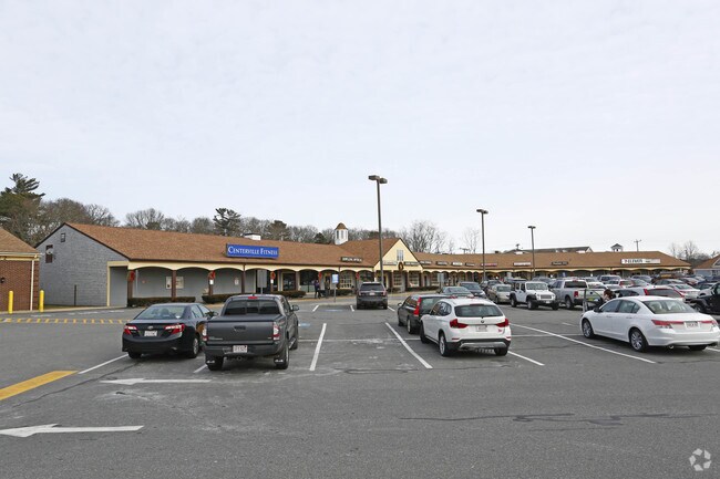
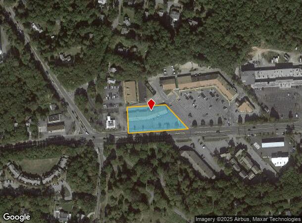
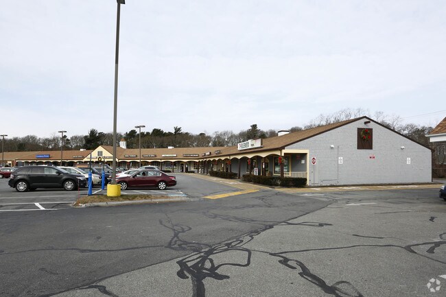
1676 Falmouth Rd
CENT-000209-000000-000003
Elva H Dahlberg
Regionalshoppingcenterormallwithanchorstore
Barnstable
X
Massachusetts
25001C0561J
3
2025
1 AC
2025
Cape Cod
012800
Other Market Areas
9,886 SF
Barnstable Town, MA
DEMOGRAPHICS near 1676 Falmouth Rd
1 Mile
3 Mile
5 Mile
2024 Total Population
4,245
27,979
45,300
2029 Population
4,313
28,426
45,994
Pop Growth 2024-2029
+ 1.60%
+ 1.60%
+ 1.53%
Average Age
49
46
47
2024 Total Households
1,769
11,569
19,016
HH Growth 2024-2029
+ 1.41%
+ 1.52%
+ 1.44%
Median Household Inc
$93,259
$85,175
$83,235
Avg Household Size
2.30
2.30
2.30
2024 Avg HH Vehicles
2.00
2.00
2.00
Median Home Value
$457,449
$453,599
$479,731
Median Year Built
1971
1976
1977
Nearby Places
Map Layers
Map Styles
 Street
 Aerial
- Restaurants
- Banks
- Shops
- Fitness
- Groceries
PUBLIC TRANSPORTATION
COMMUTER RAIL
Hyannis (CapeFLYER - Cape Cod Regional Transit Authority)
DRIVE
WALK
Distance
Hyannis (CapeFLYER - Cape Cod Regional Transit Authority)
7 min
3.9 mi
AIRPORT
Martha's Vineyard
DRIVE
WALK
Distance
Martha's Vineyard
98 min
35.0 mi
Freight Ports
Port of New Bedford Harbor
DRIVE
WALK
Distance
Port of New Bedford Harbor
66 min
45.7 mi
SALE & LEASE HISTORY
LISTING DATE
SALE/LEASE

Sep 25, 2016
For Lease
Nearby Properties
Address
Land Use
TOTAL SIZE
Lot Size
Zoning
Address
Land Use
TOTAL SIZE
Lot Size
Zoning
411,756 SF
68.70 AC
RB;HB
Address
Land Use
TOTAL SIZE
Lot Size
Zoning
44 AC
RG;RF
Address
Land Use
TOTAL SIZE
Lot Size
Zoning
10.68 AC
Address
Land Use
TOTAL SIZE
Lot Size
Zoning
25.88 AC
HB;B
Address
Land Use
TOTAL SIZE
Lot Size
Zoning
Address
Land Use
TOTAL SIZE
Lot Size
Zoning
187,006 SF
17.12 AC
RB;HB
Address
Land Use
TOTAL SIZE
Lot Size
Zoning
96,929 SF
9.63 AC
Address
Land Use
TOTAL SIZE
Lot Size
Zoning
14.34 AC
B;IND
Address
Land Use
TOTAL SIZE
Lot Size
Zoning
30,000 SF
8.48 AC
HB;RF-
Address
Land Use
TOTAL SIZE
Lot Size
Zoning
82.38 AC
RC-1;R
Address
Land Use
TOTAL SIZE
Lot Size
Zoning
79,282 SF
43.70 AC
RC;BA
Address
Land Use
TOTAL SIZE
Lot Size
Zoning
253,562 SF
12.54 AC
RC-1;H
Address
Land Use
TOTAL SIZE
Lot Size
Zoning
12.82 AC
B;HB
Address
Land Use
TOTAL SIZE
Lot Size
Zoning
54,172 SF
17.97 AC
IND;B;
Address
Land Use
TOTAL SIZE
Lot Size
Zoning
67,000 SF
9.15 AC
HB;B
Address
Land Use
TOTAL SIZE
Lot Size
Zoning
117,584 SF
9.68 AC
IND;B
Address
Land Use
TOTAL SIZE
Lot Size
Zoning
193,364 SF
54.54 AC
RB;DV
Address
Land Use
TOTAL SIZE
Lot Size
Zoning
37,169 SF
8.71 AC
RC-1;H
Address
Land Use
TOTAL SIZE
Lot Size
Zoning
90,837 SF
11.66 AC
IN
Address
Land Use
TOTAL SIZE
Lot Size
Zoning
600 SF
14.90 AC
Address
Land Use
TOTAL SIZE
Lot Size
Zoning
125,280 SF
6.41 AC
RB;HB
Address
Land Use
TOTAL SIZE
Lot Size
Zoning
49,596 SF
22.14 AC
RB;HB
Address
Land Use
TOTAL SIZE
Lot Size
Zoning
13.46 AC
IN
Address
Land Use
TOTAL SIZE
Lot Size
Zoning
3.86 AC
U
Address
Land Use
TOTAL SIZE
Lot Size
Zoning
118,274 SF
7.42 AC
Address
Land Use
TOTAL SIZE
Lot Size
Zoning
3,524 SF
10.70 AC
RD;RC
Address
Land Use
TOTAL SIZE
Lot Size
Zoning
73,621 SF
9.91 AC
RC;HB
Address
Land Use
TOTAL SIZE
Lot Size
Zoning
5.46 AC
RF
Address
Land Use
TOTAL SIZE
Lot Size
Zoning
99,248 SF
4.73 AC
HB;B
Address
Land Use
TOTAL SIZE
Lot Size
Zoning
8,879 SF
1.33 AC
R
The World's #1 Commercial Real Estate Marketplace
Connect with us
© 2025 CoStar Group
The information above has been obtained from sources believed reliable. While we do not doubt its accuracy we have not verified it and make no guarantee, warranty or representation about it. It is your responsibility to independently confirm its accuracy and completeness. Any projections, opinions, assumptions, or estimates used are for example only and do not represent the current or future performance of the property. The value of this transaction to you depends on tax and other factors which should be evaluated by your tax, financial, and legal advisors. You and your advisors should conduct a careful, independent investigation of the property to determine to your satisfaction the suitability of the property for your needs.