Property Record
16772 W Bell Rd, Surprise, AZ 85374


Save to a Folder
{{folder.Name}}
{{folder.ListingIds.length}} Properties
{{folder.ListingIds.length}} Property
Create a New Folder
Property Detail
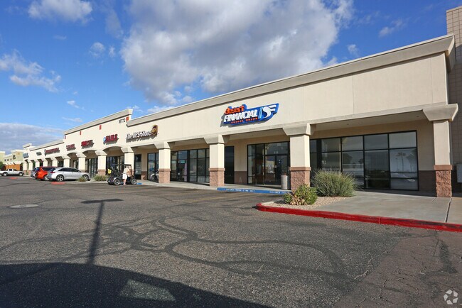
16772 W Bell Rd
232-39-739
ALBERTSONS AT BELL WEST RANCH MCR 642-02
Regionalshoppingcenterormallwithanchorstore
Maricopa
C-C
Arizona
C and X Area of minimal flood hazard, usually depicted on FIRMs as above the 500-year flood level.
3
2025
2.03 AC
2025
Surprise/North Peoria
040527
Phoenix
15,300 SF
Phoenix-Mesa-Chandler, AZ
NEARBY LISTINGS FOR SALE OR LEASE
DEMOGRAPHICS near 16772 W Bell Rd
1 mile
3 mile
5 mile
2025 Total Population
15,814
85,049
175,614
2030 Population
16,652
89,011
185,874
Pop Growth 2025-2030
+ 5.30%
+ 4.66%
+ 5.84%
Average Age
48
48
47
2025 Total Households
6,238
33,725
68,392
HH Growth 2025-2030
+ 6.12%
+ 4.97%
+ 5.86%
Median Household Inc
$89,328
$90,888
$90,700
Avg Household Size
2.50
2.50
2.50
2025 Avg HH Vehicles
2.00
2.00
2.00
Median Home Value
$396,736
$440,681
$438,842
Median Year Built
2003
2003
2003
Nearby Places
Map Layers
Map Styles
 Street
 Aerial
Layers
 Traffic
 Biking
Places
Listings with unknown addresses are not visible on the map
- Restaurants
- Banks
- Shops
- Fitness
- Groceries
PUBLIC TRANSPORTATION
AIRPORT
Phoenix Sky Harbor International
Drive
Walk
Distance
Phoenix Sky Harbor International
40 min
38.8 mi
Freight Ports
Port of San Diego
Drive
Walk
Distance
Port of San Diego
1 min
281.6 mi
SALE & LEASE HISTORY
LISTING DATE
SALE/LEASE

Mar 09, 2022
For Lease
Nearby Properties
Address
Land Use
TOTAL SIZE
Lot Size
Zoning
Address
Land Use
TOTAL SIZE
Lot Size
Zoning
290,294 SF
61.52 AC
PAD
Address
Land Use
TOTAL SIZE
Lot Size
Zoning
197,699 SF
40.78 AC
PAD
Address
Land Use
TOTAL SIZE
Lot Size
Zoning
548,535 SF
15.45 AC
C-T
Address
Land Use
TOTAL SIZE
Lot Size
Zoning
256,094 SF
49.15 AC
PAD
Address
Land Use
TOTAL SIZE
Lot Size
Zoning
5.46 AC
Address
Land Use
TOTAL SIZE
Lot Size
Zoning
296,463 SF
12.27 AC
M-H
Address
Land Use
TOTAL SIZE
Lot Size
Zoning
539,065 SF
33.30 AC
PAD
Address
Land Use
TOTAL SIZE
Lot Size
Zoning
134,364 SF
15.26 AC
PAD
Address
Land Use
TOTAL SIZE
Lot Size
Zoning
232,202 SF
27.32 AC
PAD
Address
Land Use
TOTAL SIZE
Lot Size
Zoning
210,197 SF
19.40 AC
RH15
Address
Land Use
TOTAL SIZE
Lot Size
Zoning
106,244 SF
13.55 AC
PAD
Address
Land Use
TOTAL SIZE
Lot Size
Zoning
98,560 SF
12.87 AC
PAD
Address
Land Use
TOTAL SIZE
Lot Size
Zoning
236,026 SF
6.66 AC
PAD
Address
Land Use
TOTAL SIZE
Lot Size
Zoning
104,102 SF
10.81 AC
PAD
Address
Land Use
TOTAL SIZE
Lot Size
Zoning
96,782 SF
15.66 AC
PAD
Address
Land Use
TOTAL SIZE
Lot Size
Zoning
104,619 SF
11.45 AC
PAD
Address
Land Use
TOTAL SIZE
Lot Size
Zoning
153,918 SF
20.58 AC
PAD
Address
Land Use
TOTAL SIZE
Lot Size
Zoning
154,628 SF
16.36 AC
PAD
Address
Land Use
TOTAL SIZE
Lot Size
Zoning
89,601 SF
19.92 AC
PAD
Address
Land Use
TOTAL SIZE
Lot Size
Zoning
86,770 SF
18.26 AC
PAD
Address
Land Use
TOTAL SIZE
Lot Size
Zoning
203,123 SF
8.53 AC
PAD
Address
Land Use
TOTAL SIZE
Lot Size
Zoning
340,420 SF
16.26 AC
Address
Land Use
TOTAL SIZE
Lot Size
Zoning
104,769 SF
10.41 AC
PAD
Address
Land Use
TOTAL SIZE
Lot Size
Zoning
172,273 SF
29.79 AC
RU43
Address
Land Use
TOTAL SIZE
Lot Size
Zoning
92,051 SF
15 AC
PAD
Address
Land Use
TOTAL SIZE
Lot Size
Zoning
69,504 SF
5.35 AC
PAD
Address
Land Use
TOTAL SIZE
Lot Size
Zoning
88,443 SF
6.89 AC
PAD
Address
Land Use
TOTAL SIZE
Lot Size
Zoning
208,660 SF
7.70 AC
PAD
The World's #1 Commercial Real Estate Marketplace
Connect with us
© 2026 CoStar Group
The information above has been obtained from sources believed reliable. While we do not doubt its accuracy we have not verified it and make no guarantee, warranty or representation about it. It is your responsibility to independently confirm its accuracy and completeness. Any projections, opinions, assumptions, or estimates used are for example only and do not represent the current or future performance of the property. The value of this transaction to you depends on tax and other factors which should be evaluated by your tax, financial, and legal advisors. You and your advisors should conduct a careful, independent investigation of the property to determine to your satisfaction the suitability of the property for your needs.