Property Record
1678 N Milpitas Blvd, Milpitas, CA 95035


NEARBY LISTINGS FOR SALE OR LEASE
Property Detail
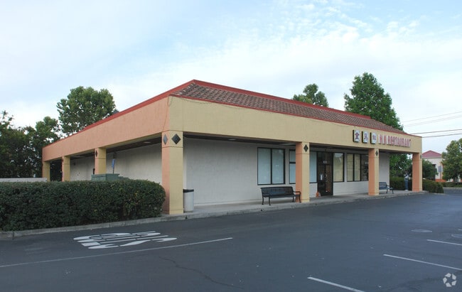
1678 N Milpitas Blvd
Regionalshoppingcenterormallwithanchorstore
Santa Clara
X
California
06085C0058J
3.82 AC
2024
Milpitas
2025
South Bay/San Jose
504422
San Jose-Sunnyvale-Santa Clara, CA
45,081 SF
026-06-030
DEMOGRAPHICS near 1678 N Milpitas Blvd
1 Mile
3 Mile
5 Mile
2024 Total Population
21,329
76,594
204,554
2029 Population
20,591
74,040
197,564
Pop Growth 2024-2029
(3.46%)
(3.33%)
(3.42%)
Average Age
40
40
38
2024 Total Households
6,333
23,522
68,084
HH Growth 2024-2029
(3.63%)
(3.35%)
(3.53%)
Median Household Inc
$149,843
$155,852
$167,033
Avg Household Size
3.20
3.20
2.90
2024 Avg HH Vehicles
2.00
2.00
2.00
Median Home Value
$1,092,366
$1,081,594
$1,080,775
Median Year Built
1983
1983
1990
Nearby Places
Map Layers
Map Styles
 Street
 Aerial
- Restaurants
- Banks
- Shops
- Fitness
- Groceries
PUBLIC TRANSPORTATION
AIRPORT
Norman Y Mineta San Jose International
DRIVE
WALK
Distance
Norman Y Mineta San Jose International
15 min
10.0 mi
Metro Oakland International
DRIVE
WALK
Distance
Metro Oakland International
36 min
27.9 mi
San Francisco International
DRIVE
WALK
Distance
San Francisco International
46 min
36.1 mi
Freight Ports
Port of Redwood City
DRIVE
WALK
Distance
Port of Redwood City
31 min
22.9 mi
Nearby Properties
Address
Land Use
TOTAL SIZE
Lot Size
Zoning
Address
Land Use
TOTAL SIZE
Lot Size
Zoning
7.49 AC
M2
Address
Land Use
TOTAL SIZE
Lot Size
Zoning
194,597 SF
20.10 AC
I
Address
Land Use
TOTAL SIZE
Lot Size
Zoning
663,216 SF
30.01 AC
Address
Land Use
TOTAL SIZE
Lot Size
Zoning
1,282,514 SF
99.02 AC
C2-S
Address
Land Use
TOTAL SIZE
Lot Size
Zoning
503,840 SF
5.02 AC
MXD2
Address
Land Use
TOTAL SIZE
Lot Size
Zoning
3.72 AC
M2S
Address
Land Use
TOTAL SIZE
Lot Size
Zoning
5.21 AC
APD
Address
Land Use
TOTAL SIZE
Lot Size
Zoning
362,780 SF
7.58 AC
APD
Address
Land Use
TOTAL SIZE
Lot Size
Zoning
4.11 AC
Address
Land Use
TOTAL SIZE
Lot Size
Zoning
214,630 SF
4.14 AC
Address
Land Use
TOTAL SIZE
Lot Size
Zoning
143,242 SF
28.95 AC
C
Address
Land Use
TOTAL SIZE
Lot Size
Zoning
561,256 SF
36.49 AC
MP
Address
Land Use
TOTAL SIZE
Lot Size
Zoning
34.20 AC
MP
Address
Land Use
TOTAL SIZE
Lot Size
Zoning
506,490 SF
29.89 AC
Address
Land Use
TOTAL SIZE
Lot Size
Zoning
274,881 SF
22.33 AC
Address
Land Use
TOTAL SIZE
Lot Size
Zoning
224,667 SF
14.70 AC
I
Address
Land Use
TOTAL SIZE
Lot Size
Zoning
224,036 SF
14.66 AC
I
Address
Land Use
TOTAL SIZE
Lot Size
Zoning
223,995 SF
14.67 AC
I
Address
Land Use
TOTAL SIZE
Lot Size
Zoning
221,580 SF
14.52 AC
I
Address
Land Use
TOTAL SIZE
Lot Size
Zoning
221,580 SF
14.52 AC
I
Address
Land Use
TOTAL SIZE
Lot Size
Zoning
470,228 SF
31.31 AC
I
Address
Land Use
TOTAL SIZE
Lot Size
Zoning
504,768 SF
33.52 AC
I
Address
Land Use
TOTAL SIZE
Lot Size
Zoning
190,586 SF
4.40 AC
Address
Land Use
TOTAL SIZE
Lot Size
Zoning
411,625 SF
26.20 AC
MPS
Address
Land Use
TOTAL SIZE
Lot Size
Zoning
245,214 SF
10.45 AC
Address
Land Use
TOTAL SIZE
Lot Size
Zoning
187,134 SF
9.65 AC
MPS
Address
Land Use
TOTAL SIZE
Lot Size
Zoning
137,913 SF
56.18 AC
M25
Address
Land Use
TOTAL SIZE
Lot Size
Zoning
259,966 SF
13.34 AC
Address
Land Use
TOTAL SIZE
Lot Size
Zoning
251,101 SF
2.76 AC
04E
Address
Land Use
TOTAL SIZE
Lot Size
Zoning
66.46 AC
LI
The World's #1 Commercial Real Estate Marketplace
Connect with us
© 2025 CoStar Group
The information above has been obtained from sources believed reliable. While we do not doubt its accuracy we have not verified it and make no guarantee, warranty or representation about it. It is your responsibility to independently confirm its accuracy and completeness. Any projections, opinions, assumptions, or estimates used are for example only and do not represent the current or future performance of the property. The value of this transaction to you depends on tax and other factors which should be evaluated by your tax, financial, and legal advisors. You and your advisors should conduct a careful, independent investigation of the property to determine to your satisfaction the suitability of the property for your needs.