Property Record
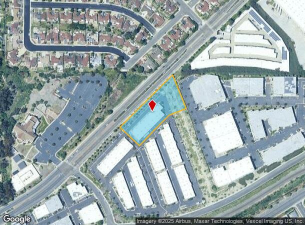
1678 Ord Way, Oceanside, CA 92056


Current Lease Availabilities
NEARBY LISTINGS FOR SALE OR LEASE
Property Detail
1678 Ord Way
162-120-80-01
Oceanside 1
Industrialcondominium
PAR 2 US3B-1PER DOC06-726381&UND INT IN TR PM20052
X
San Diego
06073C0759G
California
2024
1.83 AC
2025
Oceanside
019403
San Diego
2,663 SF
San Diego-Carlsbad, CA
DEMOGRAPHICS near 1678 Ord Way
1 Mile
3 Mile
5 Mile
2024 Total Population
16,870
145,701
284,033
2029 Population
16,679
144,362
281,286
Pop Growth 2024-2029
(1.13%)
(0.92%)
(0.97%)
Average Age
40
39
40
2024 Total Households
5,647
48,108
96,877
HH Growth 2024-2029
(1.36%)
(1.12%)
(1.17%)
Median Household Inc
$94,679
$87,977
$90,759
Avg Household Size
2.90
2.90
2.80
2024 Avg HH Vehicles
2.00
2.00
2.00
Median Home Value
$660,214
$648,111
$701,834
Median Year Built
1982
1983
1983
Nearby Places
- Restaurants
- Banks
- Shops
- Fitness
- Groceries
PUBLIC TRANSPORTATION
TRANSIT/SUBWAY
College Boulevard (Sprinter - San Diego North County Transit District (Coaster/Sprinter/Breeze))
DRIVE
WALK
Distance
College Boulevard (Sprinter - San Diego North County Transit District (Coaster/Sprinter/Breeze))
3 min
20 min
1.0 mi
COMMUTER RAIL
Oceanside Transit Center (Metrolink Inland Empire-Orange County Line - Metrolink Trains, Metrolink Orange County Line - Metrolink Trains, Orange County Line - Metrolink Trains)
DRIVE
WALK
Distance
Oceanside Transit Center (Metrolink Inland Empire-Orange County Line - Metrolink Trains, Metrolink Orange County Line - Metrolink Trains, Orange County Line - Metrolink Trains)
15 min
7.3 mi
Carlsbad Village (Coaster - San Diego North County Transit District (Coaster/Sprinter/Breeze))
DRIVE
WALK
Distance
Carlsbad Village (Coaster - San Diego North County Transit District (Coaster/Sprinter/Breeze))
14 min
7.4 mi
Freight Ports
Port of San Diego
DRIVE
WALK
Distance
Port of San Diego
57 min
43.9 mi
Nearby Properties
Address
Land Use
TOTAL SIZE
Lot Size
Zoning
Address
Land Use
TOTAL SIZE
Lot Size
Zoning
20.96 AC
SP-1-84 (I
Address
Land Use
TOTAL SIZE
Lot Size
Zoning
20.10 AC
M-U
Address
Land Use
TOTAL SIZE
Lot Size
Zoning
15.74 AC
SP-1-84 (I
Address
Land Use
TOTAL SIZE
Lot Size
Zoning
10.39 AC
M-U (40)
Address
Land Use
TOTAL SIZE
Lot Size
Zoning
18.89 AC
PD-1 (Res)
Address
Land Use
TOTAL SIZE
Lot Size
Zoning
15.25 AC
P-C
Address
Land Use
TOTAL SIZE
Lot Size
Zoning
11.17 AC
M-U
Address
Land Use
TOTAL SIZE
Lot Size
Zoning
31.94 AC
RM-B
Address
Land Use
TOTAL SIZE
Lot Size
Zoning
38.61 AC
PD-1 (IL)
Address
Land Use
TOTAL SIZE
Lot Size
Zoning
21.44 AC
C-1
Address
Land Use
TOTAL SIZE
Lot Size
Zoning
1.23 AC
SPI
Address
Land Use
TOTAL SIZE
Lot Size
Zoning
12 AC
SP-1-09
Address
Land Use
TOTAL SIZE
Lot Size
Zoning
7.97 AC
SPI-DV
Address
Land Use
TOTAL SIZE
Lot Size
Zoning
7.57 AC
R-M
Address
Land Use
TOTAL SIZE
Lot Size
Zoning
5.10 AC
R-M
Address
Land Use
TOTAL SIZE
Lot Size
Zoning
8.01 AC
PD-19-H
Address
Land Use
TOTAL SIZE
Lot Size
Zoning
96,240 SF
22.25 AC
PD-2
Address
Land Use
TOTAL SIZE
Lot Size
Zoning
6.87 AC
CN-SP-EQ
Address
Land Use
TOTAL SIZE
Lot Size
Zoning
5.24 AC
SP-1-09
Address
Land Use
TOTAL SIZE
Lot Size
Zoning
9.48 AC
R-M
Address
Land Use
TOTAL SIZE
Lot Size
Zoning
14.08 AC
RH
Address
Land Use
TOTAL SIZE
Lot Size
Zoning
10.38 AC
R-M
Address
Land Use
TOTAL SIZE
Lot Size
Zoning
6.55 AC
R-M
Address
Land Use
TOTAL SIZE
Lot Size
Zoning
15.02 AC
SP-1-84 (I
Address
Land Use
TOTAL SIZE
Lot Size
Zoning
25.16 AC
SP-1-84 (I
Address
Land Use
TOTAL SIZE
Lot Size
Zoning
87,472 SF
4.96 AC
RM-A
Address
Land Use
TOTAL SIZE
Lot Size
Zoning
65,156 SF
2.52 AC
PD-1 (IL)
Address
Land Use
TOTAL SIZE
Lot Size
Zoning
11.60 AC
RM-C
Address
Land Use
TOTAL SIZE
Lot Size
Zoning
78,489 SF
2.67 AC
PD-1 (IL)
Address
Land Use
TOTAL SIZE
Lot Size
Zoning
83,995 SF
5.88 AC
PD-1 (IL)
The World's #1 Commercial Real Estate Marketplace
Connect with us
© 2025 CoStar Group
The information above has been obtained from sources believed reliable. While we do not doubt its accuracy we have not verified it and make no guarantee, warranty or representation about it. It is your responsibility to independently confirm its accuracy and completeness. Any projections, opinions, assumptions, or estimates used are for example only and do not represent the current or future performance of the property. The value of this transaction to you depends on tax and other factors which should be evaluated by your tax, financial, and legal advisors. You and your advisors should conduct a careful, independent investigation of the property to determine to your satisfaction the suitability of the property for your needs.