Property Record
16790 E 14Th St, San Leandro, CA 94578
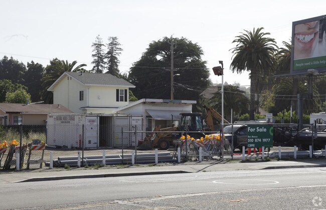

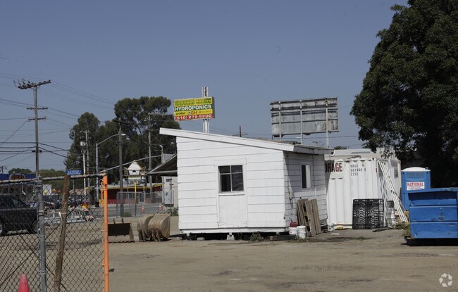
Property Detail
16790 E 14Th St
Oakland-Fremont-Berkeley, CA
LOT: 00005 BLK: 0032 AR: 080A PAGE: 0100
080A-0100-032-05
Alameda
Commercialacreage
California
B and X Area of moderate flood hazard, usually the area between the limits of the 100-year and 500-year floods.
30
2024
0.40 AC
2025
San Leandro
434000
East Bay/Oakland
168 SF
NEARBY LISTINGS FOR SALE OR LEASE
DEMOGRAPHICS near 16790 E 14Th St
1 mile
3 mile
5 mile
2025 Total Population
34,916
215,255
380,165
2030 Population
34,638
214,234
378,367
Pop Growth 2025-2030
(0.80%)
(0.47%)
(0.47%)
Average Age
39
41
41
2025 Total Households
11,371
72,042
123,509
HH Growth 2025-2030
(0.93%)
(0.56%)
(0.58%)
Median Household Inc
$87,039
$101,160
$105,292
Avg Household Size
2.90
2.90
3.00
2025 Avg HH Vehicles
2.00
2.00
2.00
Median Home Value
$789,856
$802,149
$817,560
Median Year Built
1964
1962
1964
Nearby Places
Map Layers
Map Styles
 Street
 Aerial
Layers
 Traffic
 Biking
Places
Listings with unknown addresses are not visible on the map
- Restaurants
- Banks
- Shops
- Fitness
- Groceries
PUBLIC TRANSPORTATION
COMMUTER RAIL
Drive
Walk
Distance
7 min
2.7 mi
Drive
Walk
Distance
7 min
2.8 mi
AIRPORT
Metro Oakland International
Drive
Walk
Distance
Metro Oakland International
13 min
8.4 mi
San Francisco International
Drive
Walk
Distance
San Francisco International
35 min
26.6 mi
Norman Y Mineta San Jose International
Drive
Walk
Distance
Norman Y Mineta San Jose International
39 min
31.1 mi
Freight Ports
Port of Oakland
Drive
Walk
Distance
Port of Oakland
17 min
13.0 mi
Nearby Properties
Address
Land Use
TOTAL SIZE
Lot Size
Zoning
Address
Land Use
TOTAL SIZE
Lot Size
Zoning
710,091 SF
50.34 AC
Address
Land Use
TOTAL SIZE
Lot Size
Zoning
298,256 SF
12.16 AC
Address
Land Use
TOTAL SIZE
Lot Size
Zoning
4.90 AC
Address
Land Use
TOTAL SIZE
Lot Size
Zoning
437,104 SF
0.73 AC
Address
Land Use
TOTAL SIZE
Lot Size
Zoning
2.48 AC
Address
Land Use
TOTAL SIZE
Lot Size
Zoning
1.50 AC
Address
Land Use
TOTAL SIZE
Lot Size
Zoning
187,926 SF
1.19 AC
Address
Land Use
TOTAL SIZE
Lot Size
Zoning
693,679 SF
43.49 AC
Address
Land Use
TOTAL SIZE
Lot Size
Zoning
294,146 SF
14.22 AC
Address
Land Use
TOTAL SIZE
Lot Size
Zoning
160,987 SF
7.20 AC
Address
Land Use
TOTAL SIZE
Lot Size
Zoning
133,974 SF
4.99 AC
Address
Land Use
TOTAL SIZE
Lot Size
Zoning
240,668 SF
14.11 AC
Address
Land Use
TOTAL SIZE
Lot Size
Zoning
241,382 SF
12.72 AC
Address
Land Use
TOTAL SIZE
Lot Size
Zoning
297,592 SF
11.65 AC
Address
Land Use
TOTAL SIZE
Lot Size
Zoning
310,072 SF
14.96 AC
Address
Land Use
TOTAL SIZE
Lot Size
Zoning
228,736 SF
5.95 AC
Address
Land Use
TOTAL SIZE
Lot Size
Zoning
169,371 SF
4.63 AC
Address
Land Use
TOTAL SIZE
Lot Size
Zoning
625,101 SF
35.95 AC
Address
Land Use
TOTAL SIZE
Lot Size
Zoning
137,889 SF
18.44 AC
Address
Land Use
TOTAL SIZE
Lot Size
Zoning
116,750 SF
4.72 AC
Address
Land Use
TOTAL SIZE
Lot Size
Zoning
105,730 SF
5.32 AC
Address
Land Use
TOTAL SIZE
Lot Size
Zoning
243,524 SF
15.17 AC
Address
Land Use
TOTAL SIZE
Lot Size
Zoning
149,602 SF
6.90 AC
Address
Land Use
TOTAL SIZE
Lot Size
Zoning
140,850 SF
9.98 AC
Address
Land Use
TOTAL SIZE
Lot Size
Zoning
427,400 SF
17.34 AC
Address
Land Use
TOTAL SIZE
Lot Size
Zoning
89,968 SF
5 AC
Address
Land Use
TOTAL SIZE
Lot Size
Zoning
329,346 SF
29.36 AC
Address
Land Use
TOTAL SIZE
Lot Size
Zoning
119,800 SF
5.72 AC
Address
Land Use
TOTAL SIZE
Lot Size
Zoning
178,560 SF
8.76 AC
Address
Land Use
TOTAL SIZE
Lot Size
Zoning
121,987 SF
6.20 AC
The World's #1 Commercial Real Estate Marketplace
Connect with us
© 2026 CoStar Group
The information above has been obtained from sources believed reliable. While we do not doubt its accuracy we have not verified it and make no guarantee, warranty or representation about it. It is your responsibility to independently confirm its accuracy and completeness. Any projections, opinions, assumptions, or estimates used are for example only and do not represent the current or future performance of the property. The value of this transaction to you depends on tax and other factors which should be evaluated by your tax, financial, and legal advisors. You and your advisors should conduct a careful, independent investigation of the property to determine to your satisfaction the suitability of the property for your needs.