Property Record
16790 York St, Thornton, CO 80602
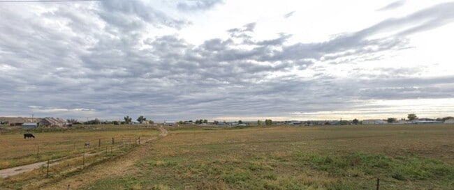

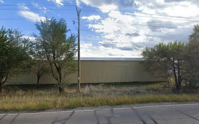
This Property Is For Sale
Property Detail
16790 York St
1573-01-0-00-015
SECT,TWN,RNG:1-1-68 DESC: W2 NW4 NW4 EXC PARC 17/25A
Pasture
Adams
A3
Colorado
A Areas with a 1% annual chance of flooding and a 26% chance of flooding over the life of a 30-year mortgage.
17.25 AC
2024
North Denver
2025
Denver
061200
Denver-Aurora-Centennial, CO
858 SF
NEARBY LISTINGS FOR SALE OR LEASE
DEMOGRAPHICS near 16790 York St
1 mile
3 mile
5 mile
2024 Total Population
2,989
17,887
89,930
2029 Population
3,192
19,196
94,989
Pop Growth 2024-2029
+ 6.79%
+ 7.32%
+ 5.63%
Average Age
36
37
39
2024 Total Households
928
6,018
31,091
HH Growth 2024-2029
+ 7.00%
+ 7.64%
+ 5.92%
Median Household Inc
$164,676
$160,443
$150,894
Avg Household Size
3.20
3.00
2.90
2024 Avg HH Vehicles
3.00
2.00
2.00
Median Home Value
$733,606
$754,399
$738,361
Median Year Built
2011
2010
2007
Nearby Places
Map Layers
Map Styles
 Street
 Aerial
Transit
 Traffic
 Biking
Places
Listings with unknown addresses are not visible on the map
- Restaurants
- Banks
- Shops
- Fitness
- Groceries
PUBLIC TRANSPORTATION
COMMUTER RAIL
Eastlake - 124Th Station Track 2 (Union Station to Eastlake & 124th Station - Regional Transportation District)
Drive
Walk
Distance
Eastlake - 124Th Station Track 2 (Union Station to Eastlake & 124th Station - Regional Transportation District)
12 min
5.5 mi
AIRPORT
Denver International
Drive
Walk
Distance
Denver International
31 min
24.8 mi
Freight Ports
Tulsa Port Of Catoosa
Drive
Walk
Distance
Tulsa Port Of Catoosa
737 min
719.0 mi
Nearby Properties
Address
Land Use
TOTAL SIZE
Lot Size
Zoning
Address
Land Use
TOTAL SIZE
Lot Size
Zoning
355,866 SF
16.17 AC
Address
Land Use
TOTAL SIZE
Lot Size
Zoning
538,595 SF
87.92 AC
Address
Land Use
TOTAL SIZE
Lot Size
Zoning
177,730 SF
17.82 AC
PUD
Address
Land Use
TOTAL SIZE
Lot Size
Zoning
202,491 SF
52.56 AC
PUD
Address
Land Use
TOTAL SIZE
Lot Size
Zoning
333,686 SF
19.68 AC
PUD
Address
Land Use
TOTAL SIZE
Lot Size
Zoning
253,459 SF
34.63 AC
Address
Land Use
TOTAL SIZE
Lot Size
Zoning
284,997 SF
13.55 AC
PUD
Address
Land Use
TOTAL SIZE
Lot Size
Zoning
176,000 SF
12.03 AC
Address
Land Use
TOTAL SIZE
Lot Size
Zoning
164,372 SF
11.58 AC
PUD
Address
Land Use
TOTAL SIZE
Lot Size
Zoning
39.44 AC
PUD
Address
Land Use
TOTAL SIZE
Lot Size
Zoning
146,300 SF
9 AC
Address
Land Use
TOTAL SIZE
Lot Size
Zoning
130,628 SF
12.13 AC
PUD
Address
Land Use
TOTAL SIZE
Lot Size
Zoning
152,841 SF
9.30 AC
PUD
Address
Land Use
TOTAL SIZE
Lot Size
Zoning
152,841 SF
7.74 AC
PUD
Address
Land Use
TOTAL SIZE
Lot Size
Zoning
152,841 SF
7.74 AC
PUD
Address
Land Use
TOTAL SIZE
Lot Size
Zoning
152,841 SF
7.74 AC
PUD
Address
Land Use
TOTAL SIZE
Lot Size
Zoning
124,446 SF
14.31 AC
Address
Land Use
TOTAL SIZE
Lot Size
Zoning
128,656 SF
6.27 AC
Address
Land Use
TOTAL SIZE
Lot Size
Zoning
112,594 SF
12.35 AC
Address
Land Use
TOTAL SIZE
Lot Size
Zoning
180,159 SF
14.93 AC
Address
Land Use
TOTAL SIZE
Lot Size
Zoning
114,700 SF
9.99 AC
Address
Land Use
TOTAL SIZE
Lot Size
Zoning
36,022 SF
2.68 AC
PUD
Address
Land Use
TOTAL SIZE
Lot Size
Zoning
196,236 SF
8.29 AC
PUD
Address
Land Use
TOTAL SIZE
Lot Size
Zoning
135,000 SF
10.66 AC
Address
Land Use
TOTAL SIZE
Lot Size
Zoning
49.84 AC
PUD
Address
Land Use
TOTAL SIZE
Lot Size
Zoning
104,625 SF
9.35 AC
Address
Land Use
TOTAL SIZE
Lot Size
Zoning
104,500 SF
7.04 AC
Address
Land Use
TOTAL SIZE
Lot Size
Zoning
112,200 SF
6.78 AC
Address
Land Use
TOTAL SIZE
Lot Size
Zoning
76,005 SF
12.67 AC
Address
Land Use
TOTAL SIZE
Lot Size
Zoning
157,235 SF
17.96 AC
The World's #1 Commercial Real Estate Marketplace
Connect with us
© 2026 CoStar Group
The information above has been obtained from sources believed reliable. While we do not doubt its accuracy we have not verified it and make no guarantee, warranty or representation about it. It is your responsibility to independently confirm its accuracy and completeness. Any projections, opinions, assumptions, or estimates used are for example only and do not represent the current or future performance of the property. The value of this transaction to you depends on tax and other factors which should be evaluated by your tax, financial, and legal advisors. You and your advisors should conduct a careful, independent investigation of the property to determine to your satisfaction the suitability of the property for your needs.