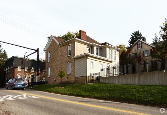
Property Record
168 E Main St, Barnesville, OH 43713


Property Detail
168 E Main St
Wheeling, WV-OH
INLOT 104-B N 1/2 82.50 X 66
34-00090-000
BELMONT
Commercialnec
Ohio
B and X Area of moderate flood hazard, usually the area between the limits of the 100-year and 500-year floods.
104-b
2025
0.13 AC
2025
Ohio South Area
010902
Other Market Areas
3,648 SF
NEARBY LISTINGS FOR SALE OR LEASE
-
-
View all Barnesville listings for sale on LoopNet.com
DEMOGRAPHICS near 168 E Main St
1 mile
3 mile
5 mile
2025 Total Population
5,388
9,409
15,432
2030 Population
5,288
9,210
15,097
Pop Growth 2025-2030
(1.86%)
(2.11%)
(2.17%)
Average Age
46
46
46
2025 Total Households
2,329
4,082
5,958
HH Growth 2025-2030
(1.98%)
(2.25%)
(2.47%)
Median Household Inc
$75,104
$73,749
$72,011
Avg Household Size
2.20
2.20
2.20
2025 Avg HH Vehicles
2.00
2.00
2.00
Median Home Value
$233,656
$238,589
$228,379
Median Year Built
1970
1971
1970
Nearby Places
Map Layers
Map Styles
 Street
 Aerial
Layers
 Traffic
 Biking
Places
Listings with unknown addresses are not visible on the map
- Restaurants
- Banks
- Shops
- Fitness
- Groceries
SALE & LEASE HISTORY
LISTING DATE
SALE/LEASE

Nov 20, 2020
For Sale
Nearby Properties
Address
Land Use
TOTAL SIZE
Lot Size
Zoning
Address
Land Use
TOTAL SIZE
Lot Size
Zoning
979,693 SF
101.79 AC
Address
Land Use
TOTAL SIZE
Lot Size
Zoning
188,437 SF
9.96 AC
Address
Land Use
TOTAL SIZE
Lot Size
Zoning
66,224 SF
2.15 AC
Address
Land Use
TOTAL SIZE
Lot Size
Zoning
73,849 SF
2.40 AC
Address
Land Use
TOTAL SIZE
Lot Size
Zoning
79,308 SF
9.49 AC
Address
Land Use
TOTAL SIZE
Lot Size
Zoning
42,846 SF
13.20 AC
Address
Land Use
TOTAL SIZE
Lot Size
Zoning
33,819 SF
16.24 AC
Address
Land Use
TOTAL SIZE
Lot Size
Zoning
131,385 SF
14.07 AC
Address
Land Use
TOTAL SIZE
Lot Size
Zoning
60,574 SF
4.51 AC
Address
Land Use
TOTAL SIZE
Lot Size
Zoning
120,494 SF
9.52 AC
Address
Land Use
TOTAL SIZE
Lot Size
Zoning
35,238 SF
1.58 AC
Address
Land Use
TOTAL SIZE
Lot Size
Zoning
27,632 SF
37.90 AC
Address
Land Use
TOTAL SIZE
Lot Size
Zoning
54,737 SF
0.97 AC
Address
Land Use
TOTAL SIZE
Lot Size
Zoning
40,183 SF
10 AC
Address
Land Use
TOTAL SIZE
Lot Size
Zoning
42,589 SF
17 AC
Address
Land Use
TOTAL SIZE
Lot Size
Zoning
70,264 SF
7.61 AC
Address
Land Use
TOTAL SIZE
Lot Size
Zoning
60,472 SF
6.76 AC
Address
Land Use
TOTAL SIZE
Lot Size
Zoning
46,099 SF
5.20 AC
Address
Land Use
TOTAL SIZE
Lot Size
Zoning
60,980 SF
14.30 AC
Address
Land Use
TOTAL SIZE
Lot Size
Zoning
203,172 SF
18.73 AC
Address
Land Use
TOTAL SIZE
Lot Size
Zoning
53,148 SF
33 AC
Address
Land Use
TOTAL SIZE
Lot Size
Zoning
27,312 SF
6.52 AC
Address
Land Use
TOTAL SIZE
Lot Size
Zoning
36,084 SF
0.50 AC
Address
Land Use
TOTAL SIZE
Lot Size
Zoning
62,400 SF
7.80 AC
Address
Land Use
TOTAL SIZE
Lot Size
Zoning
65,002 SF
10.29 AC
Address
Land Use
TOTAL SIZE
Lot Size
Zoning
47,264 SF
10.27 AC
Address
Land Use
TOTAL SIZE
Lot Size
Zoning
55,668 SF
4.09 AC
Address
Land Use
TOTAL SIZE
Lot Size
Zoning
41,683 SF
4.92 AC
Address
Land Use
TOTAL SIZE
Lot Size
Zoning
73,289 SF
2.77 AC
The World's #1 Commercial Real Estate Marketplace
Connect with us
© 2026 CoStar Group
The information above has been obtained from sources believed reliable. While we do not doubt its accuracy we have not verified it and make no guarantee, warranty or representation about it. It is your responsibility to independently confirm its accuracy and completeness. Any projections, opinions, assumptions, or estimates used are for example only and do not represent the current or future performance of the property. The value of this transaction to you depends on tax and other factors which should be evaluated by your tax, financial, and legal advisors. You and your advisors should conduct a careful, independent investigation of the property to determine to your satisfaction the suitability of the property for your needs.