Property Record
168 Nw Phosphate Blvd, Mulberry, FL 33860


NEARBY LISTINGS FOR SALE OR LEASE
Property Detail
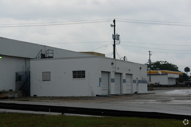
168 Nw Phosphate Blvd
Lakeland-Winter Haven, FL
Mulberry (Original)
23-30-02-154500-001010
ORIGINAL MULBERRY PB 1 PG 25B BLK A LOTS 1 & 2 LESS W 40 FT & BLK C LOTS 4, 5, 7 & 8 & CLOSED ST LYING W OF LOT 7 AND E OF LOT 8 & E1/2 OF CLOSED ST LYING W OF LOTS 4 & 5 LESS R/W FOR CANAL ST
Officebuilding
Polk
X
Florida
12105C0490G
1,2,4
2024
0.88 AC
2025
Polk County
014802
Tampa/St Petersburg
16,334 SF
DEMOGRAPHICS near 168 Nw Phosphate Blvd
1 Mile
3 Mile
5 Mile
2024 Total Population
3,511
14,917
48,630
2029 Population
4,233
17,812
57,780
Pop Growth 2024-2029
+ 20.56%
+ 19.41%
+ 18.82%
Average Age
40
39
39
2024 Total Households
1,355
5,481
17,795
HH Growth 2024-2029
+ 20.44%
+ 19.38%
+ 18.74%
Median Household Inc
$48,549
$60,117
$70,950
Avg Household Size
2.60
2.60
2.70
2024 Avg HH Vehicles
2.00
2.00
2.00
Median Home Value
$143,824
$189,894
$251,351
Median Year Built
1989
1993
1993
Nearby Places
Map Layers
Map Styles
 Street
 Aerial
- Restaurants
- Banks
- Shops
- Fitness
- Groceries
PUBLIC TRANSPORTATION
AIRPORT
Tampa International
DRIVE
WALK
Distance
Tampa International
59 min
39.3 mi
Freight Ports
Port of Tampa Bay
DRIVE
WALK
Distance
Port of Tampa Bay
49 min
32.3 mi
Nearby Properties
Address
Land Use
TOTAL SIZE
Lot Size
Zoning
Address
Land Use
TOTAL SIZE
Lot Size
Zoning
214,889 SF
23.50 AC
Address
Land Use
TOTAL SIZE
Lot Size
Zoning
166,313 SF
63.97 AC
Address
Land Use
TOTAL SIZE
Lot Size
Zoning
174,251 SF
26.66 AC
Address
Land Use
TOTAL SIZE
Lot Size
Zoning
116,961 SF
5.01 AC
I1
Address
Land Use
TOTAL SIZE
Lot Size
Zoning
81,706 SF
20.35 AC
Address
Land Use
TOTAL SIZE
Lot Size
Zoning
66,800 SF
8.65 AC
Address
Land Use
TOTAL SIZE
Lot Size
Zoning
79,100 SF
4.72 AC
PUD
Address
Land Use
TOTAL SIZE
Lot Size
Zoning
172,931 SF
20.09 AC
C4
Address
Land Use
TOTAL SIZE
Lot Size
Zoning
95,863 SF
8.10 AC
Address
Land Use
TOTAL SIZE
Lot Size
Zoning
103,698 SF
10.86 AC
GI
Address
Land Use
TOTAL SIZE
Lot Size
Zoning
56,689 SF
9.30 AC
Address
Land Use
TOTAL SIZE
Lot Size
Zoning
42,368 SF
13.63 AC
C4
Address
Land Use
TOTAL SIZE
Lot Size
Zoning
88,138 SF
7.48 AC
Address
Land Use
TOTAL SIZE
Lot Size
Zoning
41,093 SF
1.58 AC
C1
Address
Land Use
TOTAL SIZE
Lot Size
Zoning
50,303 SF
5.80 AC
Address
Land Use
TOTAL SIZE
Lot Size
Zoning
59,860 SF
10.48 AC
GI
Address
Land Use
TOTAL SIZE
Lot Size
Zoning
68,151 SF
18.63 AC
Address
Land Use
TOTAL SIZE
Lot Size
Zoning
93,186 SF
2.67 AC
I1
Address
Land Use
TOTAL SIZE
Lot Size
Zoning
17,380 SF
3.43 AC
Address
Land Use
TOTAL SIZE
Lot Size
Zoning
12,452 SF
2.49 AC
C1
Address
Land Use
TOTAL SIZE
Lot Size
Zoning
28,852 SF
5.19 AC
C2
Address
Land Use
TOTAL SIZE
Lot Size
Zoning
23.86 AC
Address
Land Use
TOTAL SIZE
Lot Size
Zoning
73.52 AC
Address
Land Use
TOTAL SIZE
Lot Size
Zoning
29,902 SF
2.93 AC
Address
Land Use
TOTAL SIZE
Lot Size
Zoning
103,151 SF
20.86 AC
Address
Land Use
TOTAL SIZE
Lot Size
Zoning
581.94 AC
Address
Land Use
TOTAL SIZE
Lot Size
Zoning
37,474 SF
13.22 AC
Address
Land Use
TOTAL SIZE
Lot Size
Zoning
62,613 SF
10.02 AC
GI
Address
Land Use
TOTAL SIZE
Lot Size
Zoning
86,860 SF
3.02 AC
GI
Address
Land Use
TOTAL SIZE
Lot Size
Zoning
46,605 SF
30.93 AC
XX
The World's #1 Commercial Real Estate Marketplace
Connect with us
© 2025 CoStar Group
The information above has been obtained from sources believed reliable. While we do not doubt its accuracy we have not verified it and make no guarantee, warranty or representation about it. It is your responsibility to independently confirm its accuracy and completeness. Any projections, opinions, assumptions, or estimates used are for example only and do not represent the current or future performance of the property. The value of this transaction to you depends on tax and other factors which should be evaluated by your tax, financial, and legal advisors. You and your advisors should conduct a careful, independent investigation of the property to determine to your satisfaction the suitability of the property for your needs.