Property Record
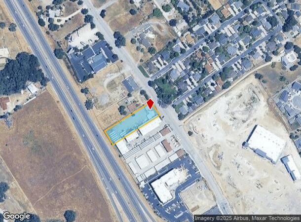
1680 El Camino Real, Atascadero, CA 93422
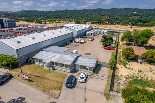
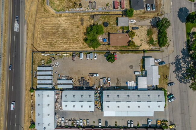
This Property Is For Sale
NEARBY LISTINGS FOR SALE OR LEASE
Property Detail
1680 El Camino Real
San Luis Obispo/Paso Robles
San Luis Obispo
San Luis Obispo-Paso Robles-Arroyo Grande, CA
California
049-133-024
0.92 AC
Sfr
North 101 Corridor
DEMOGRAPHICS near 1680 El Camino Real
1 Mile
3 Mile
5 Mile
2024 Total Population
2,506
19,079
33,823
2029 Population
2,470
18,801
33,231
Pop Growth 2024-2029
(1.44%)
(1.46%)
(1.75%)
Average Age
44
42
43
2024 Total Households
953
7,186
12,960
HH Growth 2024-2029
(1.57%)
(1.66%)
(1.94%)
Median Household Inc
$88,194
$97,043
$92,832
Avg Household Size
2.50
2.60
2.50
2024 Avg HH Vehicles
2.00
2.00
2.00
Median Home Value
$670,103
$681,923
$678,249
Median Year Built
1989
1983
1982
Nearby Places
Map Layers
Map Styles
 Street
 Aerial
- Restaurants
- Banks
- Shops
- Fitness
- Groceries
PUBLIC TRANSPORTATION
COMMUTER RAIL
Paso Robles Amtrak Station (Coast Starlight - Amtrak)
DRIVE
WALK
Distance
Paso Robles Amtrak Station (Coast Starlight - Amtrak)
11 min
8.1 mi
AIRPORT
San Luis County Regional
DRIVE
WALK
Distance
San Luis County Regional
36 min
25.9 mi
Freight Ports
The Port of Hueneme
DRIVE
WALK
Distance
The Port of Hueneme
193 min
152.9 mi
Nearby Properties
Address
Land Use
TOTAL SIZE
Lot Size
Zoning
Address
Land Use
TOTAL SIZE
Lot Size
Zoning
16 AC
PF
Address
Land Use
TOTAL SIZE
Lot Size
Zoning
88,191 SF
4.01 AC
CPK
Address
Land Use
TOTAL SIZE
Lot Size
Zoning
1.78 AC
CPK
Address
Land Use
TOTAL SIZE
Lot Size
Zoning
3.26 AC
OP
Address
Land Use
TOTAL SIZE
Lot Size
Zoning
89,617 SF
6.97 AC
CPK
Address
Land Use
TOTAL SIZE
Lot Size
Zoning
26,256 SF
1.19 AC
OP
Address
Land Use
TOTAL SIZE
Lot Size
Zoning
12 AC
CPK
Address
Land Use
TOTAL SIZE
Lot Size
Zoning
49,652 SF
3.84 AC
CR
Address
Land Use
TOTAL SIZE
Lot Size
Zoning
18,800 SF
0.45 AC
DC
Address
Land Use
TOTAL SIZE
Lot Size
Zoning
26,866 SF
2.01 AC
OP
Address
Land Use
TOTAL SIZE
Lot Size
Zoning
4.45 AC
OP
Address
Land Use
TOTAL SIZE
Lot Size
Zoning
39,765 SF
2.43 AC
CR
Address
Land Use
TOTAL SIZE
Lot Size
Zoning
7,114 SF
32.04 AC
AG
Address
Land Use
TOTAL SIZE
Lot Size
Zoning
14,932 SF
0.64 AC
DC
Address
Land Use
TOTAL SIZE
Lot Size
Zoning
228.80 AC
AG
Address
Land Use
TOTAL SIZE
Lot Size
Zoning
2,080 SF
2.76 AC
OP
Address
Land Use
TOTAL SIZE
Lot Size
Zoning
2.94 AC
CR
Address
Land Use
TOTAL SIZE
Lot Size
Zoning
21,230 SF
2.36 AC
CR
Address
Land Use
TOTAL SIZE
Lot Size
Zoning
18,765 SF
1.30 AC
OP
Address
Land Use
TOTAL SIZE
Lot Size
Zoning
34,661 SF
1.57 AC
MF20
Address
Land Use
TOTAL SIZE
Lot Size
Zoning
5.40 AC
RMF
Address
Land Use
TOTAL SIZE
Lot Size
Zoning
3.94 AC
CR
Address
Land Use
TOTAL SIZE
Lot Size
Zoning
Address
Land Use
TOTAL SIZE
Lot Size
Zoning
59,321 SF
3.92 AC
P
Address
Land Use
TOTAL SIZE
Lot Size
Zoning
151.15 AC
AG
Address
Land Use
TOTAL SIZE
Lot Size
Zoning
1,168 SF
4.82 AC
IND
Address
Land Use
TOTAL SIZE
Lot Size
Zoning
9,700 SF
0.87 AC
OP
Address
Land Use
TOTAL SIZE
Lot Size
Zoning
21,814 SF
33.47 AC
CR
Address
Land Use
TOTAL SIZE
Lot Size
Zoning
2.96 AC
OP
Address
Land Use
TOTAL SIZE
Lot Size
Zoning
1.12 AC
RMF
The World's #1 Commercial Real Estate Marketplace
Connect with us
© 2026 CoStar Group
The information above has been obtained from sources believed reliable. While we do not doubt its accuracy we have not verified it and make no guarantee, warranty or representation about it. It is your responsibility to independently confirm its accuracy and completeness. Any projections, opinions, assumptions, or estimates used are for example only and do not represent the current or future performance of the property. The value of this transaction to you depends on tax and other factors which should be evaluated by your tax, financial, and legal advisors. You and your advisors should conduct a careful, independent investigation of the property to determine to your satisfaction the suitability of the property for your needs.