Property Record
16804 Gridley Pl, Cerritos, CA 90703
NEARBY LISTINGS FOR SALE OR LEASE
Property Detail
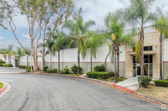
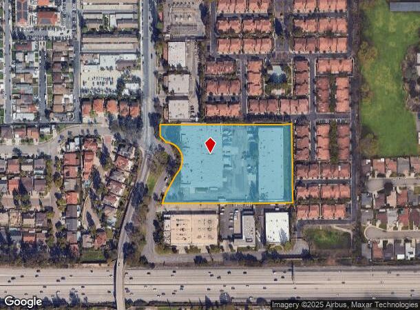
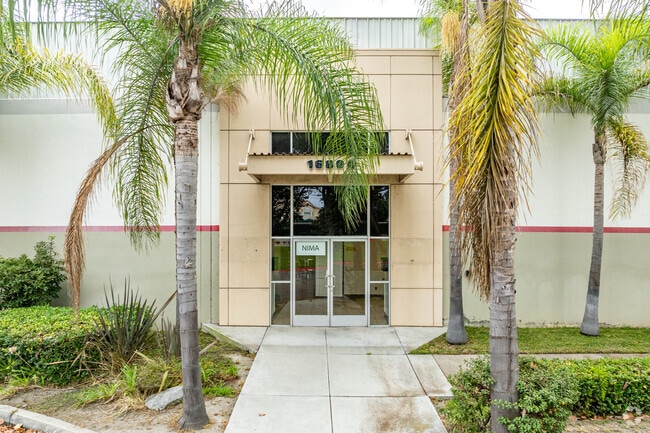
16804 Gridley Pl
Los Angeles-Long Beach-Glendale, CA
Rancho Los Coyotes
7014-007-007
RANCHO LOS COYOTES SECTIONS,TOWNSHIP AND RANGE AS PER PATENTS BK 1 PG 493-494 AND ORM7425 PG 20-21 LOT COM S 89 24 E 20 FT AND S 660 FT AND S 89 24 E 20 FT FROM NW COR OF NW 1/4 OF SE 1/4 OF SEC 1/4 OF SE 1/4 OF SEC 25 T 3S R 12W
Heavyindustrial
Los Angeles
X
California
06037C1839F
25
2024
4.87 AC
2025
Cerritos/Norwalk
554521
Los Angeles
100,560 SF
DEMOGRAPHICS near 16804 Gridley Pl
1 mile
3 mile
5 mile
2024 Total Population
22,146
247,894
614,784
2029 Population
21,351
239,187
594,618
Pop Growth 2024-2029
(3.59%)
(3.51%)
(3.28%)
Average Age
41
40
40
2024 Total Households
6,079
74,223
185,262
HH Growth 2024-2029
(3.85%)
(3.76%)
(3.51%)
Median Household Inc
$87,945
$87,342
$88,322
Avg Household Size
3.40
3.20
3.20
2024 Avg HH Vehicles
2.00
2.00
2.00
Median Home Value
$689,803
$709,977
$711,399
Median Year Built
1962
1963
1961
Nearby Places
Map Layers
Map Styles
 Street
 Aerial
Transit
 Traffic
 Biking
Places
Listings with unknown addresses are not visible on the map
- Restaurants
- Banks
- Shops
- Fitness
- Groceries
PUBLIC TRANSPORTATION
COMMUTER RAIL
Norwalk/Santa Fe Springs (91 Line - Southern California Regional Rail Authority (Metrolink), Orange County Line - Southern California Regional Rail Authority (Metrolink))
Drive
Walk
Distance
Norwalk/Santa Fe Springs (91 Line - Southern California Regional Rail Authority (Metrolink), Orange County Line - Southern California Regional Rail Authority (Metrolink))
9 min
4.3 mi
Buena Park (91 Line - Southern California Regional Rail Authority (Metrolink), Orange County Line - Southern California Regional Rail Authority (Metrolink))
Drive
Walk
Distance
Buena Park (91 Line - Southern California Regional Rail Authority (Metrolink), Orange County Line - Southern California Regional Rail Authority (Metrolink))
13 min
6.7 mi
AIRPORT
Long Beach (Daugherty Field)
Drive
Walk
Distance
Long Beach (Daugherty Field)
17 min
9.1 mi
Los Angeles International
Drive
Walk
Distance
Los Angeles International
30 min
22.7 mi
John Wayne/Orange County
Drive
Walk
Distance
John Wayne/Orange County
31 min
23.2 mi
Freight Ports
Port of Long Beach
Drive
Walk
Distance
Port of Long Beach
24 min
16.1 mi
SALE & LEASE HISTORY
LISTING DATE
SALE/LEASE

Nov 07, 2023
For Lease
Mar 30, 2017
For Lease
Jun 26, 2020
For Lease
Jun 16, 2025
For Lease
Jan 04, 2024
For Lease
Feb 10, 2017
For Lease
Nearby Properties
Address
Land Use
TOTAL SIZE
Lot Size
Zoning
Address
Land Use
TOTAL SIZE
Lot Size
Zoning
324,400 SF
55.03 AC
CECR
Address
Land Use
TOTAL SIZE
Lot Size
Zoning
634,060 SF
76.06 AC
SSM2
Address
Land Use
TOTAL SIZE
Lot Size
Zoning
235,971 SF
10.58 AC
HGC4*
Address
Land Use
TOTAL SIZE
Lot Size
Zoning
383,495 SF
11.60 AC
DOR3PUD*
Address
Land Use
TOTAL SIZE
Lot Size
Zoning
730,731 SF
14.89 AC
BFCG*
Address
Land Use
TOTAL SIZE
Lot Size
Zoning
369,940 SF
8.70 AC
CEM
Address
Land Use
TOTAL SIZE
Lot Size
Zoning
353,001 SF
4.81 AC
CEM
Address
Land Use
TOTAL SIZE
Lot Size
Zoning
224,131 SF
9.03 AC
CEM
Address
Land Use
TOTAL SIZE
Lot Size
Zoning
518,296 SF
13.94 AC
NOCO(PF)*
Address
Land Use
TOTAL SIZE
Lot Size
Zoning
266,337 SF
2.40 AC
CE-ADP-16
Address
Land Use
TOTAL SIZE
Lot Size
Zoning
163,350 SF
7.58 AC
CEM
Address
Land Use
TOTAL SIZE
Lot Size
Zoning
154,616 SF
7.53 AC
CEM
Address
Land Use
TOTAL SIZE
Lot Size
Zoning
247,536 SF
5.79 AC
CECR
Address
Land Use
TOTAL SIZE
Lot Size
Zoning
168,912 SF
8.09 AC
CEM
Address
Land Use
TOTAL SIZE
Lot Size
Zoning
124,820 SF
4.11 AC
NOM2*
Address
Land Use
TOTAL SIZE
Lot Size
Zoning
161,650 SF
6 AC
CEM(D1)*
Address
Land Use
TOTAL SIZE
Lot Size
Zoning
300,102 SF
11.94 AC
SSM2*
Address
Land Use
TOTAL SIZE
Lot Size
Zoning
145,520 SF
6.64 AC
CEADP1
Address
Land Use
TOTAL SIZE
Lot Size
Zoning
64,160 SF
6.62 AC
CEADP1
Address
Land Use
TOTAL SIZE
Lot Size
Zoning
138,944 SF
2.03 AC
NOSPA1*
Address
Land Use
TOTAL SIZE
Lot Size
Zoning
140,624 SF
4.35 AC
ATMRV1200*
Address
Land Use
TOTAL SIZE
Lot Size
Zoning
99,238 SF
3.49 AC
NOR3YY
Address
Land Use
TOTAL SIZE
Lot Size
Zoning
131,066 SF
9.45 AC
NOM1-P*
Address
Land Use
TOTAL SIZE
Lot Size
Zoning
1,004,620 SF
19.73 AC
CECR
Address
Land Use
TOTAL SIZE
Lot Size
Zoning
102,680 SF
4.43 AC
CEADP1
Address
Land Use
TOTAL SIZE
Lot Size
Zoning
132,019 SF
5.22 AC
LKMFR*
Address
Land Use
TOTAL SIZE
Lot Size
Zoning
70,210 SF
3.14 AC
SSM1-BP*
Address
Land Use
TOTAL SIZE
Lot Size
Zoning
290,000 SF
11.83 AC
CEADP1
Address
Land Use
TOTAL SIZE
Lot Size
Zoning
181,405 SF
4.57 AC
NOC3VV
Address
Land Use
TOTAL SIZE
Lot Size
Zoning
80,339 SF
5.88 AC
ATCPD*
The World's #1 Commercial Real Estate Marketplace
Connect with us
© 2026 CoStar Group
The information above has been obtained from sources believed reliable. While we do not doubt its accuracy we have not verified it and make no guarantee, warranty or representation about it. It is your responsibility to independently confirm its accuracy and completeness. Any projections, opinions, assumptions, or estimates used are for example only and do not represent the current or future performance of the property. The value of this transaction to you depends on tax and other factors which should be evaluated by your tax, financial, and legal advisors. You and your advisors should conduct a careful, independent investigation of the property to determine to your satisfaction the suitability of the property for your needs.