Property Record
1681 Jacaranda Blvd, Venice, FL 34293


Property Detail
1681 Jacaranda Blvd
North Port-Bradenton-Sarasota, FL
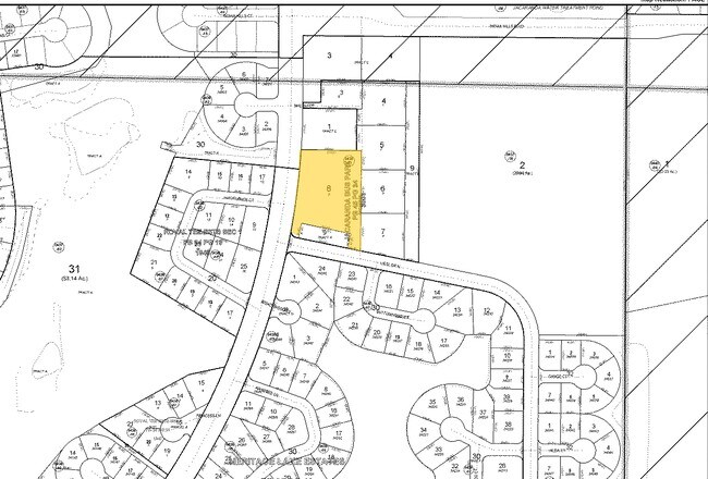
LOT 5, JACARANDA BUSINESS PARK
0438-01-0008
SARASOTA
Commercialacreage
Florida
RSF2
5
AE The base floodplain where base flood elevations are provided. AE Zones are now used on new format FIRMs instead of A1-A30 Zones.
2.01 AC
2024
Sarasota Outlying
2025
Tampa/St Petersburg
002510
NEARBY LISTINGS FOR SALE OR LEASE
DEMOGRAPHICS near 1681 Jacaranda Blvd
1 mile
3 mile
5 mile
2025 Total Population
6,507
53,940
100,602
2030 Population
6,885
57,408
108,547
Pop Growth 2025-2030
+ 5.81%
+ 6.43%
+ 7.90%
Average Age
57
57
59
2025 Total Households
3,179
26,427
50,337
HH Growth 2025-2030
+ 5.79%
+ 6.49%
+ 7.99%
Median Household Inc
$75,697
$78,062
$78,661
Avg Household Size
2.00
2.00
1.90
2025 Avg HH Vehicles
2.00
2.00
2.00
Median Home Value
$425,238
$403,151
$440,907
Median Year Built
1984
1993
1993
Nearby Places
Map Layers
Map Styles
 Street
 Aerial
Layers
 Traffic
 Biking
Places
Listings with unknown addresses are not visible on the map
- Restaurants
- Banks
- Shops
- Fitness
- Groceries
PUBLIC TRANSPORTATION
AIRPORT
Sarasota/Bradenton International
Drive
Walk
Distance
Sarasota/Bradenton International
44 min
31.8 mi
Punta Gorda
Drive
Walk
Distance
Punta Gorda
44 min
35.6 mi
Freight Ports
Port Manatee
Drive
Walk
Distance
Port Manatee
56 min
44.3 mi
Nearby Properties
Address
Land Use
TOTAL SIZE
Lot Size
Zoning
Address
Land Use
TOTAL SIZE
Lot Size
Zoning
333,296 SF
16.80 AC
RMF3
Address
Land Use
TOTAL SIZE
Lot Size
Zoning
432,671 SF
48.53 AC
RMF2
Address
Land Use
TOTAL SIZE
Lot Size
Zoning
421,272 SF
31.96 AC
PUD
Address
Land Use
TOTAL SIZE
Lot Size
Zoning
251,872 SF
25.01 AC
RMF2
Address
Land Use
TOTAL SIZE
Lot Size
Zoning
191,373 SF
23.12 AC
RMF2
Address
Land Use
TOTAL SIZE
Lot Size
Zoning
173,966 SF
17 AC
CG
Address
Land Use
TOTAL SIZE
Lot Size
Zoning
149,834 SF
36.95 AC
GU
Address
Land Use
TOTAL SIZE
Lot Size
Zoning
223,397 SF
453.78 AC
G
Address
Land Use
TOTAL SIZE
Lot Size
Zoning
123,659 SF
50.42 AC
RSF2
Address
Land Use
TOTAL SIZE
Lot Size
Zoning
159,759 SF
12.60 AC
RMF3
Address
Land Use
TOTAL SIZE
Lot Size
Zoning
201,992 SF
22.45 AC
CG
Address
Land Use
TOTAL SIZE
Lot Size
Zoning
85,177 SF
68.01 AC
RE1
Address
Land Use
TOTAL SIZE
Lot Size
Zoning
81,883 SF
11.90 AC
CSC
Address
Land Use
TOTAL SIZE
Lot Size
Zoning
146,990 SF
8.90 AC
CG
Address
Land Use
TOTAL SIZE
Lot Size
Zoning
63,549 SF
6.26 AC
OPI
Address
Land Use
TOTAL SIZE
Lot Size
Zoning
98,113 SF
12.05 AC
CSC
Address
Land Use
TOTAL SIZE
Lot Size
Zoning
111,306 SF
9.35 AC
CSC
Address
Land Use
TOTAL SIZE
Lot Size
Zoning
138,547 SF
18.63 AC
CSC
Address
Land Use
TOTAL SIZE
Lot Size
Zoning
78,975 SF
8.40 AC
RSF4
Address
Land Use
TOTAL SIZE
Lot Size
Zoning
66,899 SF
30.10 AC
GU
Address
Land Use
TOTAL SIZE
Lot Size
Zoning
121,747 SF
17.54 AC
OUE1
Address
Land Use
TOTAL SIZE
Lot Size
Zoning
101,219 SF
4.90 AC
OPI
Address
Land Use
TOTAL SIZE
Lot Size
Zoning
112,415 SF
8.77 AC
CSC
Address
Land Use
TOTAL SIZE
Lot Size
Zoning
76,247 SF
13.89 AC
CG
Address
Land Use
TOTAL SIZE
Lot Size
Zoning
74,937 SF
354.80 AC
RSF2
Address
Land Use
TOTAL SIZE
Lot Size
Zoning
125,001 SF
3.13 AC
CG
Address
Land Use
TOTAL SIZE
Lot Size
Zoning
8,040 SF
46.23 AC
RMH
Address
Land Use
TOTAL SIZE
Lot Size
Zoning
92,802 SF
4.78 AC
CN
Address
Land Use
TOTAL SIZE
Lot Size
Zoning
101,496 SF
19.08 AC
CG
Address
Land Use
TOTAL SIZE
Lot Size
Zoning
119,222 SF
12.47 AC
CG
The World's #1 Commercial Real Estate Marketplace
Connect with us
© 2026 CoStar Group
The information above has been obtained from sources believed reliable. While we do not doubt its accuracy we have not verified it and make no guarantee, warranty or representation about it. It is your responsibility to independently confirm its accuracy and completeness. Any projections, opinions, assumptions, or estimates used are for example only and do not represent the current or future performance of the property. The value of this transaction to you depends on tax and other factors which should be evaluated by your tax, financial, and legal advisors. You and your advisors should conduct a careful, independent investigation of the property to determine to your satisfaction the suitability of the property for your needs.